File:Europe laea location map.svg
Μετάβαση στην πλοήγηση
Πήδηση στην αναζήτηση

Το μέγεθος αυτής της PNG προεπισκόπησης αυτού του SVG το αρχείο: 701 × 599 εικονοστοιχεία. Άλλες αναλύσεις: 281 × 240 εικονοστοιχεία | 561 × 480 εικονοστοιχεία | 898 × 768 εικονοστοιχεία | 1.198 × 1.024 εικονοστοιχεία | 2.395 × 2.048 εικονοστοιχεία | 1.401 × 1.198 εικονοστοιχεία.
Πρωτότυπο αρχείο (Αρχείο SVG, ονομαστικό μέγεθος 1.401 × 1.198 εικονοστοιχεία, μέγεθος αρχείου: 2,21 MB)
Λεζάντες
Λεζάντες
Δεν ορίστηκε λεζάντα
Σύνοψη[επεξεργασία]
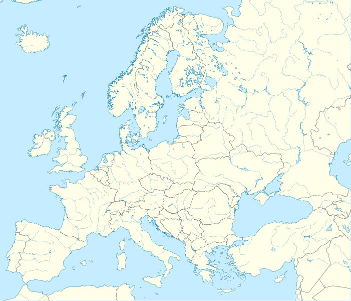
| Περιγραφή |
Deutsch: Positionskarte Europa; Politisch mit Staatsgrenzen, Inlandgewässer; Flächentreue Azimutalprojektion
English: Location map Europe; Political with state boundaries, inland water; Lambert azimuthal equal-area projection
Français : Carte de localisation Europe; Politique avec frontières d'Etats, mers intérieures; projection de Lambert azimuthale
Русский: Политическая карта Европы с границами государств и внутренними водами по состоянию на 2010 год (равновеликая азимутальная проекция Ламберта)
|
||
| Ημερομηνία | |||
| Πηγή |
Έργο αυτού που το ανεβάζει
|
||
| Δημιουργός | Alexrk2 | ||
| άλλες εκδόσεις |
Derivative works of this file:
[]
|
||
| SVG ανάπτυξη |
|


.svg)


Αδειοδότηση[επεξεργασία]
Εγώ, ο κάτοχος των πνευματικών δικαιωμάτων αυτού του έργου, το δημοσιεύω δια του παρόντος υπό την εξής άδεια χρήσης:
Το αρχείο διανέμεται υπό την άδεια Creative Commons Αναφορά προέλευσης-Παρόμοια διανομή 3.0 Μη εισαγόμενη
- Είστε ελεύθερος:
- να μοιραστείτε – να αντιγράψετε, διανέμετε και να μεταδώσετε το έργο
- να διασκευάσετε – να τροποποιήσετε το έργο
- Υπό τις ακόλουθες προϋποθέσεις:
- αναφορά προέλευσης – Θα πρέπει να κάνετε κατάλληλη αναφορά, να παρέχετε σύνδεσμο για την άδεια και να επισημάνετε εάν έγιναν αλλαγές. Μπορείτε να το κάνετε με οποιοδήποτε αιτιολογήσιμο λόγο, χωρίς όμως να εννοείται με οποιονδήποτε τρόπο ότι εγκρίνουν εσάς ή τη χρήση του έργου από εσάς.
- παρόμοια διανομή – Εάν αλλάξετε, τροποποιήσετε ή δημιουργήσετε πάνω στο έργο αυτό, μπορείτε να διανείμετε αυτό που θα προκύψει μόνο υπό τους όρους της ίδιας ή συμβατής άδειας με το πρωτότυπο.
Ιστορικό αρχείου
Πατήστε σε μια ημερομηνία/ώρα για να δείτε το αρχείο όπως εμφανιζόταν εκείνη την χρονική στιγμή.
| Ημερομηνία/Ώρα | Μικρογραφία | Διαστάσεις | Χρήστης | Σχόλιο | |
|---|---|---|---|---|---|
| τρέχον | 22:57, 20 Αυγούστου 2012 | | 1.401 × 1.198 (2,21 MB) | McZusatz (συζήτηση | Συνεισφορά) | Reverted to version as of 19:40, 10 March 2010 (...thumb fixed?) |
| 22:56, 20 Αυγούστου 2012 |  | 1.401 × 1.198 (1,45 MB) | McZusatz (συζήτηση | Συνεισφορά) | Reverted to version as of 18:44, 10 March 2010 (fixing thumb...) | |
| 19:40, 10 Μαρτίου 2010 |  | 1.401 × 1.198 (2,21 MB) | Alexrk2 (συζήτηση | Συνεισφορά) | +San Marino, enh. coastline & countries | |
| 18:44, 10 Μαρτίου 2010 |  | 1.401 × 1.198 (1,45 MB) | Alexrk2 (συζήτηση | Συνεισφορά) | == Summary == {{Information |Description= {{de|Positionskarte Europa; Politisch mit Staatsgrenzen, Inlandgewässer; Flächentreue Azimutalprojektion}} {{en|Location map Europe; Political with state boundaries, inland water; L |
Δεν μπορείτε να αντικαταστήσετε αυτό το αρχείο.
Χρήση αρχείου
Περισσότεροι από 100 σελίδες χρησιμοποιούν αυτό το αρχείο. Η ακόλουθη λίστα δείχνει τις πρώτες 100 σελίδες που συνδέονται με αυτό το αρχείο μονοσήμαντα. Η πλήρης λίστα είναι διαθέσιμη.
- File:Abkhazia in Europe (de-facto).svg
- File:Abkhazia in Europe (de-facto) (-rivers -mini map).svg
- File:Akrotiri and Dhekelia in Europe.svg
- File:Akrotiri and Dhekelia in Europe (-rivers -mini map).svg
- File:Aland in Europe.svg
- File:Aland in Europe (-rivers -mini map).svg
- File:Albania in Europe.svg
- File:Albania in Europe (-rivers -mini map).svg
- File:Andorra in Europe.svg
- File:Andorra in Europe (-rivers -mini map).svg
- File:Armenia in Europe.svg
- File:Armenia in Europe (-rivers -mini map).svg
- File:Artsakh in Europe.svg
- File:Austria in Europe.svg
- File:Austria in Europe (-rivers -mini map).svg
- File:Austria in European Union.svg
- File:Azerbaijan in Europe.svg
- File:Azerbaijan in Europe (-rivers -mini map).svg
- File:Belarus in Europe.svg
- File:Belarus in Europe (-rivers -mini map).svg
- File:Belgium in Europe.svg
- File:Belgium in Europe (-rivers -mini map).svg
- File:Bosnia and Herzegovina in Europe.svg
- File:Bosnia and Herzegovina in Europe (-rivers -mini map).svg
- File:Bulgaria in Europe.svg
- File:Bulgaria in Europe (-rivers -mini map).svg
- File:Croatia in Europe.svg
- File:Croatia in Europe (-rivers -mini map).svg
- File:Cyprus in Europe.svg
- File:Cyprus in Europe (-rivers -mini map).svg
- File:Cyprus in Europe (de-facto).svg
- File:Cyprus in Europe (de-facto) (-rivers -mini map).svg
- File:Czech Republic in Europe.svg
- File:Czech Republic in Europe (-rivers -mini map).svg
- File:Denmark in Europe.svg
- File:Denmark in Europe (-rivers -mini map).svg
- File:Estonia in Europe.svg
- File:Estonia in Europe (-rivers -mini map).svg
- File:Europe EU laea location map.svg
- File:Europe blank laea location map.svg
- File:Europe bluemarble laea location map.jpg
- File:Europe laea location map.svg
- File:Europe laea location map with borders.svg (ανακατεύθυνση του αρχείου)
- File:Europe natural laea location map.jpg
- File:Europe relief laea location map.jpg
- File:Europe relief laea location map BG.png
- File:Faroe Islands in Europe.svg
- File:Faroe Islands in Europe (-rivers -mini map).svg
- File:Finland in Europe.svg
- File:Finland in Europe (-rivers -mini map).svg
- File:France in Europe.svg
- File:France in Europe (-rivers -mini map).svg
- File:France in Europe (relief).svg
- File:Georgia in Europe.svg
- File:Georgia in Europe (de-facto).svg
- File:Germany in Europe.svg
- File:Gibraltar in Europe.svg
- File:Greece in Europe.svg
- File:Guernsey in Europe.svg
- File:Hungary in Europe.svg
- File:Iceland in Europe.svg
- File:Ireland in Europe.svg
- File:Isle of Man in Europe.svg
- File:Italy in Europe.svg
- File:Jersey in Europe.svg
- File:Kazakhstan in Europe.svg
- File:Kingdom of Denmark in Europe.svg
- File:Kosovo in Europe (de-facto).svg
- File:Latvia in Europe.svg
- File:Liechtenstein in Europe.svg
- File:Lithuania in Europe.svg
- File:Luxembourg in Europe.svg
- File:Luxembourg in Europe (special marker).svg
- File:Macedonia in Europe.svg
- File:Malta in Europe.svg
- File:Moldova in Europe.svg
- File:Monaco in Europe.svg
- File:Montenegro in Europe.svg
- File:Netherlands in Europe.svg
- File:Northern Cyprus in Europe (de-facto).svg
- File:Norway in Europe.svg
- File:Poland in Europe.svg
- File:Portugal in Europe.svg
- File:Romania in Europe.svg
- File:Russia in Europe.svg
- File:San Marino in Europe.svg
- File:Serbia in Europe.svg
- File:Serbia in Europe (de-facto).svg
- File:Slovakia in Europe.svg
- File:Slovenia in Europe.svg
- File:South Ossetia in Europe (de-facto).svg
- File:Spain in Europe.svg
- File:Sweden in Europe.svg
- File:Switzerland in Europe.svg
- File:Transnistria in Europe.svg
- File:Transnistria in Europe (special marker).svg
- File:Turkey in Europe.svg
- File:Ukraine in Europe.svg
- File:United Kingdom in Europe.svg
- File:United Kingdom in Europe (wo crown dependencies).svg
.svg)
_(-rivers_-mini_map).svg)
.svg)
.svg)
.svg)
.svg)
.svg)
.svg)
.svg)
.svg)
.svg)
.svg)
.svg)
.svg)
.svg)
.svg)
_(-rivers_-mini_map).svg)
.svg)
.svg)
.svg)
.svg)
.svg)
.svg)
.svg)
.svg)
.svg)
.svg)
.svg)
.svg)
.svg)
.svg)
.svg)
Δείτε περισσότερους συνδέσμους προς αυτό το αρχείο.
Καθολική χρήση αρχείου
Τα ακόλουθα άλλα wiki χρησιμοποιούν αυτό το αρχείο:
- Χρήση σε als.wikipedia.org
- Χρήση σε an.wikipedia.org
- Χρήση σε av.wikipedia.org
- Χρήση σε az.wikipedia.org
- Dunay
- Reyn
- UEFA Çempionlar Liqası 1994/1995
- UEFA Çempionlar Liqası 2007/2008
- Şablon:Yer xəritəsi Avropa
- Aqriate
- Akkona (səhra)
- Bardenas-Reales
- Pişinas
- Tabernas (səhra)
- Aleşkov qumları
- Mançester Arenada terror (2017)
- Avropa Gənclər Olimpiya Festivalı
- UEFA Çempionlar Liqası 2017/2018
- Yan çayı
- UEFA Çempionlar Liqası 2018/2019
- Moneqros səhrası
- UEFA Çempionlar Liqası 2019/2020
- UEFA Çempionlar Liqası 2020/2021
- UEFA Çempionlar Liqası 2021/2022
- Χρήση σε ba.wikipedia.org
Δείτε περισσότερη καθολική χρήση αυτού του αρχείου.