File:Falk Oberdorf Breitenbrink Gipfel.jpg
Jump to navigation
Jump to search

Size of this preview: 450 × 600 pixels. Other resolutions: 180 × 240 pixels | 360 × 480 pixels | 576 × 768 pixels | 768 × 1,024 pixels | 1,536 × 2,048 pixels | 2,976 × 3,968 pixels.
Original file (2,976 × 3,968 pixels, file size: 3.7 MB, MIME type: image/jpeg)
Captions
Captions
Add a one-line explanation of what this file represents
Summary
[edit]| Description |
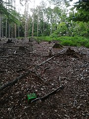
Deutsch: Gipfel des Breitenbrinks mit trigonometrischen Punkt |
| Date | |
| Source |
Own work Original text: selbst fotografiert |
| Author | Falk Oberdorf, Osterstr. 8. 32312 Lübbecke |
| Camera location | | View this and other nearby images on: OpenStreetMap |
|---|
Licensing
[edit]This file is licensed under the Creative Commons Attribution-Share Alike 4.0 International license.
- You are free:
- to share – to copy, distribute and transmit the work
- to remix – to adapt the work
- Under the following conditions:
- attribution – You must give appropriate credit, provide a link to the license, and indicate if changes were made. You may do so in any reasonable manner, but not in any way that suggests the licensor endorses you or your use.
- share alike – If you remix, transform, or build upon the material, you must distribute your contributions under the same or compatible license as the original.
Original upload log
[edit]Transferred from de.wikipedia to Commons by Wdwdbot using script bot_filetrans.pl (r121M).
The original description page was here. All following user names refer to de.wikipedia.
- 2020-06-03 21:56:59 Flk-Brdrf (3879373 Bytes) {{Information |Beschreibung = Gipfel des Breitenbrinks mit trigonometrischen Punkt |Quelle = selbst fotografiert |Urheber = Falk Oberdorf, Osterstr. 8. 32312 Lübbecke |Datum = 01.06.20 |Genehmigung = ~~~ |Andere Versionen = |Anmerkungen = }}

File history
Click on a date/time to view the file as it appeared at that time.
| Date/Time | Thumbnail | Dimensions | User | Comment | |
|---|---|---|---|---|---|
| current | 19:56, 16 November 2021 | | 2,976 × 3,968 (3.7 MB) | Wdwdbot (talk | contribs) | Bot Move: Original uploader of this revision (#1) was Flk-Brdrf at de.wikipedia |
You cannot overwrite this file.
File usage on Commons
There are no pages that use this file.
File usage on other wikis
The following other wikis use this file:
- Usage on de.wikipedia.org