File:Farne Islands map 1947.jpg
Jump to navigation
Jump to search
Size of this preview: 435 × 599 pixels. Other resolutions: 174 × 240 pixels | 348 × 480 pixels | 557 × 768 pixels | 743 × 1,024 pixels | 2,544 × 3,504 pixels.
Original file (2,544 × 3,504 pixels, file size: 1.01 MB, MIME type: image/jpeg)
Captions
Captions
Add a one-line explanation of what this file represents
This work is an Ordnance Survey map over 50 years old, which is covered by Crown Copyright which in this case expires 50 years after publication. Ordnance Survey does however ask that they be credited and that the date of publication be given.
Any ancillary rights gained through the creation of the electronic version are granted as freely usable under any circumstances.
|
This work created by the United Kingdom Government is in the public domain.
This is because it is one of the following:
HMSO has declared that the expiry of Crown Copyrights applies worldwide (ref: HMSO Email Reply)
|
 |
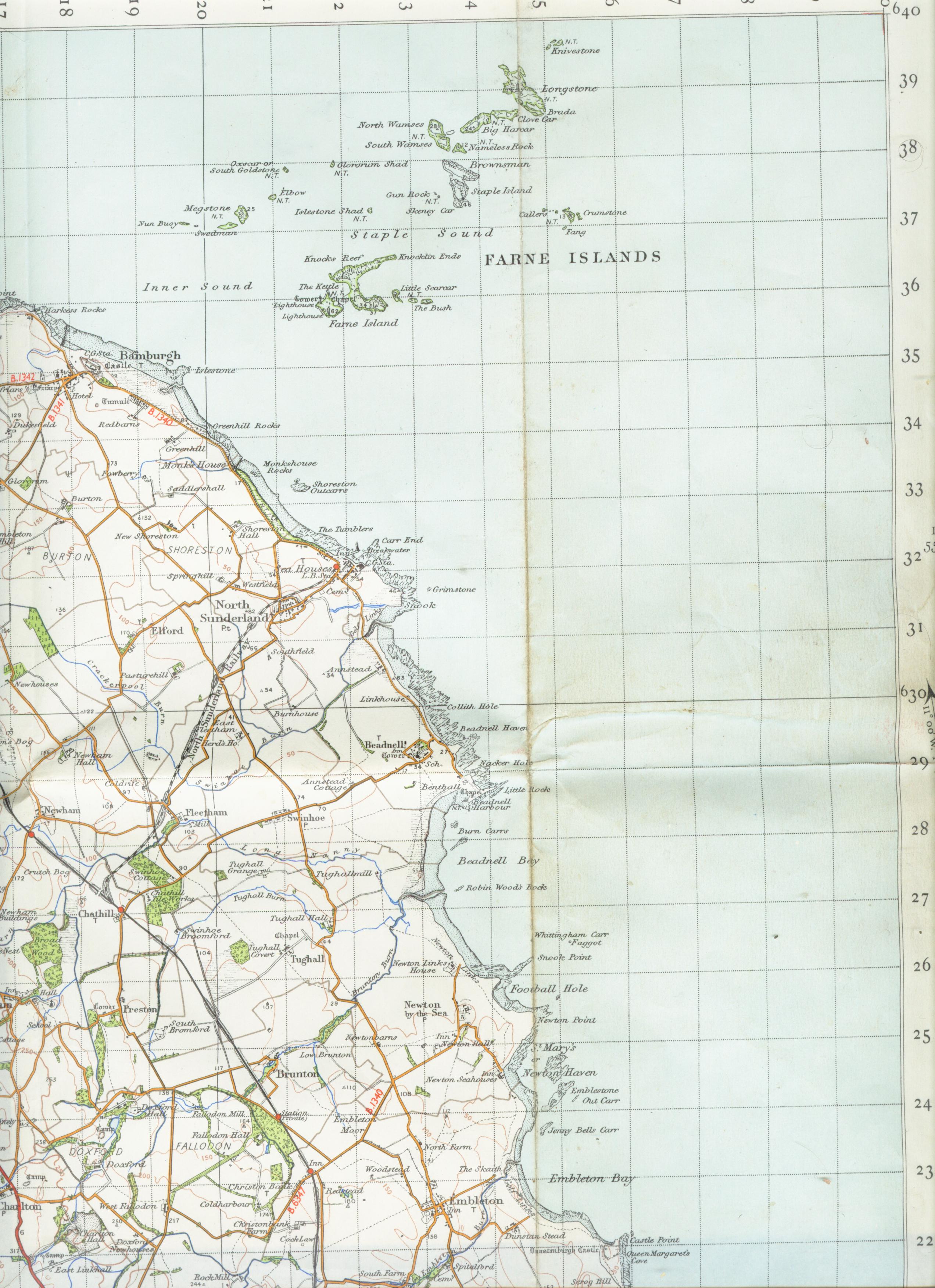
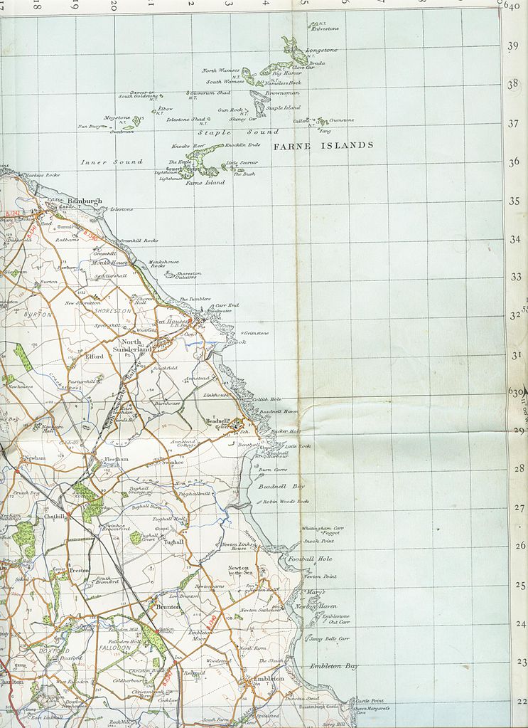
| Description | map of Farne Islands |
| Date | |
| Source | old OS map |
| Author | OS |
File history
Click on a date/time to view the file as it appeared at that time.
| Date/Time | Thumbnail | Dimensions | User | Comment | |
|---|---|---|---|---|---|
| current | 11:54, 23 September 2006 | | 2,544 × 3,504 (1.01 MB) | Geni (talk | contribs) | rotated through 180 degrees so right way up |
| 11:43, 23 September 2006 |  | 2,544 × 3,504 (1.01 MB) | Geni (talk | contribs) | {{oldOS}} {{Information |Description=map of Farne Islands |Source=old OS map |Date=1947 |Author=OS |Permission=none needed |other_versions= }} |
You cannot overwrite this file.
File usage on Commons
There are no pages that use this file.