File:Fires in Africa (MODIS 2020-08-24).jpg
Jump to navigation
Jump to search

Size of this preview: 757 × 600 pixels. Other resolutions: 303 × 240 pixels | 606 × 480 pixels | 970 × 768 pixels | 1,280 × 1,014 pixels | 2,560 × 2,028 pixels | 7,705 × 6,103 pixels.
Original file (7,705 × 6,103 pixels, file size: 4.23 MB, MIME type: image/jpeg)
Captions
Captions
Add a one-line explanation of what this file represents
Summary
[edit].jpg&action=edit§ion=1)
| Description |
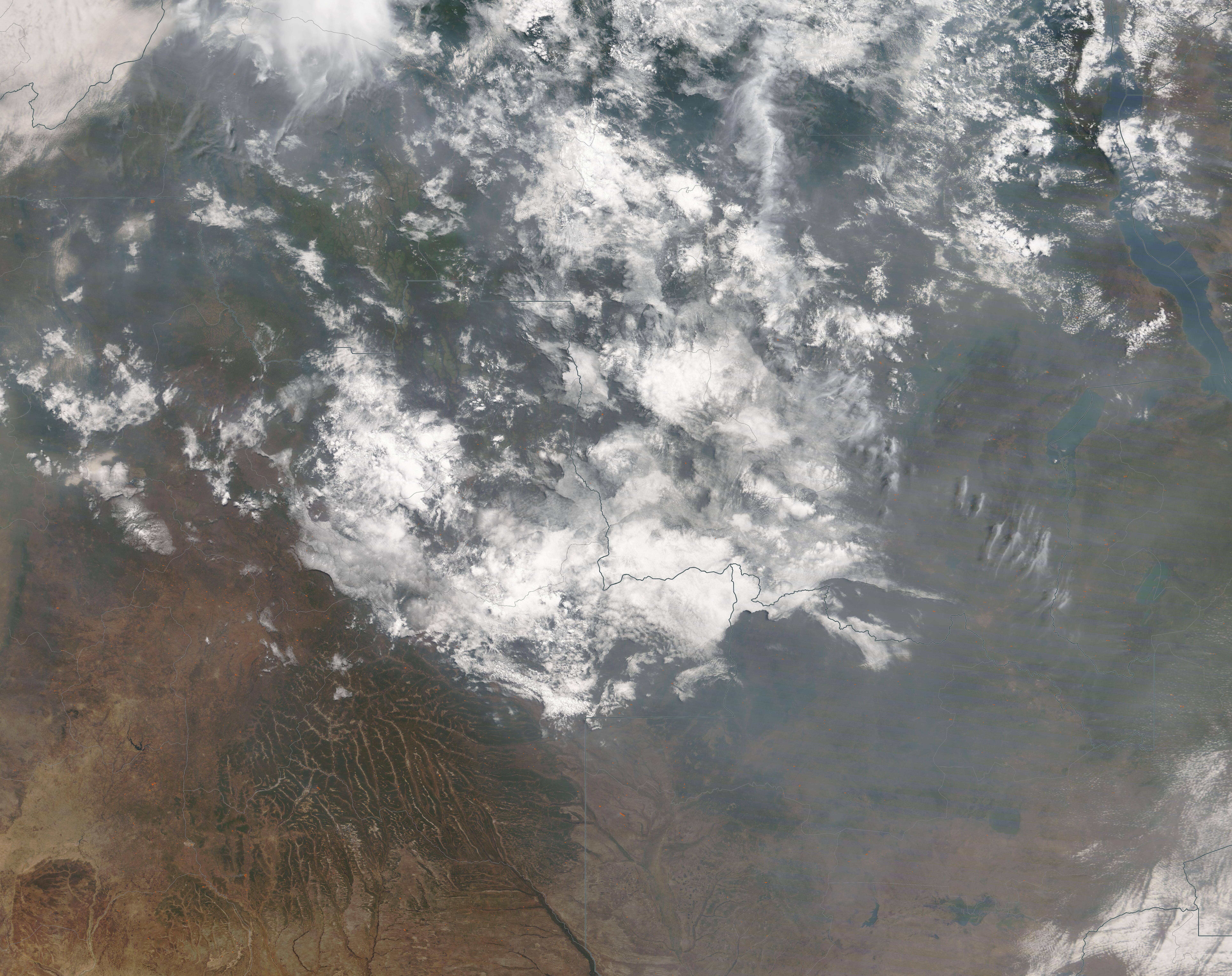
English: Smoke blanketed south-central Africa in late August 2020, stretching nearly 3,000 miles (4,828 km) across the continent and the South Atlantic Ocean and about 1,700 miles (2,736 km) from the northern edge of the Sahel almost to South Africa. Agricultural fires are common in the region during this time of the year, and are deliberately ignited to open lands for agricultural use, to freshen pasture, to clean the residue from fading crops, and to prepare land for planting, among other reasons. While the use of fire is a traditional, useful, and inexpensive method of land management, the widespread use of fire can create numerous hazards, including damaging deforestation and thick smoke that can be harmful to the respiratory system of humans and animals.
On August 21, the Moderate Resolution Imaging Spectroradiometer (MODIS) on board NASA’s Terra satellite acquired a true-color image of fires and smoke over a small portion of Africa that includes Angola (southwest), Zambia (southeast), and Democratic Republic of the Congo (north). Each red “hot spot” marks an area where the thermal bands on the instrument detected high temperatures. When accompanied by typical smoke, as in this image, such hot spots are diagnostic for actively burning fire. Most of the hot spots visible cluster in and around Angola’s Ahaggar Mountains and along the border area between Zambia and Democratic Republic of the Congo. In some areas the smoke is so thick that it is difficult to see the land beneath. Several plumes of dark smoke rise from active fires and blow in near-parallel lines to the southeast. The smoke, which blankets most of the region, rises not just from these fires, but from many thousands of fires currently burning across Central Africa. |
||
| Date | Taken on 21 August 2020 | ||
| Source |
|
||
| Author | MODIS Land Rapid Response Team, NASA GSFC |
| This media is a product of the Terra mission Credit and attribution belongs to the mission team, if not already specified in the "author" row |
Licensing
[edit].jpg&action=edit§ion=2)
| This file is in the public domain in the United States because it was solely created by NASA. NASA copyright policy states that "NASA material is not protected by copyright unless noted". (See Template:PD-USGov, NASA copyright policy page or JPL Image Use Policy.) | ||
 |
Warnings:
|
File history
Click on a date/time to view the file as it appeared at that time.
| Date/Time | Thumbnail | Dimensions | User | Comment | |
|---|---|---|---|---|---|
| current | 02:50, 17 February 2024 | | 7,705 × 6,103 (4.23 MB) | OptimusPrimeBot (talk | contribs) | #Spacemedia - Upload of http://modis.gsfc.nasa.gov/gallery/images/image08242020_250m.jpg via Commons:Spacemedia |
You cannot overwrite this file.
File usage on Commons
There are no pages that use this file.
.jpg&oldid=852731158)