File:Fires in Brazil (MODIS 2022-08-20).jpg

Original file (7,722 × 6,123 pixels, file size: 4.55 MB, MIME type: image/jpeg)
Captions
Captions
Summary[edit]
.jpg&action=edit§ion=1)
| Description |
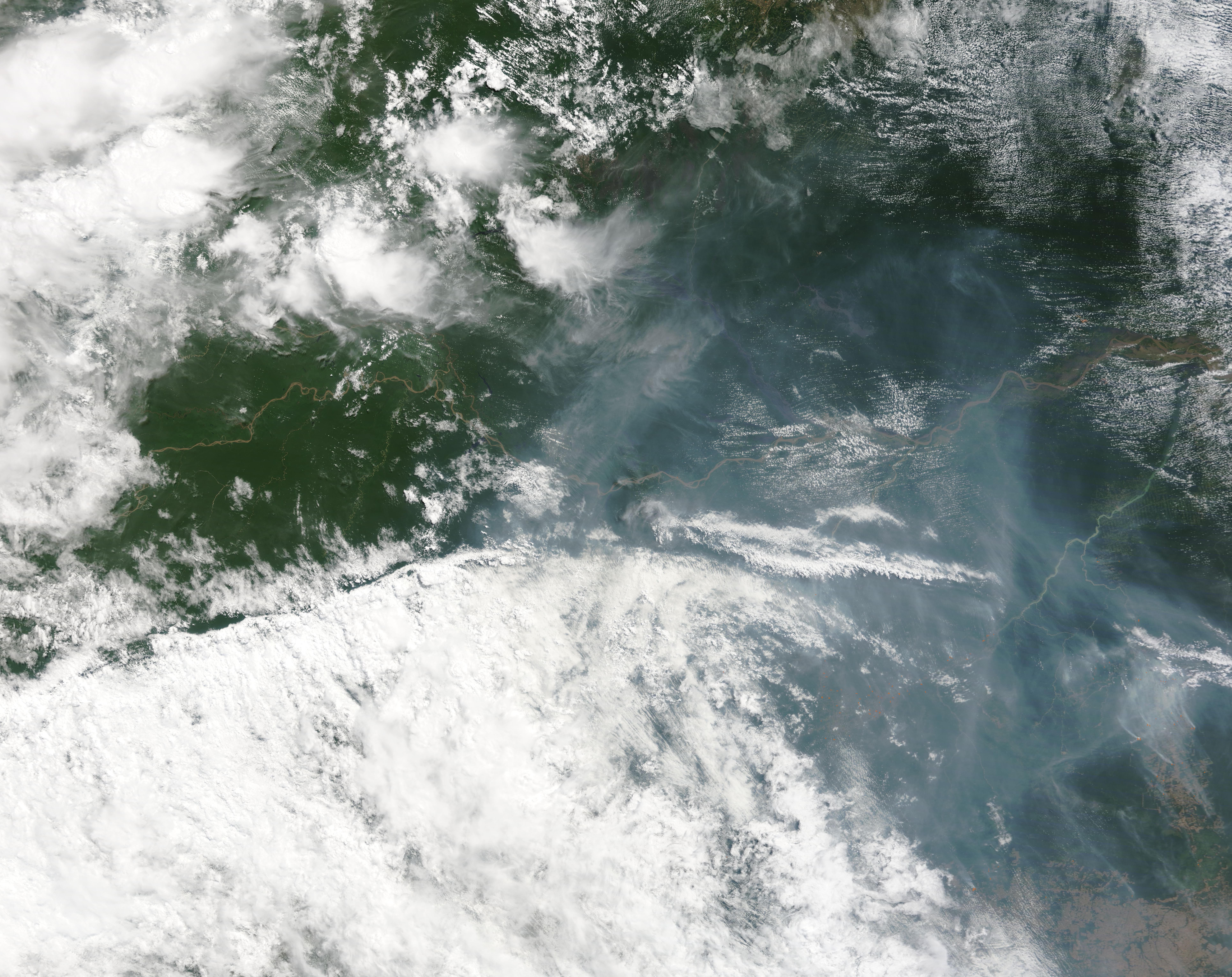
English: Despite a canopy of heavy cloud and thick smoke, dozens of fires can be seen burning in the forests of the states of Amazonas and Pará, northern Brazil in mid-August 2022. The Moderate Resolution Imaging Spectroradiometer (MODIS) on NASA’s Terra satellite acquired this true-color image on August 17.
Each red “hot spot” is an area where the thermal bands on the instrument detected high temperatures. When combined with typical smoke, as in this image, these hot spots mark actively burning fire. The largest cluster of fires, near the southeastern corner, appears to follow along part of the Tapajós River. Some may burn in or near the Tapajós Environmental Protection Area and Indigenous land. Another large cluster sits at the southeastern (lower right) edge of the image. Here the fires are located at forest edge. Other fires are scatted across the image and, based on other images, even more fires are obscured by the clouds. While it is not possible to know the cause of a fire based on satellite imagery alone, based on the location and time of year, it is very likely that most of these fires are agricultural in origin. Such fires are deliberately set and managed to ready land for planting or pasture, burn waste left after timber cutting, or open new lands for use. Slash-and-burn agriculture has been used by small farmers in traditional land management, but it is also used by large farms and corporations to clear large swaths of land and is a major cause of deforestation in the Amazon rainforest. At times, small agricultural fires can escape control and become large wildfires. In 2021, Brazil was a signatory to COP26, a pledge by 110 world leaders, to end deforestation by 2030. This follows two years of increasing deforestation of the Amazon under Brazilian President Jair Bolsonaro, with the rate in 2020 the highest in 12 years. Unfortunately, the numbers of fires burning in Brazil’s Amazon reached a 15-year high in June 2022, which flies in the face of the pledge to preserve the forests. Fire season in Brazil typically peaks in August and September. |
||
| Date | Taken on 19 August 2022 | ||
| Source |
|
||
| Author | MODIS Land Rapid Response Team, NASA GSFC |
| This media is a product of the Terra mission Credit and attribution belongs to the mission team, if not already specified in the "author" row |
Licensing[edit]
.jpg&action=edit§ion=2)
| This file is in the public domain in the United States because it was solely created by NASA. NASA copyright policy states that "NASA material is not protected by copyright unless noted". (See Template:PD-USGov, NASA copyright policy page or JPL Image Use Policy.) | ||
 |
Warnings:
|
File history
Click on a date/time to view the file as it appeared at that time.
| Date/Time | Thumbnail | Dimensions | User | Comment | |
|---|---|---|---|---|---|
| current | 21:52, 9 January 2024 | | 7,722 × 6,123 (4.55 MB) | OptimusPrimeBot (talk | contribs) | #Spacemedia - Upload of http://modis.gsfc.nasa.gov/gallery/images/image08202022_250m.jpg via Commons:Spacemedia |
You cannot overwrite this file.
File usage on Commons
There are no pages that use this file.
.jpg&oldid=840065591)