File:Fires in northern South America (MODIS 2016-02-09).jpg

Original file (6,800 × 5,200 pixels, file size: 6.75 MB, MIME type: image/jpeg)
Captions
Captions
Summary[edit]
.jpg&action=edit§ion=1)
| Description |
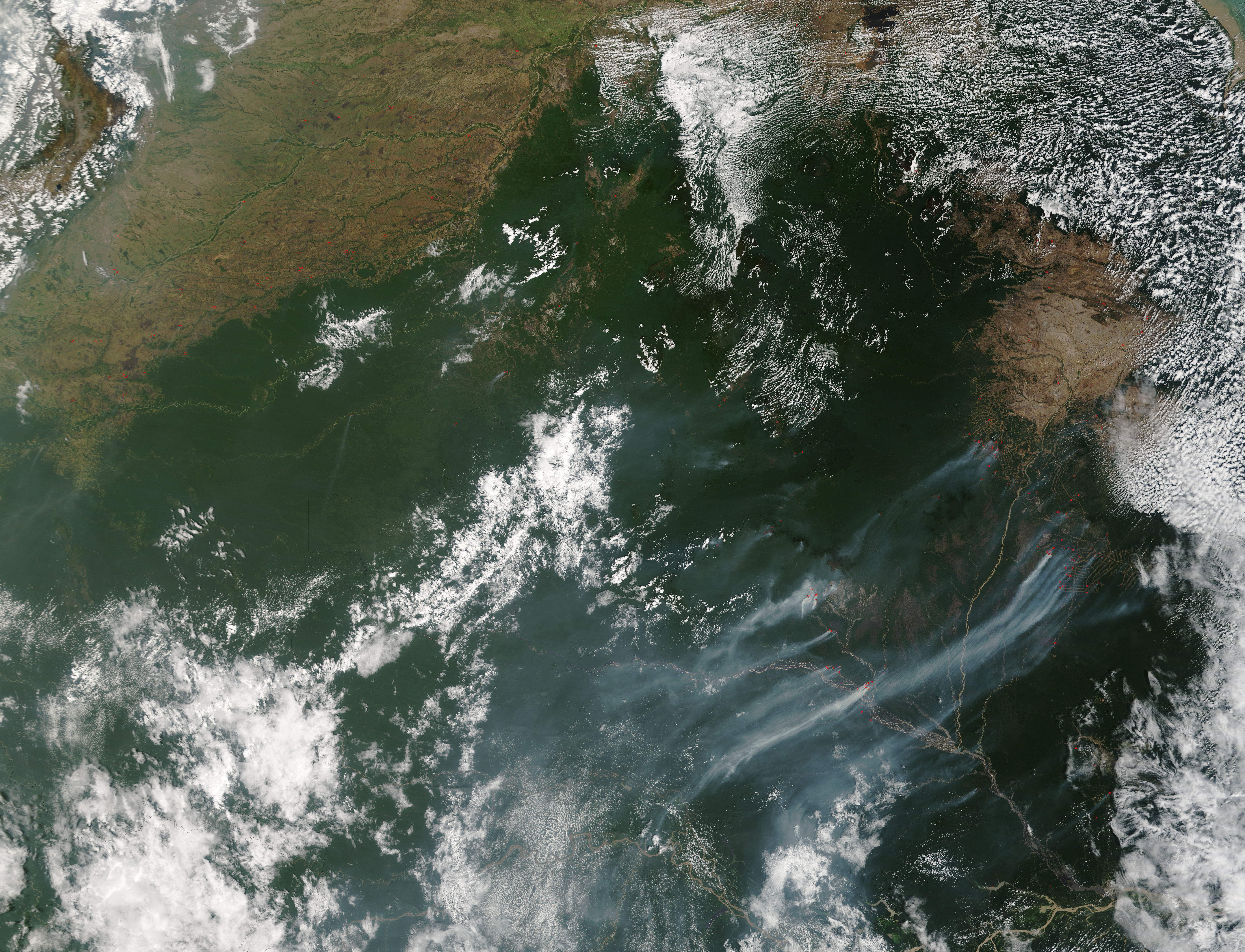
English: Fires continued to burn across northern South American at the close of January 2016. The Moderate Resolution Imaging Spectroradiometer (MODIS) aboard NASA�s Terra satellite captured this true-color image on January 30 as it passed over the region.
> Red hot spots can be seen speckling the landscape in Colombia (west), Venezuela (north) and Brazil (south). Each hot spot represents an area where the thermal bands on the MODIS instrument detected temperatures significantly higher than background. When accompanied by plumes of smoke, as are most in this image, such hot spots are diagnostic for actively burning fire. The widespread nature of the fires, the location and the time of the year suggest that most of these fires are agricultural in origin and were deliberately set to manage cropland or pasture. In the west and northwest, most of the fires are scattered in tan areas which are primarily grassland. In Brazil, however, fires are clustered in the deep green of the Amazon. Many of these fires are profusely smoky, and strong wind blows the smoke hundreds of miles to the southwest. The Brazilian fires are burning primarily in the State of Roraima, an area with high biodiversity and multiple ecosystems, including heavily vegetated forest. According to NASA researcher Doug Morton, who works with a team predicting fire severity in the region, the link between El Ni�o conditions and fires in the Brazilian state of Roraima has been seen before in the historic record, as relatively weak El Ni�o events in 2002-2003 and 2006-2007 led to large increases in fire activity. In addition, International Forest Fire News (IFFN) has described how a strong El Ni�o led to the �Great Fire� of 1998, which impacted 6% - 7% of Roraima�s original forest ecosystem. A NASA feature article published online in August 2015 quotes Dr. Morton as saying "Roraima�s increase in fire risk during El Ni�o events is so consistent that you don't need our model to know that the region will experience significant fire risk in 2015-2016." To read more about prediction of Amazon fire risk and severity in the 2015 fire season go to: https://www.nasa.gov/feature/goddard/amazon-fire-risk-differs-across-east-west-divide-in-2015 . |
||
| Date | Taken on 30 January 2016 | ||
| Source |
Fires in northern South America (direct link)
|
||
| Author | Jeff Schmaltz, MODIS Land Rapid Response Team, NASA GSFC |
| This media is a product of the Terra mission Credit and attribution belongs to the mission team, if not already specified in the "author" row |
Licensing[edit]
.jpg&action=edit§ion=2)
| This file is in the public domain in the United States because it was solely created by NASA. NASA copyright policy states that "NASA material is not protected by copyright unless noted". (See Template:PD-USGov, NASA copyright policy page or JPL Image Use Policy.) | ||
 |
Warnings:
|
File history
Click on a date/time to view the file as it appeared at that time.
| Date/Time | Thumbnail | Dimensions | User | Comment | |
|---|---|---|---|---|---|
| current | 19:46, 15 February 2024 | | 6,800 × 5,200 (6.75 MB) | OptimusPrimeBot (talk | contribs) | #Spacemedia - Upload of http://modis.gsfc.nasa.gov/gallery/images/image02092016_250m.jpg via Commons:Spacemedia |
You cannot overwrite this file.
File usage on Commons
There are no pages that use this file.
.jpg&oldid=852074980)