File:Flag-map of Manitoba.svg
Aller à la navigation
Aller à la recherche

Taille de cet aperçu PNG pour ce fichier SVG : 358 × 510 pixels. Autres résolutions : 168 × 240 pixels | 337 × 480 pixels | 539 × 768 pixels | 719 × 1 024 pixels | 1 437 × 2 048 pixels.
Fichier d’origine (Fichier SVG, nominalement de 358 × 510 pixels, taille : 128 kio)
Légendes
Légendes
Ajoutez en une ligne la description de ce que représente ce fichier
Description
[modifier]
| Description |
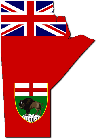
English: Flag-map of Manitoba |
| Date | (UTC) |
| Source | |
| Auteur |
|
Conditions d’utilisation
[modifier]
Ce fichier est disponible selon les termes de la licence Creative Commons Attribution – Partage dans les Mêmes Conditions 3.0 (non transposée).
- Vous êtes libre :
- de partager – de copier, distribuer et transmettre cette œuvre
- d’adapter – de modifier cette œuvre
- Sous les conditions suivantes :
- paternité – Vous devez donner les informations appropriées concernant l'auteur, fournir un lien vers la licence et indiquer si des modifications ont été faites. Vous pouvez faire cela par tout moyen raisonnable, mais en aucune façon suggérant que l’auteur vous soutient ou approuve l’utilisation que vous en faites.
- partage à l’identique – Si vous modifiez, transformez, ou vous basez sur cette œuvre, vous devez distribuer votre contribution sous la même licence ou une licence compatible avec celle de l’original.
Journal des téléversements d’origine
[modifier]
This image is a derivative work of the following images:
- File:Canada_Manitoba_location_map.svg licensed with Cc-by-sa-3.0
- 2009-08-28T11:57:45Z NordNordWest 1512x1864 (828380 Bytes) {{int:filedesc}} {{Information |Description= {{de|Positionskarte von [[:de:Manitoba|Manitoba]], [[:de:Kanada|Kanada]]}} Quadratische Plattkarte, N-S-Streckung 170 %. Geographische Begrenzung der Karte: * N: 60.3° N * S: 48.7
- File:Flag_of_Manitoba.svg licensed with PD-author
- 2006-05-04T19:31:25Z Episteme 1000x500 (25298 Bytes) DOCTYPE added
- 2006-03-06T22:09:12Z Denelson83 1000x500 (25199 Bytes) Dimensions rounded off; colour corrected
- 2005-11-26T21:11:38Z Kooma 992x496 (23155 Bytes) {{Information| |Description = Flag of [[:Category:Manitoba|Manitoba]] |Source = [http://www.sodipodi.com/index.php3?section=clipart/flags&area=flags&n=49 Sodipodi's Clipart Gallery] |Date = |Author = James Leigh |Permission
- File:MB_flag-contour.png licensed with PD-self
- 2006-11-24T00:41:39Z Qyd 435x654 (87283 Bytes) {{Information |Description=Contour flag of [[Manitoba]], [[Canada]] |Source=GIS data, flag colors |Date=Nov 2006 |Author={{User|Qyd}} |Permission=All (PD) |other_versions= }} [[Category:Maps of Manitoba]] [[Category:Flag maps
Téléversé avec derivativeFX
Historique du fichier
Cliquer sur une date et heure pour voir le fichier tel qu'il était à ce moment-là.
| Date et heure | Vignette | Dimensions | Utilisateur | Commentaire | |
|---|---|---|---|---|---|
| actuel | 27 octobre 2015 à 03:34 | | 358 × 510 (128 kio) | Echando una mano (d | contributions) | Official coat of arms |
| 9 mai 2010 à 22:48 |  | 358 × 510 (63 kio) | Svgalbertian (d | contributions) | Tweek. | |
| 9 mai 2010 à 21:44 |  | 358 × 510 (63 kio) | Svgalbertian (d | contributions) | Adjust. | |
| 9 mai 2010 à 19:42 |  | 358 × 510 (67 kio) | Svgalbertian (d | contributions) | == {{int:filedesc}} == {{Information |Description={{en|Flag-map of Manitoba}} |Source=*File:Canada_Manitoba_location_map.svg *File:Flag_of_Manitoba.svg *File:MB_flag-contour.png |Date=2010-05-09 19:41 (UTC) |Author=*[[:File:Canada_Manito |
Vous ne pouvez pas remplacer ce fichier.
Utilisations locales du fichier
Les 5 pages suivantes utilisent ce fichier :
Utilisations du fichier sur d’autres wikis
Les autres wikis suivants utilisent ce fichier :
- Utilisation sur ca.wikipedia.org
- Utilisation sur cs.wikipedia.org
- Utilisation sur cy.wikipedia.org
- Utilisation sur en.wikipedia.org
- Talk:Canadian English
- Talk:Moose
- Neelin
- Talk:French colonization of the Americas
- Talk:Neil Young
- Talk:Michif
- Talk:Taiga
- Talk:Bobcat
- Talk:Canoe
- Talk:Gimli Glider
- Talk:Hudson Bay
- Talk:Ojibwe
- Talk:Louis Riel
- Talk:New France
- Talk:War Plan Red
- Talk:Tommy Prince
- Talk:Ipsos-Reid
- Talk:Winnipeg
- Talk:Battle of Seven Oaks
- Talk:First Nations in Canada
- Talk:J. S. Woodsworth
- Talk:Chris Jericho
- Talk:Venetian Snares
- Talk:Red River Floodway
- Talk:Cree language
- Talk:Winnipeg general strike
- Talk:George-Étienne Cartier
- Talk:Manitoba
- Talk:1997 Red River flood
- Dominion City
- West Hawk crater
- Talk:Churchill, Manitoba
- Talk:Royal Regiment of Canadian Artillery
- Talk:Dust Bowl
- Talk:List of communities in Manitoba
- Talk:Rebecca Blaikie
- Forrest, Manitoba
- Talk:Métis
- Talk:Flin Flon
- Talk:Canadian Wheat Board
- Talk:Music of Manitoba
Voir davantage sur l’utilisation globale de ce fichier.