File:Flooding in Northern Italy (MODIS).jpg

Original file (1,296 × 1,045 pixels, file size: 180 KB, MIME type: image/jpeg)
Captions
Captions
Summary[edit]
.jpg&action=edit§ion=1)
| Description |
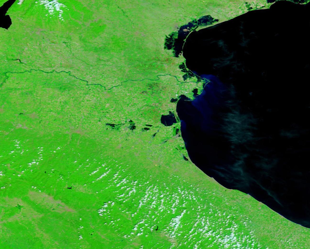
English: May 26, 2023 May 5, 2023
Heavy rainfall drenched north-central Italy, especially the Emilia-Romagna region, between April 30 and late May 2023. On May 19, ReliefWeb advised that at least 20 rivers had overflowed and at least 300 landslides had occurred. According to the World Health Organization (WHO), as of May 22 the flooding has led to the death of at least 23 people in Italy and forced thousands of residents to flee their homes. 10,000 people had been evacuated and 200 roads had been reported closed. On May 21, the Italian authorities activated the EU Civil Protection Mechanism, requesting assistance for high-capacity pumping equipment. The European Union mobilized offers of equipment from Austria, Bulgaria, Germany, France, Poland, Romania, Slovenia, and Slovakia. Floodwaters have lingered across much of the inundated region, including in the town of Conselice, in the province of Ravenna. On May 26, the mayor of that town ordered the evacuation of all homes in the sections that are still flooded due to health and hygiene concerns brought on by “stagnant water, the failure of the sewage system, the possible interruptions to drinking water supply, and the presence of uncollected waste”. A vaccination program to protect against tetanus is also underway, according to media reports. On May 26, 2023, the Moderate Resolution Imaging Spectroradiometer (MODIS) on board NASA’s Terra satellite acquired a false-color image of north-central Italy showing severe flooding of the region. In this type of image, water appears deep blue, vegetation looks green, and open or sparsely vegetated land is tan. The town of Ravenna is marked by a group of tan-toned pixels south of the large rounded lagoon-and-wetland complex of Valli de Comacchio. It is obvious in this image that waterways are swollen and flooding overlies fields, especially north of Valli de Comacchio. By clicking on the dates, it is easy to compare the May 26 image with a second Terra MODIS false-color image acquired on May 5. It is obvious that flooding is more severe in the May 26 image, especially in the south. However, May 5 also shows flooding following extreme rains of May 2-3 which delivered more than 20 centimeters (8 inches) in a 24-hour period in some locations. |
||
| Date | Taken on 26 May 2023 | ||
| Source |
Flooding in Northern Italy (direct link)
|
||
| Author | MODIS Land Rapid Response Team, NASA GSFC |
| This media is a product of the Terra mission Credit and attribution belongs to the mission team, if not already specified in the "author" row |
Licensing[edit]
.jpg&action=edit§ion=2)
| This file is in the public domain in the United States because it was solely created by NASA. NASA copyright policy states that "NASA material is not protected by copyright unless noted". (See Template:PD-USGov, NASA copyright policy page or JPL Image Use Policy.) | ||
 |
Warnings:
|
File history
Click on a date/time to view the file as it appeared at that time.
| Date/Time | Thumbnail | Dimensions | User | Comment | |
|---|---|---|---|---|---|
| current | 19:55, 31 July 2023 | | 1,296 × 1,045 (180 KB) | OptimusPrimeBot (talk | contribs) | #Spacemedia - Upload of http://modis.gsfc.nasa.gov/gallery/images/image05302023_250m.jpg via Commons:Spacemedia |
You cannot overwrite this file.
File usage on Commons
There are no pages that use this file.
.jpg&oldid=792463395)