File:Fort Biehler Mainz-Kastel.jpg
Jump to navigation
Jump to search
Size of this preview: 800 × 487 pixels. Other resolutions: 320 × 195 pixels | 640 × 390 pixels | 936 × 570 pixels.
Original file (936 × 570 pixels, file size: 216 KB, MIME type: image/jpeg)
Captions
Captions
Add a one-line explanation of what this file represents
Summary[edit]
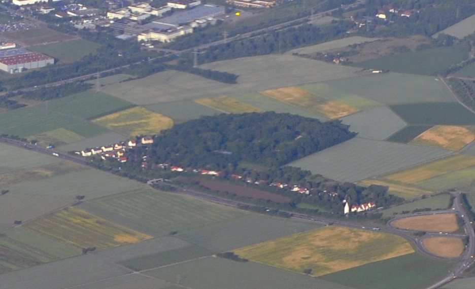
| Description |
Français : Vue aérienne de l'aéroport militaire de Erbenheim. En haut de l'image, on voit passer le fleuve le Rhin et la ville de Mayence.
Deutsch: Luftaufnahme des Wiesbaden Army Airfield. Im oberen Teil des Bildes sieht man den Rhein und die Stadt Mainz. |
| Date | |
| Source | Vue aerienne de l'aeroport militaire de Mechtildshausen |
| Author | T A from Düsseldorf, Allemagne |
| Other versions |

Licensing[edit]
This file is licensed under the Creative Commons Attribution-Share Alike 2.0 Generic license.
- You are free:
- to share – to copy, distribute and transmit the work
- to remix – to adapt the work
- Under the following conditions:
- attribution – You must give appropriate credit, provide a link to the license, and indicate if changes were made. You may do so in any reasonable manner, but not in any way that suggests the licensor endorses you or your use.
- share alike – If you remix, transform, or build upon the material, you must distribute your contributions under the same or compatible license as the original.
File history
Click on a date/time to view the file as it appeared at that time.
| Date/Time | Thumbnail | Dimensions | User | Comment | |
|---|---|---|---|---|---|
| current | 15:08, 11 June 2020 | | 936 × 570 (216 KB) | Hans Kastellan (talk | contribs) | File:Flugplatz Wiesbaden-Erbenheim 91.jpg cropped 78 % horizontally, 80 % vertically using CropTool with lossless mode. |
You cannot overwrite this file.
File usage on Commons
The following 3 pages use this file:
File usage on other wikis
The following other wikis use this file:
- Usage on ceb.wikipedia.org
- Usage on de.wikipedia.org
- Usage on www.wikidata.org