File:Fulleren, Mairie-école.jpg
跳转到导航
跳转到搜索

本预览的尺寸:777 × 600像素。 其他分辨率:311 × 240像素 | 622 × 480像素 | 995 × 768像素 | 1,280 × 988像素 | 2,560 × 1,977像素 | 4,204 × 3,246像素。
原始文件 (4,204 × 3,246像素,文件大小:2.12 MB,MIME类型:image/jpeg)
说明
说明
添加一行文字以描述该文件所表现的内容
| 描述 |
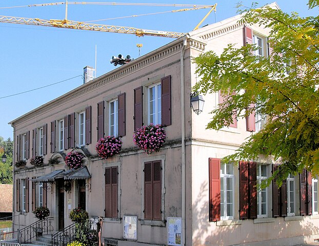
Français : La mairie-école de Fulleren Deutsch: Rathaus und Schule der Gemeinde Fulleren |
||
| 日期 | |||
| 来源 | 自行拍摄 | ||
| 作者 | Rauenstein | ||
| 授权 (二次使用本文件) |
|
| 物体位置 | | 在以下服务上查看本图像和附近其他图像: OpenStreetMap |
|---|
|
This building is indexed in the base Mérimée, a database of architectural heritage maintained by the French Ministry of Culture, under the reference IA68002765
|
文件历史
点击某个日期/时间查看对应时刻的文件。
| 日期/时间 | 缩略图 | 大小 | 用户 | 备注 | |
|---|---|---|---|---|---|
| 当前 | 2024年7月5日 (五) 11:21 | | 4,204 × 3,246(2.12 MB) | Rauenstein(留言 | 贡献) | {{Information |Description={{fr|La mairie-école de Fulleren}} {{de|Rathaus und Schule der Gemeinde Fulleren}} |Source={{self-photographed}} |Date=2011-10-02 |Author=Rauenstein |Permission={{PD-self}} |other_versions= }} {{Object location|47|35|39.87|N|7|8|50.96|E}} {{Mérimée|IA68002765}} mairie Category:Monuments à l’inventaire in Arrondissement Altkirch Category:Mairies-écoles in Arrondissement Altkirch [[... |
| 2011年10月9日 (日) 11:12 |  | 2,964 × 2,260(5.28 MB) | Rauenstein(留言 | 贡献) | {{Information |Description={{fr|La mairie-école de Fulleren}} {{de|Rathaus- und Schulgebäude in Fulleren}} |Source=own photograph |Date=2011-10-02 |Author=Rauenstein |Permission={{cc-by-s |
您不可以覆盖此文件。
文件用途
全域文件用途
以下其他wiki使用此文件:
- als.wikipedia.org上的用途
- ca.wikipedia.org上的用途
- ceb.wikipedia.org上的用途
- ce.wikipedia.org上的用途
- cs.wikipedia.org上的用途
- de.wikipedia.org上的用途
- diq.wikipedia.org上的用途
- en.wikipedia.org上的用途
- eo.wikipedia.org上的用途
- es.wikipedia.org上的用途
- eu.wikipedia.org上的用途
- fr.wikipedia.org上的用途
- hu.wikipedia.org上的用途
- it.wikipedia.org上的用途
- la.wikipedia.org上的用途
- ms.wikipedia.org上的用途
- nl.wikipedia.org上的用途
- oc.wikipedia.org上的用途
- pfl.wikipedia.org上的用途
- pl.wikipedia.org上的用途
- pt.wikipedia.org上的用途
- ro.wikipedia.org上的用途
- ru.wikipedia.org上的用途
- tt.wikipedia.org上的用途
- uk.wikipedia.org上的用途
- uz.wikipedia.org上的用途
- vec.wikipedia.org上的用途
- www.wikidata.org上的用途
- zh-min-nan.wikipedia.org上的用途
- zh.wikipedia.org上的用途