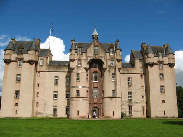
File:Fyvie Castle, Geograph.jpg
出自Wikimedia Commons
跳至導覽
跳至搜尋
Fyvie_Castle,_Geograph.jpg (640 × 480 像素,檔案大小:60 KB,MIME 類型:image/jpeg)
檔案資訊
結構化資料
說明
說明
添加單行說明來描述出檔案所代表的內容
| 拍攝地點 | 57° 26′ 33.97″ 北, 2° 23′ 41.92″ 西 | 位於此地的本圖片與其他圖片: OpenStreetMap |
|---|
| 目標地點 | 57° 26′ 35″ 北, 2° 23′ 42″ 西 | 位於此地的本圖片與其他圖片: OpenStreetMap |
|---|
| 描述Fyvie Castle, Geograph.jpg | Fyvie Castle in the village of Fyvie, near Turriff in Aberdeenshire, Scotland. | ||
| 日期 | |||
| 來源 | Geograph project | ||
| 作者 | Mike and Kirsty Grundy | ||
| 授權許可 (重用此檔案) |
此檔案採用創用CC 姓名標示-相同方式分享 2.0 通用版授權條款。 姓名標示: Mike and Kirsty Grundy
|
檔案歷史
點選日期/時間以檢視該時間的檔案版本。
| 日期/時間 | 縮圖 | 尺寸 | 使用者 | 備註 | |
|---|---|---|---|---|---|
| 目前 | 2007年12月31日 (一) 17:24 |  | 640 × 480(60 KB) | GeeJo(留言 | 貢獻) | {{Information |Description=Fyvie Castle in the village of Fyvie, near Turriff in Aberdeenshire, Scotland. |Source=Geograph project |Date=26 July 2007 |Author=Mike and Kirsty Grundy |Permission={{Geograph|507903|Mike and Kirsty Grundy}} |other_versions= }} |
無法覆蓋此檔案。
檔案用途
沒有使用此檔案的頁面。
全域檔案使用狀況
以下其他 wiki 使用了這個檔案:
- de.wikipedia.org 的使用狀況
- en.wikipedia.org 的使用狀況
- es.wikipedia.org 的使用狀況
- fr.wikipedia.org 的使用狀況
- hu.wikipedia.org 的使用狀況
- it.wikipedia.org 的使用狀況
- pt.wikipedia.org 的使用狀況
- ru.wikipedia.org 的使用狀況
- sv.wikipedia.org 的使用狀況
- zh.wikipedia.org 的使用狀況
隱藏分類:
- Files with coordinates missing SDC location of creation
- CC-BY-SA-2.0
- Images from Geograph Britain and Ireland
- Images from Geograph Britain and Ireland missing SDC depicts
- Images from Geograph Britain and Ireland missing SDC creator
- Images from Geograph Britain and Ireland missing SDC source of file
- Images from Geograph Britain and Ireland missing SDC location of creation
- United Kingdom photographs taken on 2007-07-26

