File:Gasquet Landslide CALTRANS.jpg

Gasquet_Landslide_CALTRANS.jpg (720 × 405 pixels, file size: 129 KB, MIME type: image/jpeg)
Captions
Captions
| Description |
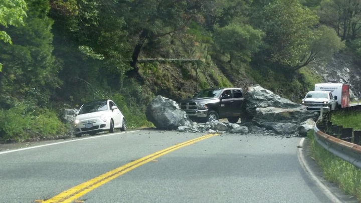
English: Exceptionally large boulders crashed onto 199 during a rock slide U.S. Route 199 between Gasquet and Patrick’s Creek, CA on May 13, 2017. |
|||
| Date | ||||
| Source | https://lostcoastoutpost.com/loco-media/cache/af/ff/affff9c32d01560cc4fc67d7d2ae6e73.jpg https://lostcoastoutpost.com/chpwatch/2017/may/13/00059/ | |||
| Author | California Department of Transportation "Caltrans" | |||
| Permission (Reusing this file) |
|

| Camera location | | View this and other nearby images on: OpenStreetMap |
|---|
approximate
File history
Click on a date/time to view the file as it appeared at that time.
| Date/Time | Thumbnail | Dimensions | User | Comment | |
|---|---|---|---|---|---|
| current | 00:14, 14 May 2017 | | 720 × 405 (129 KB) | Ellin Beltz (talk | contribs) | {{Information |Description ={{en|1=Exceptionally large boulders crashed onto 199 during a rock slide U.S. Route 199 between Gasquet and Patrick’s Creek, CA on May 13, 2017. }} |Source =https://lostcoastoutpost.com/loco-media/cache/af/ff/af... |
You cannot overwrite this file.
File usage on Commons
There are no pages that use this file.