File:General soil map - Miami Valley Resource Conservation and Development in partnership with Clinton County Regional Planning Commission, Cowan Lake Watershed, Clinton County, Ohio LOC 00561186.jpg
Jump to navigation
Jump to search

Size of this preview: 800 × 528 pixels. Other resolutions: 320 × 211 pixels | 640 × 423 pixels | 1,024 × 676 pixels | 1,280 × 845 pixels | 2,560 × 1,690 pixels | 5,204 × 3,436 pixels.
Original file (5,204 × 3,436 pixels, file size: 1.9 MB, MIME type: image/jpeg)
Captions
Captions
Add a one-line explanation of what this file represents
Summary
[edit]| Description |
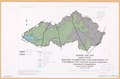
English: Includes location map. "February 1995 1008091-01." "Source: State Soil Geographic data base (STATSGO). Original map scale 1:250,000. Bureau of the Census tiger line files, 1:24,000 USGS quadrangles and information from NRCS field personnel. Available also through the Library of Congress Web site as a raster image. |
||
| Title | General soil map : Miami Valley Resource Conservation and Development in partnership with Clinton County Regional Planning Commission, Cowan Lake Watershed, Clinton County, Ohio | ||
| Shelf ID | G4082.C77J3 1995 .U5 | ||
| Date | |||
| Source | https://www.loc.gov/item/00561186/ | ||
| Author | United States. Natural Resources Conservation Service; National Cartography And Geographic Information Systems Center (U.S.) | ||
| Permission (Reusing this file) |
|
||
| Other versions |
|
||
| Location | United States · Cowan Lake Watershed. · Cowan Lake Watershed · Ohio | ||
| Part of | American Memory · Catalog · Geography And Map Division · Additional Conservation And Environment Cartographic Items | ||
| Subject | Soils · United States · Maps · Ohio · Cowan Lake Watershed · Cowan Lake Watershed (Ohio) |

Licensing
[edit]
This work is in the public domain in the United States because it is a work prepared by an officer or employee of the United States Government as part of that person’s official duties under the terms of Title 17, Chapter 1, Section 105 of the US Code.
Note: This only applies to original works of the Federal Government and not to the work of any individual U.S. state, territory, commonwealth, county, municipality, or any other subdivision. This template also does not apply to postage stamp designs published by the United States Postal Service since 1978. (See § 313.6(C)(1) of Compendium of U.S. Copyright Office Practices). It also does not apply to certain US coins; see The US Mint Terms of Use.
|
 | |
| This file has been identified as being free of known restrictions under copyright law, including all related and neighboring rights. | ||
File history
Click on a date/time to view the file as it appeared at that time.
| Date/Time | Thumbnail | Dimensions | User | Comment | |
|---|---|---|---|---|---|
| current | 06:13, 8 March 2020 | | 5,204 × 3,436 (1.9 MB) | Fæ (talk | contribs) | LOC Maps https://www.loc.gov/item/00561186/ #38174 |
You cannot overwrite this file.
File usage on Commons
The following page uses this file: