File:Generalstabskartan södra 45 Linköping 1883.jpg

Original file (7,078 × 5,441 pixels, file size: 16.77 MB, MIME type: image/jpeg)
Captions
Captions
Summary[edit]
| Description |
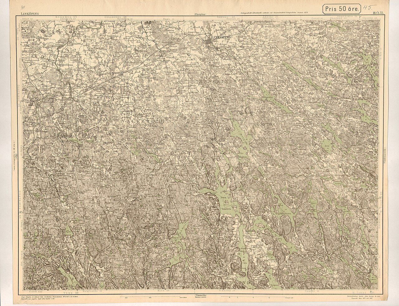
Svenska: Generalstabens karta öfver Sverige. Södra delen. 45 Linköping (III.Ö. 35).
Höjdsiffrorna angifva höjd öfver hafvet i fot. English: Swedish topographic map 'Generalstabskartan' for southern Sweden, leaf 45 Linköping (III.Ö. 35). |
| Date | |
| Source | Printed in 1883, scanned in December 2012 in 400 dpi in 4 parts by Claes Schibler, stitched together in January 2013 by LA2 with Hugin (free software) |
| Author | Generalstabens litografiska anstalt |
Licensing[edit]
|
This work is in the public domain in its country of origin and other countries and areas where the copyright term is the author's life plus 70 years or fewer.
| |
| This file has been identified as being free of known restrictions under copyright law, including all related and neighboring rights. | |
File history
Click on a date/time to view the file as it appeared at that time.
| Date/Time | Thumbnail | Dimensions | User | Comment | |
|---|---|---|---|---|---|
| current | 19:26, 16 January 2013 | | 7,078 × 5,441 (16.77 MB) | LA2 (talk | contribs) | =={{int:filedesc}}== {{Information |description={{sv|1=Generalstabens karta öfver Sverige. Södra delen. 45 Linköping (III.Ö. 35). Generalstabens karta öfver Sverige 1882. Uppmätt åren 1877 och 1878. Märk att järnväg... |
You cannot overwrite this file.
File usage on Commons
The following page uses this file:
- File:Generalstabskartan södra 45 Linköping 1882.jpg (file redirect)
File usage on other wikis
The following other wikis use this file:
- Usage on sv.wikipedia.org