File:Geographical description of Scotland.pdf
Jump to navigation
Jump to search

Size of this JPG preview of this PDF file: 334 × 600 pixels. Other resolutions: 133 × 240 pixels | 267 × 480 pixels | 662 × 1,189 pixels.

Original file (662 × 1,189 pixels, file size: 667 KB, MIME type: application/pdf, 16 pages)
Captions
Captions
Add a one-line explanation of what this file represents
Summary
[edit]| Geographical description of Scotland
( |
||
|---|---|---|
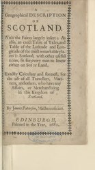
| Title |
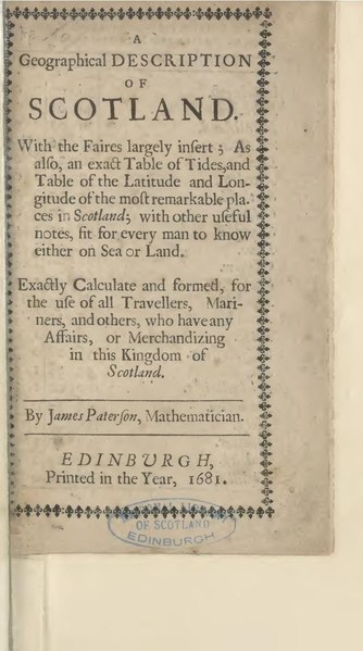
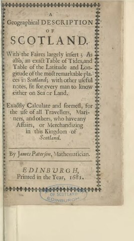
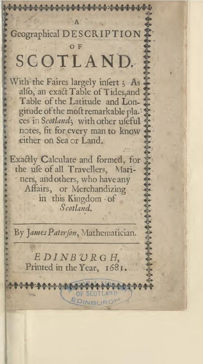
Geographical description of Scotland |
 |
| Description |
With the faires largely insert; as also, an exact table of tides, and table of the latitude and longitude of the most remarkable pla.ces (sic) in Scotland; with other useful notes, fit for every man to know either on sea or land. Exactly calculate and formed, for the use of all travellers, mariners, and others, who have any affairs, or merchandizing in this kingdom of Scotland. By James Paterson, mathematician. Edinburgh : Publisher not identified, Printed in the year, 1681. |
|
| Language | English | |
| Publication date | 1681 | |
| Source | https://digital.nls.uk/104184136 | |
Licensing
[edit]|
This work is in the public domain in its country of origin and other countries and areas where the copyright term is the author's life plus 70 years or fewer. | |
| This file has been identified as being free of known restrictions under copyright law, including all related and neighboring rights. | |
File history
Click on a date/time to view the file as it appeared at that time.
| Date/Time | Thumbnail | Dimensions | User | Comment | |
|---|---|---|---|---|---|
| current | 13:58, 2 June 2020 |  | 662 × 1,189, 16 pages (667 KB) | FrancineMillard (talk | contribs) | pattypan 20.04 |
You cannot overwrite this file.
File usage on Commons
The following page uses this file:
File usage on other wikis
The following other wikis use this file:
- Usage on en.wikisource.org
- Index:Geographical description of Scotland.pdf
- Page:Geographical description of Scotland.pdf/1
- Page:Geographical description of Scotland.pdf/2
- Page:Geographical description of Scotland.pdf/3
- Page:Geographical description of Scotland.pdf/4
- Page:Geographical description of Scotland.pdf/5
- Page:Geographical description of Scotland.pdf/6
- Page:Geographical description of Scotland.pdf/7
- Page:Geographical description of Scotland.pdf/8
- Page:Geographical description of Scotland.pdf/9
- Page:Geographical description of Scotland.pdf/10
- Page:Geographical description of Scotland.pdf/11
- Page:Geographical description of Scotland.pdf/12
- Page:Geographical description of Scotland.pdf/13
- Page:Geographical description of Scotland.pdf/14
- Page:Geographical description of Scotland.pdf/15
- Page:Geographical description of Scotland.pdf/16