File:Germany (+districts) location map.svg
Siirry navigaatioon
Siirry hakuun

Tämän PNG-esikatselun koko koskien SVG-tiedostoa: 506 × 600 kuvapistettä. Muut resoluutiot: 202 × 240 kuvapistettä | 405 × 480 kuvapistettä | 648 × 768 kuvapistettä | 864 × 1 024 kuvapistettä | 1 728 × 2 048 kuvapistettä | 1 073 × 1 272 kuvapistettä.
Alkuperäinen tiedosto (SVG-tiedosto; oletustarkkuus 1 073 × 1 272 kuvapistettä; tiedostokoko 2,21 MiB)
Kuvatekstit
Kuvatekstit
Lisää yhden rivin pituinen kuvaus tästä tiedostosta
Yhteenveto
[muokkaa]_location_map.svg&action=edit§ion=1)
| Kuvaus |
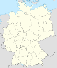
Deutsch: Positionskarte von Deutschland mit Grenzen der Regierungsbezirke und Landkreise
Quadratische Plattkarte, N-S-Streckung 150 %. Geographische Begrenzung der Karte:
English: Location map of Germany with waterbodies
Equirectangular projection, N/S stretching 150 %. Geographic limits of the map:
|
| Päiväys | |
| Lähde |
Oma teos Tämä vektorigrafiikkatiedosto luotiin käyttäen apuna ohjelmaa Adobe Illustrator. Tämä tiedosto tallennettiin Commonsiin Commonist-tietokoneohjelmalla. This vector image includes elements that have been taken or adapted from this file: This vector image includes elements that have been taken or adapted from this file: |
| Tekijä |
TUBS |
| Muut versiot |
_-_de_-_colored.svg) |
Lisenssi
[muokkaa]_location_map.svg&action=edit§ion=2)
Minä, tämän teoksen tekijänoikeuksien haltija, julkaisen täten tämän teoksen seuraavilla lisensseillä:
Tämä tiedosto on lisensoitu Creative Commons Nimeä-JaaSamoin 3.0 Ei sovitettu -lisenssillä.
- Voit:
- jakaa – kopioida, levittää ja esittää teosta
- remiksata – valmistaa muutettuja teoksia
- Seuraavilla ehdoilla:
- nimeäminen – Sinun on mainittava lähde asianmukaisesti, tarjottava linkki lisenssiin sekä merkittävä, mikäli olet tehnyt muutoksia. Voit tehdä yllä olevan millä tahansa kohtuullisella tavalla, mutta et siten, että annat ymmärtää lisenssinantajan suosittelevan sinua tai teoksen käyttöäsi.
- jaa samoin – Jos muutat tai perustat tähän työhön, voit jakaa tuloksena syntyvää työtä vain tällä tai tämän kaltaisella lisenssillä.

|
Voit kopioida, levittää ja/tai muuttaa tätä asiakirjaa GNU Free Documentation License -lisenssin version 1.2 tai minkä tahansa Free Software Foundationin julkaiseman myöhemmän version ehtojen alaisena; ei koske muuttumattomia kohtia, etukannen tekstejä eikä takakannen tekstejä. Kopio tästä lisenssistä on saatavilla osiossa GNU Free Documentation License. |
Voit valita haluamasi lisenssin.

|
I'd greatly appreciate, that you attribute this media file to Wikimedia Commons, if used outside Wikipedia or Commons. For use in publications such as books, newspapers, blogs, websites, please insert here the following line:
|
_location_map.svg)
Tiedoston historia
Päiväystä napsauttamalla näet, millainen tiedosto oli kyseisellä hetkellä.
| Päiväys | Pienoiskuva | Koko | Käyttäjä | Kommentti | |
|---|---|---|---|---|---|
| nykyinen | 14. toukokuuta 2022 kello 12.40 | | 1 073 × 1 272 (2,21 MiB) | TUBS (keskustelu | muokkaukset) | erlangen + höchstadt - double borders |
| 14. toukokuuta 2022 kello 12.18 |  | 1 073 × 1 272 (4,18 MiB) | TUBS (keskustelu | muokkaukset) | Reverted to version as of 09:22, 14 February 2020 (UTC): reverted. Did more harm than good (esp. concering islands in the Baltic and North See) and double/ghost borders. Will deal with the Franconian issue later. | |
| 7. joulukuuta 2021 kello 08.49 |  | 1 073 × 1 272 (4,15 MiB) | TUBS (keskustelu | muokkaukset) | erlangen + höchstadt vereint | |
| 14. helmikuuta 2020 kello 09.22 |  | 1 073 × 1 272 (4,18 MiB) | TUBS (keskustelu | muokkaukset) | pushed LK Kehlheim to the right Bezirk. ((This is not an update. Some districts have merged by now, e.g. Göttignen/Osterode. Some borders have changed as of February 2020. Don't have the time to redraw the map.) | |
| 29. lokakuuta 2013 kello 13.01 |  | 1 073 × 1 272 (3,17 MiB) | TUBS (keskustelu | muokkaukset) | ||
| 29. lokakuuta 2013 kello 12.52 |  | 1 073 × 1 272 (1,61 MiB) | TUBS (keskustelu | muokkaukset) | real loc map | |
| 28. lokakuuta 2013 kello 18.44 |  | 1 073 × 1 272 (5,82 MiB) | TUBS (keskustelu | muokkaukset) | == {{int:filedesc}} == {{Information |Description={{de|Karte der politischen Gliederung Deutschlands in Länder, Regierungsbezirke, Landkreise und krsfr. Städte}} {{en|Map of administrative divisions of Germany. States, government districts, districts... |
Et voi tallentaa uutta tiedostoa tämän tilalle.
Tiedoston käyttö
Seuraavat 32 sivua käyttävät tätä tiedostoa:
- File:Deutschland Autobahnen.svg
- File:East-West-Germany-October 1949-July 1952.svg
- File:East Germany location map.svg
- File:Germany, Federal Republic of location map 23 May 1949 - 6 Oct 1949.svg
- File:Germany, Federal Republic of location map April 1952 - August 1955.svg
- File:Germany, Federal Republic of location map December 1950 - April 1952.svg
- File:Germany, Federal Republic of location map January 1957 - October 1990.svg
- File:Germany, Federal Republic of location map October 1949 - November 1950.svg
- File:Germany, Federal Republic of location map September 1955 - December 1956.svg
- File:Germany, German Democratic Republic location map January 1957 - October 1990.svg
- File:Germany, German Democratic Republic location map July 1952 - January 1957.svg
- File:Germany, German Democratic Republic location map October 1949 - July 1952.svg
- File:Germany, German Democratic Republic location map w·o FRG July 1952 - October 1990.svg
- File:Germany, German Democratic Republic location map w·o FRG October 1949 - June 1952.svg
- File:Germany, administrative divisions (+districts) - de - colored.svg
- File:Germany, location map (SBZ perspective) 23 May 1949 - 6 Oct 1949.svg
- File:Germany2 location map.svg
- File:Germany (+districts +municipalities) location map.png
- File:Germany (+districts +municipalities) location map 2013.svg
- File:Germany (+districts +municipalities) location map current.svg
- File:Germany location map.svg
- File:Germany location map 23 April 1949 - 22 May 1949.svg
- File:Germany location map 8 Jun 1947 - 22 Apr 1949.svg
- File:Germany location map April 1992 - July 1992.svg
- File:Germany location map August 1992 - June 1993.svg
- File:Germany location map July 1993 - December 2009.svg
- File:Germany location map October 1990 - March 1992.svg
- File:Germany location map labeled 8 Jun 1947 - 22 Apr 1949.svg
- File:Lage Freiberg in Deutschland.png
- File:Relief Map of Germany.png
- File:Relief Map of Germany.svg
- Template:Germany location map/other versions
_23_May_1949_-_6_Oct_1949.svg)
_location_map.png)
_location_map_2013.svg)
_location_map_current.svg)
Tiedoston järjestelmänlaajuinen käyttö
Seuraavat muut wikit käyttävät tätä tiedostoa:
- Käyttö kohteessa de.wikipedia.org
_location_map.svg&oldid=655989313)