File:Glietz Dorfanger Eiche 01.JPG
Original file (3,628 × 4,610 pixels, file size: 13.68 MB, MIME type: image/jpeg)
Captions
Summary[edit]
DescriptionGlietz Dorfanger Eiche 01.JPG |
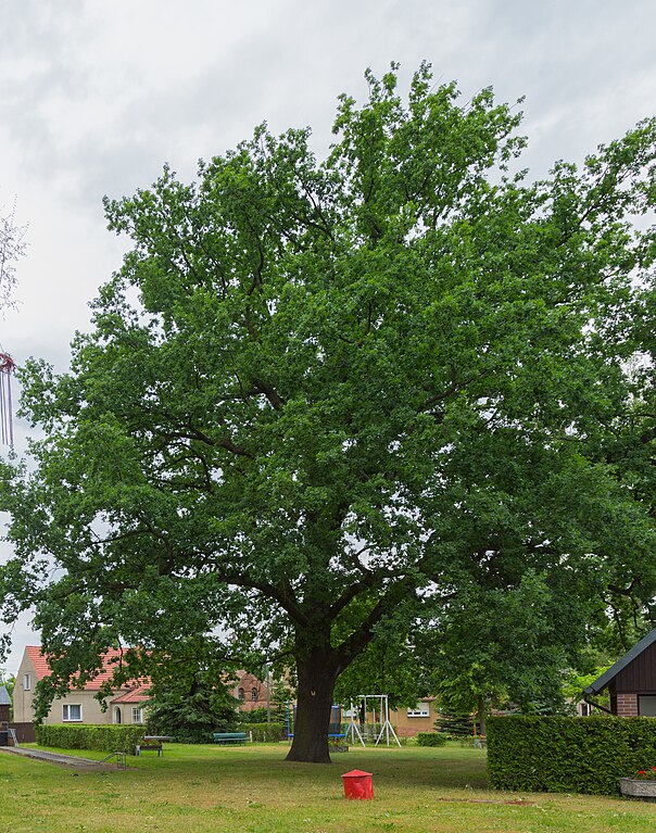
English: Oak (Quercus) in the village green of Glietz, a district of Märkische Heide, Landkreis Dahme-Spreewald, Brandenburg, Germany. The oak is a listed natural monument.
Deutsch: Eiche (Quercus) auf dem Dorfplatz von Glietz, einem Ortsteil der Gemeinde Märkische Heide, Landkreis Dahme-Spreewald, Brandenburg, Deutschland. Der Baum ist in die Naturdenkmalliste eingetragen.
| ||||
references InfoField |
|
||||
Date | |||||
Source | Own work | ||||
Author | J.-H. Janßen |
Camera location | 52° 00′ 31.49″ N, 14° 04′ 52.11″ E | View this and other nearby images on: OpenStreetMap | 52.008748; 14.081143 |
---|
Licensing[edit]
- You are free:
- to share – to copy, distribute and transmit the work
- to remix – to adapt the work
- Under the following conditions:
- attribution – You must give appropriate credit, provide a link to the license, and indicate if changes were made. You may do so in any reasonable manner, but not in any way that suggests the licensor endorses you or your use.
- share alike – If you remix, transform, or build upon the material, you must distribute your contributions under the same or compatible license as the original.
This image was uploaded as part of Wiki Loves Earth 2021.
aragonés ∙ asturianu ∙ azərbaycanca ∙ Bahasa Indonesia ∙ Bahasa Melayu ∙ brezhoneg ∙ català ∙ čeština ∙ Cymraeg ∙ Deutsch ∙ eesti ∙ English ∙ español ∙ euskara ∙ français ∙ galego ∙ hrvatski ∙ italiano ∙ latviešu ∙ Nederlands ∙ norsk ∙ norsk bokmål ∙ português ∙ polski ∙ português do Brasil ∙ română ∙ shqip ∙ sicilianu ∙ slovenščina ∙ svenska ∙ Türkçe ∙ Ελληνικά ∙ беларуская (тарашкевіца) ∙ български ∙ македонски ∙ русский ∙ српски / srpski ∙ українська ∙ ქართული ∙ հայերեն ∙ नेपाली ∙ मराठी ∙ বাংলা ∙ മലയാളം ∙ ไทย ∙ 한국어 ∙ 日本語 ∙ 中文 ∙ 中文(台灣) ∙ 中文(简体) ∙ 中文(繁體) ∙ עברית ∙ اردو ∙ العربية ∙ فارسی ∙ +/− |
File history
Click on a date/time to view the file as it appeared at that time.
Date/Time | Thumbnail | Dimensions | User | Comment | |
---|---|---|---|---|---|
current | 10:40, 8 May 2021 | 3,628 × 4,610 (13.68 MB) | J.-H. Janßen (talk | contribs) | revised | |
21:05, 6 May 2021 | 3,648 × 5,472 (17.69 MB) | J.-H. Janßen (talk | contribs) | {{Naturdenkmal Deutschland |1=|2=BB |3=Märkische Heide |4= |5=Märkische Heide}} {{Information |Description={{en|1=Oak (''Quercus'') in the village green of Glietz, a district of Märkische Heide, Landkreis Dahme-Spreewald, Brandenburg, Germany. The oak is a listed natural monument.}} {{de|1=Eiche (''Quercus'') auf dem Dorfplatz von Glietz, einem Ortsteil der Gemeinde [[:Cate... |
You cannot overwrite this file.
File usage on Commons
The following page uses this file:
File usage on other wikis
The following other wikis use this file:
- Usage on de.wikipedia.org
- Usage on www.wikidata.org
Metadata
This file contains additional information such as Exif metadata which may have been added by the digital camera, scanner, or software program used to create or digitize it. If the file has been modified from its original state, some details such as the timestamp may not fully reflect those of the original file. The timestamp is only as accurate as the clock in the camera, and it may be completely wrong.
Camera manufacturer | Canon |
---|---|
Camera model | Canon EOS 6D |
Author | Wikimedia User J.-H. Janssen |
Exposure time | 1/60 sec (0.016666666666667) |
F-number | f/8 |
ISO speed rating | 100 |
Date and time of data generation | 15:29, 8 June 2015 |
Lens focal length | 28 mm |
Latitude | 52° 0′ 31.49″ N |
Longitude | 14° 4′ 52.12″ E |
Altitude | 54.2 meters above sea level |
Horizontal resolution | 300 dpi |
Vertical resolution | 300 dpi |
Software used | Adobe Photoshop Lightroom 5.7.1 (Windows) |
File change date and time | 11:13, 8 May 2021 |
Exposure Program | Landscape mode (for landscape photos with the background in focus) |
Exif version | 2.3 |
Date and time of digitizing | 15:29, 8 June 2015 |
APEX shutter speed | 5.906891 |
APEX aperture | 6 |
APEX exposure bias | 0 |
Maximum land aperture | 4 APEX (f/4) |
Metering mode | Pattern |
Flash | Flash did not fire, compulsory flash suppression |
DateTimeOriginal subseconds | 92 |
DateTimeDigitized subseconds | 92 |
Color space | sRGB |
Focal plane X resolution | 1,520 |
Focal plane Y resolution | 1,520 |
Focal plane resolution unit | 3 |
Custom image processing | Normal process |
Exposure mode | Auto exposure |
White balance | Manual white balance |
Scene capture type | Standard |
GPS time (atomic clock) | 13:28 |
Satellites used for measurement | 9 |
Receiver status | Measurement in progress |
Measurement mode | 3-dimensional measurement |
Measurement precision | Poor (50) |
Geodetic survey data used | WGS-84 |
GPS date | 8 June 2015 |
GPS tag version | 0.0.3.2 |
Serial number of camera | 033024001627 |
Lens used | EF24-105mm f/4L IS USM |
Date metadata was last modified | 13:13, 8 May 2021 |
Unique ID of original document | CA35CA44448635960B540B46512440A4 |
IIM version | 4 |
Structured data
Items portrayed in this file
depicts
8 June 2015
52°0'31.493"N, 14°4'52.115"E
0.01666666666666666666 second
28 millimetre
100
image/jpeg
- Files with coordinates missing SDC location of creation
- CC-BY-SA-4.0
- Images from Wiki Loves Earth 2021
- Images from Wiki Loves Earth 2021 in Germany
- Images from Wiki Loves Earth missing SDC depicts
- Images from Wiki Loves Earth missing SDC location of creation
- Images from Wiki Loves Earth 2021, DE-BB
- Taken with Canon EOS 6D and Canon EF 24-105mm F4L IS USM
- Photographs by J.-H. Janßen/Wiki Loves Earth
- Images from Wiki Loves Earth 2021, DE landscape
- Pages with maps