File:Glory Mountain and Trapper Lake.tif
Jump to navigation
Jump to search

Size of this JPG preview of this TIF file: 800 × 600 pixels. Other resolutions: 320 × 240 pixels | 640 × 480 pixels | 1,024 × 768 pixels | 1,280 × 960 pixels | 2,560 × 1,920 pixels | 3,264 × 2,448 pixels.
Original file (3,264 × 2,448 pixels, file size: 14.55 MB, MIME type: image/tiff)
Captions
Captions
Add a one-line explanation of what this file represents
Summary
[edit]| Description |
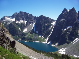
English: Glory Mountain (left) and Trapper Lake. Trapper Annex (right). |
| Date | circa 2012 |
| Source | https://npgallery.nps.gov/AssetDetail/31cf7cea-b08f-47dd-8171-83e5899d8f8e |
| Author | National Park Service/Mack Kolarich |
| Camera location | | View this and other nearby images on: OpenStreetMap |
|---|
Licensing
[edit]| This image or media file contains material based on a work of a National Park Service employee, created as part of that person's official duties. As a work of the U.S. federal government, such work is in the public domain in the United States. See the NPS website and NPS copyright policy for more information. |
File history
Click on a date/time to view the file as it appeared at that time.
| Date/Time | Thumbnail | Dimensions | User | Comment | |
|---|---|---|---|---|---|
| current | 21:13, 26 March 2021 |  | 3,264 × 2,448 (14.55 MB) | Ron Clausen (talk | contribs) | Uploaded a work by National Park Service/Mack Kolarich from https://npgallery.nps.gov/AssetDetail/31cf7cea-b08f-47dd-8171-83e5899d8f8e with UploadWizard |
You cannot overwrite this file.
File usage on Commons
There are no pages that use this file.
File usage on other wikis
The following other wikis use this file:
- Usage on en.wikipedia.org