File:Golan 1994.jpg
Jump to navigation
Jump to search

Size of this preview: 474 × 599 pixels. Other resolutions: 190 × 240 pixels | 379 × 480 pixels | 607 × 768 pixels | 810 × 1,024 pixels | 1,885 × 2,384 pixels.
Original file (1,885 × 2,384 pixels, file size: 794 KB, MIME type: image/jpeg)
Captions
Captions
Add a one-line explanation of what this file represents
| Description |
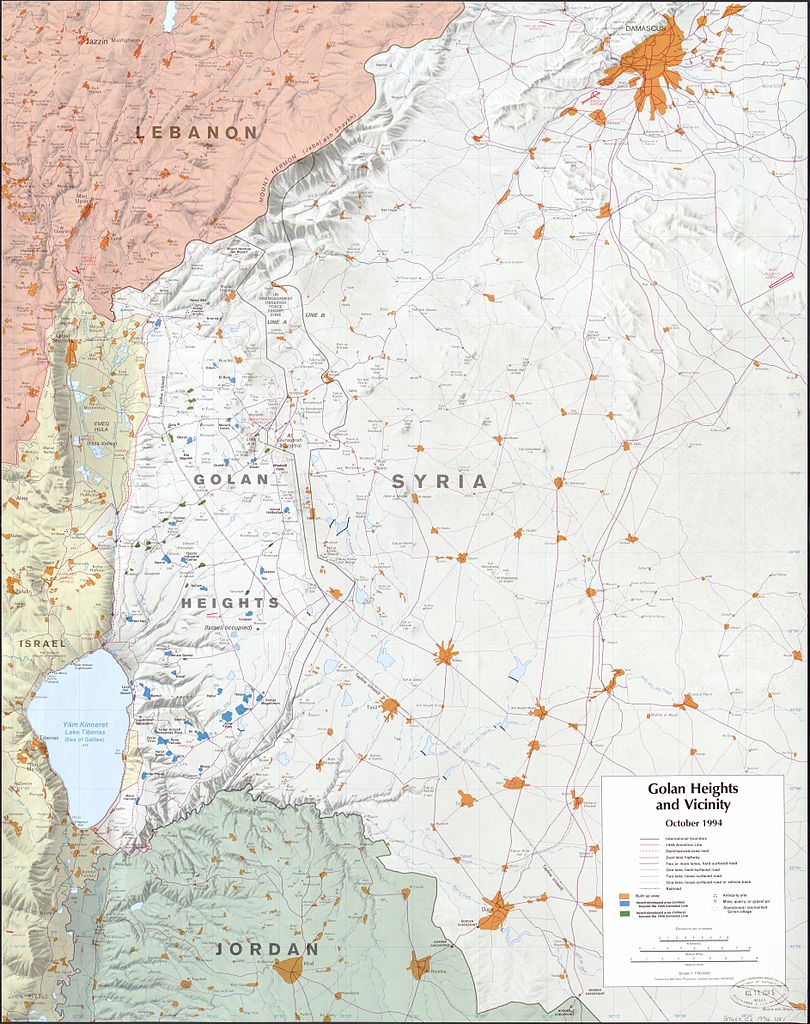
English: Map of the Golan Heights and vicinity |
|||
| Date | ||||
| Source | https://www.loc.gov/item/2006458563 | |||
| Author | United States Central Intelligence Agency | |||
| Permission (Reusing this file) |
|

File history
Click on a date/time to view the file as it appeared at that time.
| Date/Time | Thumbnail | Dimensions | User | Comment | |
|---|---|---|---|---|---|
| current | 11:20, 2 August 2013 | | 1,885 × 2,384 (794 KB) | Osiris (talk | contribs) | {{Information |Description ={{en|1=Map of the Golan Heights and vicinity}} |Source =http://www.loc.gov/item/2006458563 |Author =United States Central Intelligence Agency |Date =October 1994 |Permission ={{PD-USGov-CIA}}... |
You cannot overwrite this file.
File usage on Commons
There are no pages that use this file.