File:Golden Horde 1389.svg
Pāriet uz navigāciju
Pāriet uz meklēšanu

Size of this PNG preview of this SVG file: 800 × 569 pikseļi. Citi izmēri: 320 × 228 pikseļi | 640 × 455 pikseļi | 1 024 × 728 pikseļi | 1 280 × 910 pikseļi | 2 560 × 1 820 pikseļi | 962 × 684 pikseļi.
Sākotnējais fails (SVG fails, definētais izmērs 962 × 684 pikseļi, faila izmērs: 146 KB)
Captions
Captions
Pievieno vienas rindiņas aprakstu, ko šis fails attēlo
Kopsavilkums[labot šo sadaļu]
| Apraksts |
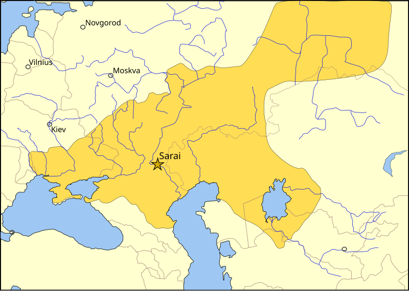
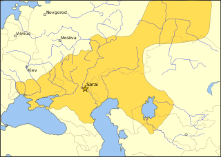
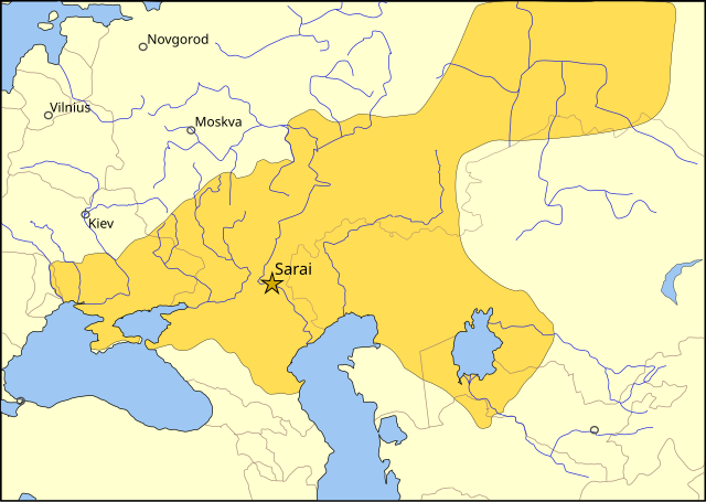
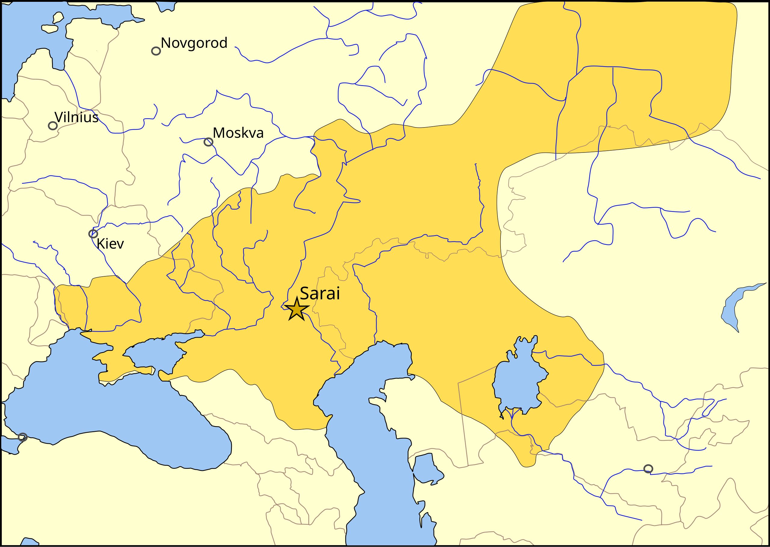
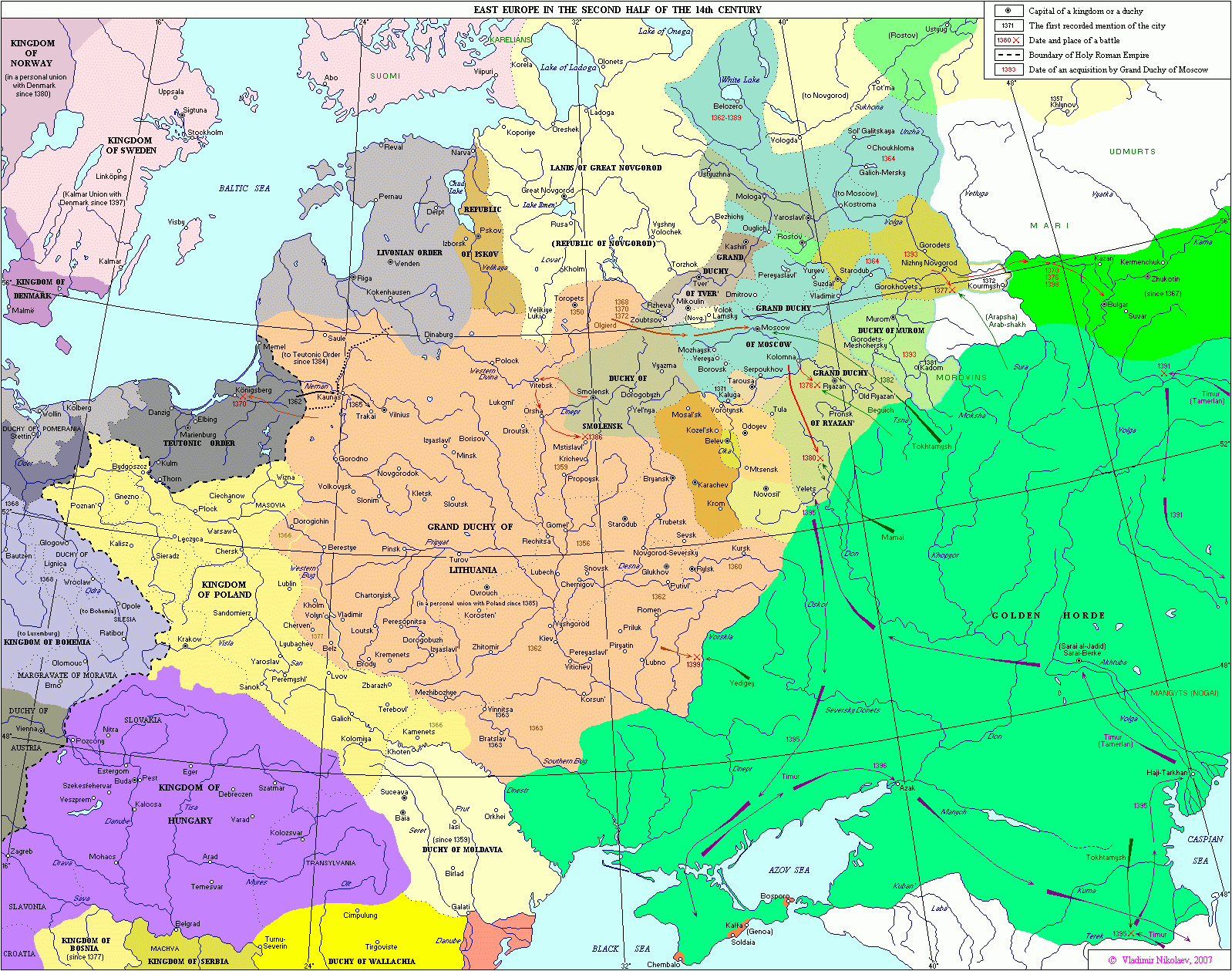
The domains of the Golden Horde in the year 1389, before the Tokhtamysh-Timur war. The rivers are shown in blue, the 2006 international borders in light brown, and important cities of 1389 with a black circle. The capital of the Golden Horde, Sarai is shown with a gold star. Kiev, Moscow, Novgorod and Vilnius are shown as circles. This map uses a Lambert azimuthal equal-area projection. |
| Datums | |
| Avots |
Paša darbs. Sources used in creating this map:
|
| Autors | MapMaster |
| Citas versijas |
[]
|
| SVG veidošana |


Licence[labot šo sadaļu]
Es, šī darba autortiesību īpašnieks, publicēju to saskaņā ar šo licenci:

|
Ir dota atļauja kopēt, izplatīt un/vai pārveidot šo dokumentu saskaņā ar GNU brīvās dokumentācijas licences, versijas 1.2 vai jebkuras vēlākas versijas, ko publiskojis Brīvās programmatūras fonds nosacījumiem; bez nemainīgajām sadaļā, priekšējā un aizmugurēja'vāka tekstiem. Licences kopija ir iekļauta sadaļā ar nosaukumu GNU brīvās dokumentācijas licence. |
| Šis fails tiek izplatīts saskaņā ar licences Creative Commons Atsauce-Līdzīgi Noteikumi 3.0 Vispārējiem noteikumiem. | ||
| ||
| This licensing tag was added to this file as part of the GFDL licensing update. |
Faila hronoloģija
Uzklikšķini uz datums/laiks kolonnā esošās saites, lai apskatītos, kā šis fails izskatījās tad.
| Datums/Laiks | Attēls | Izmēri | Dalībnieks | Komentārs | |
|---|---|---|---|---|---|
| tagadējais | 2022. gada 17. oktobris, plkst. 20.28 | | 962 × 684 (146 KB) | Archiwald (diskusija | devums) | File uploaded using svgtranslate tool (https://svgtranslate.toolforge.org/). Added translation for pl. |
| 2012. gada 17. novembris, plkst. 11.44 |  | 962 × 684 (148 KB) | Joe Roe (diskusija | devums) | Expanded city labels | |
| 2011. gada 29. jūnijs, plkst. 14.44 |  | 962 × 684 (148 KB) | Любослов Езыкин (diskusija | devums) | Chose a wrong file, sorry. | |
| 2011. gada 29. jūnijs, plkst. 14.42 |  | 962 × 684 (148 KB) | Любослов Езыкин (diskusija | devums) | The borders were totally fake and arbitrary. Fixed the borders of the Horde. Removed the senseless territory with the fake borders pretended to be the Moscow Principality. Add Vilnius. | |
| 2007. gada 23. janvāris, plkst. 18.58 |  | 962 × 684 (149 KB) | MapMaster (diskusija | devums) | Moved western border to the w:en:Sura River. | |
| 2006. gada 6. decembris, plkst. 04.05 |  | 962 × 684 (147 KB) | MapMaster (diskusija | devums) | Minor but necessary corrections (see my Talk page). ~~~~ | |
| 2006. gada 5. decembris, plkst. 00.05 |  | 962 × 684 (149 KB) | MapMaster (diskusija | devums) | First version was truncated due to file settings. Re-upload, s'il vous plait. | |
| 2006. gada 5. decembris, plkst. 00.01 |  | 512 × 346 (148 KB) | MapMaster (diskusija | devums) | The domains of the Golden Horde in the year 1389, before the Tokhtamysh-Timur war. |
Šo failu nevar pārrakstīt.
Faila lietojums
Šo failu izmanto šajās 13 lapās:
- User:MapMaster
- File:Golden Horde 1389-HE.svg
- File:Golden Horde 1389-ar.svg
- File:Golden Horde 1389-es.svg
- File:Golden Horde 1389-pt.svg
- File:Golden Horde 1389-ru.svg
- File:Golden Horde 1389-tr.svg
- File:Golden Horde 1389.svg
- File:Golden Horde 1389 el.PNG
- File:Golden Horde 1389 sr.svg
- Template:Other versions/Golden Horde 1389
- Category:Golden Horde
- Category:People of Golden Horde
Globālais faila lietojums
Šīs Vikipēdijas izmanto šo failu:
- Izmantojums als.wikipedia.org
- Izmantojums an.wikipedia.org
- Izmantojums azb.wikipedia.org
- Izmantojums az.wikipedia.org
- Izmantojums bn.wikipedia.org
- Izmantojums bs.wikipedia.org
- Izmantojums ca.wikipedia.org
- Izmantojums cs.wikipedia.org
- Izmantojums da.wikipedia.org
- Izmantojums de.wikipedia.org
- Izmantojums en.wikipedia.org
- Izmantojums en.wikibooks.org
- Izmantojums eo.wikipedia.org
- Izmantojums et.wikipedia.org
- Izmantojums fa.wikipedia.org
- Izmantojums fi.wikipedia.org
- Izmantojums fr.wikipedia.org
- Izmantojums ga.wikipedia.org
- Izmantojums he.wikipedia.org
- Izmantojums hr.wikipedia.org
- Izmantojums hu.wikipedia.org
Skatīt šī faila pilno globālo izmantojumu.