File:Gränskarta Sverige - Norge. Gränsmätning 1738-48. Översikt 1747.tif
Jump to navigation
Jump to search

Size of this JPG preview of this TIF file: 800 × 579 pixels. Other resolutions: 320 × 232 pixels | 640 × 463 pixels | 1,024 × 741 pixels | 1,280 × 927 pixels | 2,624 × 1,900 pixels.
Original file (2,624 × 1,900 pixels, file size: 22.03 MB, MIME type: image/tiff)
Captions
Captions
Add a one-line explanation of what this file represents
Summary
[edit]| Description |
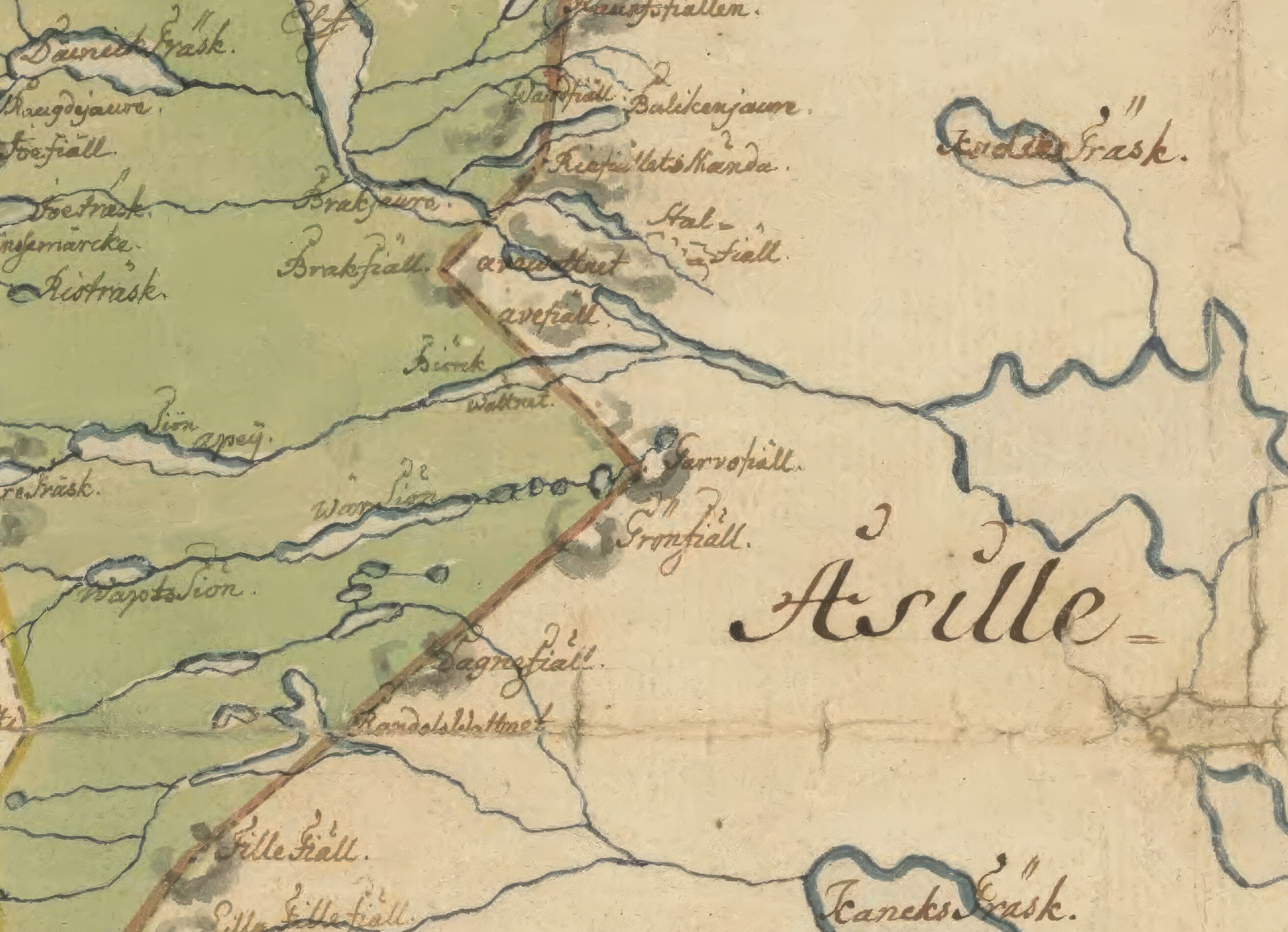
Svenska: Charta öfver största delen af riksgränssen emillan Swerige ock Norrige vid kongl. gränse commissionen åhren 1738, 1739, 1741, 1742, 1743, 1744, 1745 ock 1746, författad, men sedermera i mindre form transporterad uti kongl. landtmäteri contoiret i Stockholm år 1747. |
| Date | |
| Source | Own work |
| Author | Länsmannen |
Licensing
[edit]I, the copyright holder of this work, hereby publish it under the following license:
This file is licensed under the Creative Commons Attribution-Share Alike 4.0 International license.
- You are free:
- to share – to copy, distribute and transmit the work
- to remix – to adapt the work
- Under the following conditions:
- attribution – You must give appropriate credit, provide a link to the license, and indicate if changes were made. You may do so in any reasonable manner, but not in any way that suggests the licensor endorses you or your use.
- share alike – If you remix, transform, or build upon the material, you must distribute your contributions under the same or compatible license as the original.
File history
Click on a date/time to view the file as it appeared at that time.
| Date/Time | Thumbnail | Dimensions | User | Comment | |
|---|---|---|---|---|---|
| current | 15:11, 9 May 2024 |  | 2,624 × 1,900 (22.03 MB) | Viroix (talk | contribs) | Uploaded while editing "Matsdal" on sv.wikipedia.org |
You cannot overwrite this file.
File usage on Commons
There are no pages that use this file.
File usage on other wikis
The following other wikis use this file:
- Usage on sv.wikipedia.org