File:GrahamLandstubmap.png
跳转到导航
跳转到搜索
没有更高的分辨率。
GrahamLandstubmap.png (243 × 334像素,文件大小:30 KB,MIME类型:image/png)
说明
说明
添加一行文字以描述该文件所表现的内容
摘要
[编辑]
| 描述 |
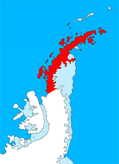
English: Outline map of the Antarctic Peninsula showing Graham Land.
Drawn by me (User:Grutness) based on File:Ant-pen_map.png by Giovanni Fattori. |
| 日期 | 2011年7月2日 (原始上传日期) |
| 来源 | 本檔案是從en.wikipedia轉移到維基共享資源。 |
| 作者 | 原上传者为英语维基百科的Grutness |
许可协议
[编辑]

|
已授权您依据自由软件基金会发行的无固定段落及封面封底文字(Invariant Sections, Front-Cover Texts, and Back-Cover Texts)的GNU自由文件许可协议1.2版或任意后续版本的条款,复制、传播和/或修改本文件。该协议的副本请见“GNU Free Documentation License”。 |
原始上传日志
[编辑]
原始描述頁面位於這裡。下列使用者名稱均來自en.wikipedia。
- 2011-07-02 09:38 Grutness 243×334× (30925 bytes) Outline map of the Antarctic Peninsula showing [[Graham Land]]. Drawn by me (User:Grutness) based on [[:File:Ant-pen_map.png]] by Giovanni Fattori.{{GFDL}}
文件历史
点击某个日期/时间查看对应时刻的文件。
| 日期/时间 | 缩略图 | 大小 | 用户 | 备注 | |
|---|---|---|---|---|---|
| 当前 | 2011年7月9日 (六) 20:06 | | 243 × 334(30 KB) | MGA73bot2(留言 | 贡献) | {{BotMoveToCommons|en.wikipedia|year={{subst:CURRENTYEAR}}|month={{subst:CURRENTMONTHNAME}}|day={{subst:CURRENTDAY}}}} {{Information |Description={{en|Outline map of the Antarctic Peninsula showing en:Graham Land. Drawn by me (User:Grutness) base |
您不可以覆盖此文件。
文件用途
没有页面使用本文件。
全域文件用途
以下其他wiki使用此文件:
- az.wikipedia.org上的用途
- bg.wikipedia.org上的用途
- cs.wikipedia.org上的用途
- da.wikipedia.org上的用途
- de.wikipedia.org上的用途
- en.wikipedia.org上的用途
- Mount Scott (Antarctica)
- Bowman Coast
- Cuverville Island
- Danco Island
- Charlotte Bay
- Loubet Coast
- Mill Inlet
- Cabinet Inlet
- Cape Alexander
- Cole Peninsula
- Castle Peak (Antarctica)
- Quartermain Glacier
- Quervain Peak
- Aagaard Glacier
- Bigourdan Fjord
- Cape Jeremy
- Weertman Island
- Bennett Islands
- Liard Island
- Devil Island
- Upper Island
- Useful Island
- Mount Zdarsky
- Mount Shackleton
- Shag Rock (Antarctica)
- Shanty Point
- Sharp Glacier
- Mount Shelby
- Mount St. Louis
- Shull Rocks
- Simler Snowfield
- Zilva Peaks
- Saffery Islands
- Index Peak
- Foyn Point
- Haefeli Glacier
- Finsterwalder Glacier
- Avsyuk Glacier
查看此文件的更多全域用途。