File:Great Britain Army, Damieh (FL189885465 2367623).jpg
Jump to navigation
Jump to search

Size of this preview: 418 × 600 pixels. Other resolutions: 167 × 240 pixels | 334 × 480 pixels | 535 × 768 pixels | 713 × 1,024 pixels | 1,427 × 2,048 pixels | 12,184 × 17,488 pixels.
Original file (12,184 × 17,488 pixels, file size: 225.91 MB, MIME type: image/jpeg)
Captions
Captions
Add a one-line explanation of what this file represents
Summary
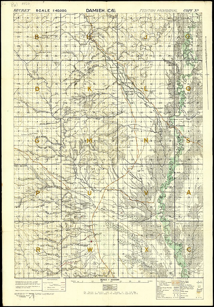
[edit]| British Army: Damieh
( |
||||||||||||||||||||||||
|---|---|---|---|---|---|---|---|---|---|---|---|---|---|---|---|---|---|---|---|---|---|---|---|---|
| Artist |
|
|||||||||||||||||||||||
| Title |
Damieh |
|||||||||||||||||||||||
| Publisher |
Survey of Egypt |
|||||||||||||||||||||||
| Description |
Damieh. |
|||||||||||||||||||||||
| Language | English | |||||||||||||||||||||||
| Publication date | 1918 | |||||||||||||||||||||||
| Collection |
|
|||||||||||||||||||||||
| Current location |
|
|||||||||||||||||||||||
| Place of publication | Cairo | |||||||||||||||||||||||
| search Merhav catalog | Cairo | |||||||||||||||||||||||
| Notes |
June 1918; Jisr ed Damiye אזור גשר אדם. English: Palestine. 1:40,000, C.6 | |||||||||||||||||||||||
| scale | 1:40,000 cm | |||||||||||||||||||||||
| IE PID | IE189885463 | |||||||||||||||||||||||
| Rosetta filename | FL189885465 | |||||||||||||||||||||||
| NNL item ID (P3959) | 990023676230205171 | |||||||||||||||||||||||
| search Merhav catalog | English, British Army | |||||||||||||||||||||||
| search Merhav catalog | Survey of Egypt | |||||||||||||||||||||||
| Source/Photographer |
|
|||||||||||||||||||||||
| Other versions | ||||||||||||||||||||||||
| Jpg / Tif version |
|
|||||||||||||||||||||||
_MOD_45152541.jpg)

.jpg)

.jpg&action=edit§ion=1)
Licensing
[edit].jpg&action=edit§ion=2)
This work created by the United Kingdom Government is in the public domain.
This is because it is one of the following:
HMSO has declared that the expiry of Crown Copyrights applies worldwide (ref: HMSO Email Reply)
|
 |
File history
Click on a date/time to view the file as it appeared at that time.
| Date/Time | Thumbnail | Dimensions | User | Comment | |
|---|---|---|---|---|---|
| current | 17:46, 31 July 2023 | | 12,184 × 17,488 (225.91 MB) | Geagea (talk | contribs) | pattypan 22.03 |
You cannot overwrite this file.
File usage on Commons
The following page uses this file:
.jpg&oldid=788747350)