File:Greater London UK location map 2.svg
跳至導覽
跳至搜尋

此 SVG 檔案的 PNG 預覽的大小:750 × 600 像素。 其他解析度:300 × 240 像素 | 600 × 480 像素 | 960 × 768 像素 | 1,280 × 1,024 像素 | 2,560 × 2,048 像素 | 1,425 × 1,140 像素。
原始檔案 (SVG 檔案,表面大小:1,425 × 1,140 像素,檔案大小:2.18 MB)
說明
說明
添加單行說明來描述出檔案所代表的內容
| 描述 |
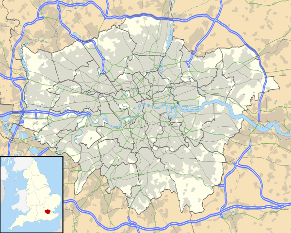
Map of Greater London, UK with the following information shown:
The data includes both primary routes and railway lines. Equirectangular map projection on WGS 84 datum, with N/S stretched 160% Geographic limits:
|
| 日期 | |
| 來源 |
|
| 作者 | Nilfanion, created using Ordnance Survey data |
| 授權許可 (重用此檔案) |
此檔案採用共享創意 姓名標示-相同方式分享 3.0 未在地化版本授權條款。 姓名標示: Contains Ordnance Survey data © Crown copyright and database right
|
| 其他版本 | File:Greater London UK district map (blank).svg - Blank map, File:Greater London UK location map.svg - excluding primary routes and railways |
.svg)
檔案歷史
點選日期/時間以檢視該時間的檔案版本。
| 日期/時間 | 縮圖 | 尺寸 | 用戶 | 備註 | |
|---|---|---|---|---|---|
| 目前 | 2010年10月5日 (二) 17:43 | | 1,425 × 1,140(2.18 MB) | Nilfanion(對話 | 貢獻) | {{Information |Description=Map of Greater London, UK with the following information shown: *Administrative borders *Coastline, lakes and rivers *Roads and railways *Urban areas The data includes both primary routes and railway lines. |
無法覆蓋此檔案。
檔案用途
下列41個頁面有用到此檔案:
- File:BLANK in Greater London.svg
- File:Barking and Dagenham in Greater London.svg
- File:Barnet in Greater London.svg
- File:Bexley in Greater London.svg
- File:Brent in Greater London.svg
- File:Bromley in Greater London.svg
- File:Camden in Greater London.svg
- File:City of London (ceremonial county) in its region.svg
- File:City of London in Greater London.svg
- File:City of Westminster in Greater London.svg
- File:Croydon in Greater London.svg
- File:Ealing in Greater London.svg
- File:Enfield in Greater London.svg
- File:Great North Wood map.png
- File:Greater London (ceremonial county) in its region.svg
- File:Greater London in Greater London (-City of London).svg
- File:Greater london outline map bw.png
- File:Greenwich in Greater London.svg
- File:Hackney in Greater London.svg
- File:Hammersmith and Fulham in Greater London.svg
- File:Haringey in Greater London.svg
- File:Harrow in Greater London.svg
- File:Havering in Greater London.svg
- File:Hillingdon in Greater London.svg
- File:Hounslow in Greater London.svg
- File:Islington in Greater London.svg
- File:Kensington and Chelsea in Greater London.svg
- File:Kingston upon Thames in Greater London.svg
- File:Lambeth in Greater London.svg
- File:Lewisham in Greater London.svg
- File:M25 cat killer map.png
- File:Map of Network Rail Strategic Routes in England and Wales 2014.svg
- File:Merton in Greater London.svg
- File:Newham in Greater London.svg
- File:Redbridge in Greater London.svg
- File:Richmond in Greater London.svg
- File:Southwark in Greater London.svg
- File:Sutton in Greater London.svg
- File:Tower Hamlets in Greater London.svg
- File:Waltham Forest in Greater London.svg
- File:Wandsworth in Greater London.svg
_in_its_region.svg)
_in_its_region.svg)
.svg)
全域檔案使用狀況
以下其他 wiki 使用了這個檔案:
- af.wikipedia.org 的使用狀況
- Londense Tower
- Westminster-abdy
- Twickenham
- Greenwich (Londen)
- Penge (Londen)
- Paleis van Westminster
- Canary Wharf
- St John's Wood
- Marylebone
- Stratford, Londen
- Queen Elizabeth Olympic Park
- Sjabloon:Liggingkaart Groter Londen
- Leyton
- Charing Cross
- Lughawe Londen-Heathrow
- Strand, Londen
- Muswell Hill
- London City-lughawe
- Dulwich Village
- Hampstead
- Silvertown
- Shoreditch
- Islington
- Clerkenwell
- Holland Park
- Soho
- Chelsea, Londen
- Southwark
- Hackney Central
- Notting Hill
- Paddington
- Crouch End
- Highgate
- Primrose Hill
- Bloomsbury
- Camden Town
- Spitalfields
- Vauxhall
- Holborn
- Kensington
- Battersea
- Belgravia
- Limehouse
- Bishopsgate
- ar.wikipedia.org 的使用狀況
檢視此檔案的更多全域使用狀況。