File:Grossdeutsches Reich.jpg
跳至導覽
跳至搜尋

預覽大小:733 × 600 像素。 其他解析度:293 × 240 像素 | 587 × 480 像素 | 939 × 768 像素 | 1,252 × 1,024 像素 | 2,503 × 2,048 像素 | 9,839 × 8,050 像素。
原始檔案 (9,839 × 8,050 像素,檔案大小:10.86 MB,MIME 類型:image/jpeg)
說明
說明
添加單行說明來描述出檔案所代表的內容
摘要
[編輯]| 警告 | 部分瀏覽器在瀏覽此圖片的完整大小時可能會遇到困難:該圖片中有數量巨大的像素點,可能無法完全載入或者導致您的瀏覽器停止回應。 |
|---|
| 描述 |
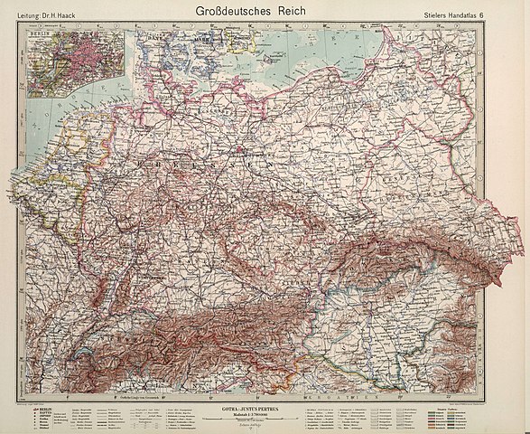
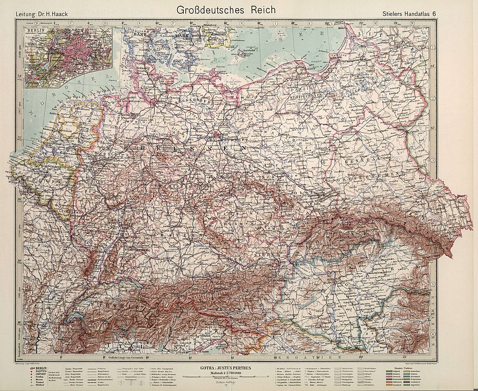
English: Outline color. Text/Index Map pages printed in blue ink. Relief shown by hachures. Editions of this atlas extended through the years of World War II. This edition is the last edition of the Stieler atlas. It is very rare and known only in a few copies. It was printed during the final months of World War II, probably in April or May of 1945. |
|||||||
| 日期 | 1944, 10th edition. Further informations: Stielers Hand-Atlas (1817-1945). | |||||||
| 來源 | Stielers Hand-Atlas. 254 Haupt- und Nebenkarten in Kupferstich. Zehnte Auflage Hundertjahr - Ausgabe. Herausegeben unter Leitung von Prof. Dr. H. Haack, in Justus Perthes' Geogr. Anstalt. Gotha: Justus Perthes. >> (David Rumsey Historical Map Collection ). Original image resized and compressed before uploading. | |||||||
| 作者 | Adolf Stieler (1775-1836). | |||||||
| 授權許可 (重用此檔案) |
|
|||||||
| 其他版本 |
|
|||||||

.jpg)
檔案歷史
點選日期/時間以檢視該時間的檔案版本。
| 日期/時間 | 縮圖 | 尺寸 | 用戶 | 備註 | |
|---|---|---|---|---|---|
| 目前 | 2018年6月21日 (四) 15:39 | | 9,839 × 8,050(10.86 MB) | FDRMRZUSA(對話 | 貢獻) | User created page with UploadWizard |
無法覆蓋此檔案。
檔案用途
下列頁面有用到此檔案:
全域檔案使用狀況
以下其他 wiki 使用了這個檔案:
- af.wikipedia.org 的使用狀況
- de.wikipedia.org 的使用狀況
- en.wikipedia.org 的使用狀況
- it.wikipedia.org 的使用狀況
- pt.wikipedia.org 的使用狀況
- zh.wikipedia.org 的使用狀況