File:Guam Census 2000 Block Map (cropped).jpg
Jump to navigation
Jump to search

Size of this preview: 505 × 600 pixels. Other resolutions: 202 × 240 pixels | 404 × 480 pixels | 647 × 768 pixels | 862 × 1,024 pixels | 1,725 × 2,048 pixels | 7,248 × 8,605 pixels.
Original file (7,248 × 8,605 pixels, file size: 4.73 MB, MIME type: image/jpeg)
Captions
Captions
Add a one-line explanation of what this file represents
Summary[edit]
| Description |
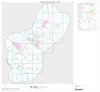
English: U.S. Census Block Map of Guam |
|||
| Source | http://ftp2.census.gov/geo/maps/blk2000/st66_Guam/County/66010_Guam/CBC66010_000.pdf | |||
| Author | U.S. Census Bureau | |||
| Permission (Reusing this file) |
|
|||
| Other versions |


|
This map image could be re-created using vector graphics as an SVG file. This has several advantages; see Commons:Media for cleanup for more information. If an SVG form of this image is available, please upload it and afterwards replace this template with
{{vector version available|new image name}}.
It is recommended to name the SVG file “Guam Census 2000 Block Map (cropped).svg”—then the template Vector version available (or Vva) does not need the new image name parameter. |


.jpg&action=edit§ion=1)
File history
Click on a date/time to view the file as it appeared at that time.
| Date/Time | Thumbnail | Dimensions | User | Comment | |
|---|---|---|---|---|---|
| current | 17:46, 3 March 2021 | | 7,248 × 8,605 (4.73 MB) | Featous (talk | contribs) | File:GuamCensusBlockMap.pdf cropped 33 % horizontally, 13 % vertically using CropTool with lossless mode. |
You cannot overwrite this file.
File usage on Commons
The following page uses this file:
File usage on other wikis
The following other wikis use this file:
- Usage on en.wikipedia.org
.jpg&oldid=545956350)