File:Guantian villages & Wushantou.svg
Jump to navigation
Jump to search

Size of this PNG preview of this SVG file: 790 × 470 pixels. Other resolutions: 320 × 190 pixels | 640 × 381 pixels | 1,024 × 609 pixels | 1,280 × 762 pixels | 2,560 × 1,523 pixels.
Original file (SVG file, nominally 790 × 470 pixels, file size: 246 KB)
Captions
Captions
Add a one-line explanation of what this file represents
Summary
[edit]| Description |
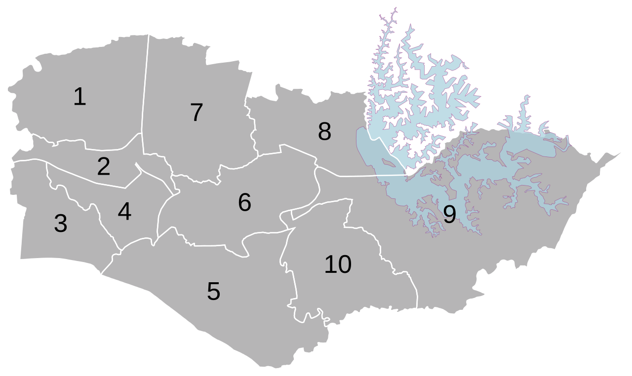
Deutsch: Ortsteile des Stadtbezirks Guantian von Tainan (+ Wushantou-Stausee). English: All villages of Guantian district, Tainan (+Wushantou reservoir). |
||
| villages (里) | 1 Nanbu (南廍里) |
||
| Date | |||
| Source | Own work based on: 村里界圖(TWD97經緯度), Wushantou reservoir from Openstreetmap | ||
| Author | Own work | ||
| Permission (Reusing this file) |
I, the copyright holder of this work, hereby publish it under the following licenses: This file is licensed under the Creative Commons Attribution-Share Alike 3.0 Unported license.
You may select the license of your choice. |
||
| SVG development | This map was created with Adobe Illustrator. |

File history
Click on a date/time to view the file as it appeared at that time.
| Date/Time | Thumbnail | Dimensions | User | Comment | |
|---|---|---|---|---|---|
| current | 19:53, 1 May 2019 | | 790 × 470 (246 KB) | Furfur (talk | contribs) | transparent |
| 14:26, 1 May 2019 |  | 790 × 470 (246 KB) | Furfur (talk | contribs) | == {{int:filedesc}} == {{Information |Description={{de|1=Ortsteile des Stadtbezirks Guantian von Tainan (+ Wushantou-Stausee).}}{{en|1=All villages of Guantian district, Tainan (+Wushantou reservoir).}} |Other fields 1= {{Information field |Name={{LangSwitch |de=Ortsteile (里)<br> |en=villages (里) |zh=里 |default=里 }} |Value= <div class="references-small" style="-moz-column-count:5; column-count:5;"> 1 Nanbu (南廍里)<br /> 2 Longben (隆本里)<br /> 3 Dongxizhuang (東西庄里)<br /> 4 Longtian (隆田里)<br /> 5... |
You cannot overwrite this file.
File usage on Commons
There are no pages that use this file.
File usage on other wikis
The following other wikis use this file:
- Usage on de.wikipedia.org