File:HUC1111.jpg
Jump to navigation
Jump to search

No higher resolution available.
HUC1111.jpg (632 × 434 pixels, file size: 453 KB, MIME type: image/jpeg)
Captions
Captions
Add a one-line explanation of what this file represents
Summary[edit]
| Description |
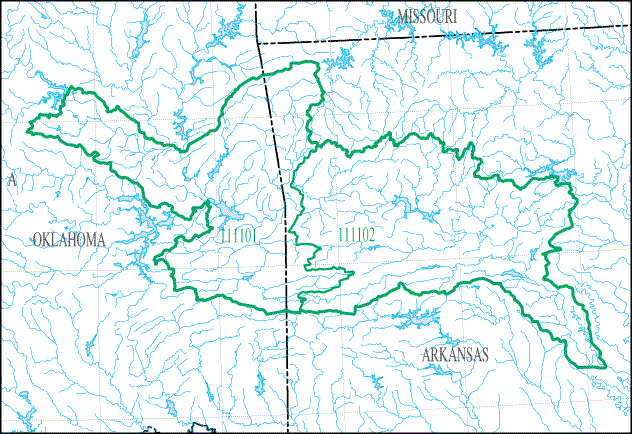
English: Map of HUC1111 - The Arkansas River Basin below Keystone Dam to the point of highest backwater effect of the Mississippi River below Lock and Dam 4 on the Arkansas River, but excluding the Canadian, Neosho, and Verdigris River Basins. |
| Date | |
| Source | https://water.usgs.gov/wsc/sub/1111.jpg |
| Author | USGS |
Licensing[edit]
This image is in the public domain in the United States because it only contains materials that originally came from the United States Geological Survey, an agency of the United States Department of the Interior. For more information, see the official USGS copyright policy.
|
File history
Click on a date/time to view the file as it appeared at that time.
| Date/Time | Thumbnail | Dimensions | User | Comment | |
|---|---|---|---|---|---|
| current | 23:18, 11 September 2018 | | 632 × 434 (453 KB) | Furicorn (talk | contribs) | Transferred from https://water.usgs.gov/wsc/sub/1111.jpg |
You cannot overwrite this file.
File usage on Commons
There are no pages that use this file.
File usage on other wikis
The following other wikis use this file:
- Usage on en.wikipedia.org