File:Halcott Mountain map.png
Jump to navigation
Jump to search

Size of this preview: 800 × 551 pixels. Other resolutions: 320 × 220 pixels | 640 × 441 pixels | 867 × 597 pixels.
Original file (867 × 597 pixels, file size: 1.25 MB, MIME type: image/png)
Captions
Captions
Add a one-line explanation of what this file represents
Summary
[edit]
| Description |
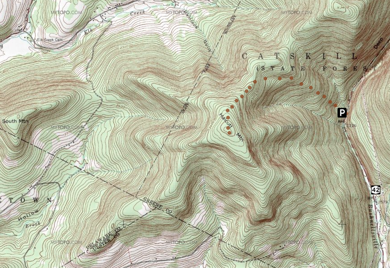
English: Map of Halcott Mountain in the Catskills of the U.S. state of New York showing most common route used to climb it. |
|||
| Date | Original map ca. 1940; overlays added February 1, 2010 | |||
| Source | From USGS West Kill quad as displayed at ACME Mapper | |||
| Author | USGS cartographers; map overlays using NPS symbol, NY state highway shield and dotted route to summit by Daniel Case | |||
| Permission (Reusing this file) |
|
File history
Click on a date/time to view the file as it appeared at that time.
| Date/Time | Thumbnail | Dimensions | User | Comment | |
|---|---|---|---|---|---|
| current | 06:46, 1 February 2010 | | 867 × 597 (1.25 MB) | Daniel Case (talk | contribs) | {{Information |Description={{en|1=Map of Halcott Mountain in the Catskills of the U.S. state of New York showing most common route used to climb it.}} |Source=From USGS West Kill quad as displayed at ACME Ma |
You cannot overwrite this file.
File usage on Commons
There are no pages that use this file.
File usage on other wikis
The following other wikis use this file:
- Usage on en.wikipedia.org