File:Hillside View of Own Ibn Ali Tomb.jpg
Original file (5,184 × 3,888 pixels, file size: 6.65 MB, MIME type: image/jpeg)
Captions
Summary
[edit]DescriptionHillside View of Own Ibn Ali Tomb.jpg |
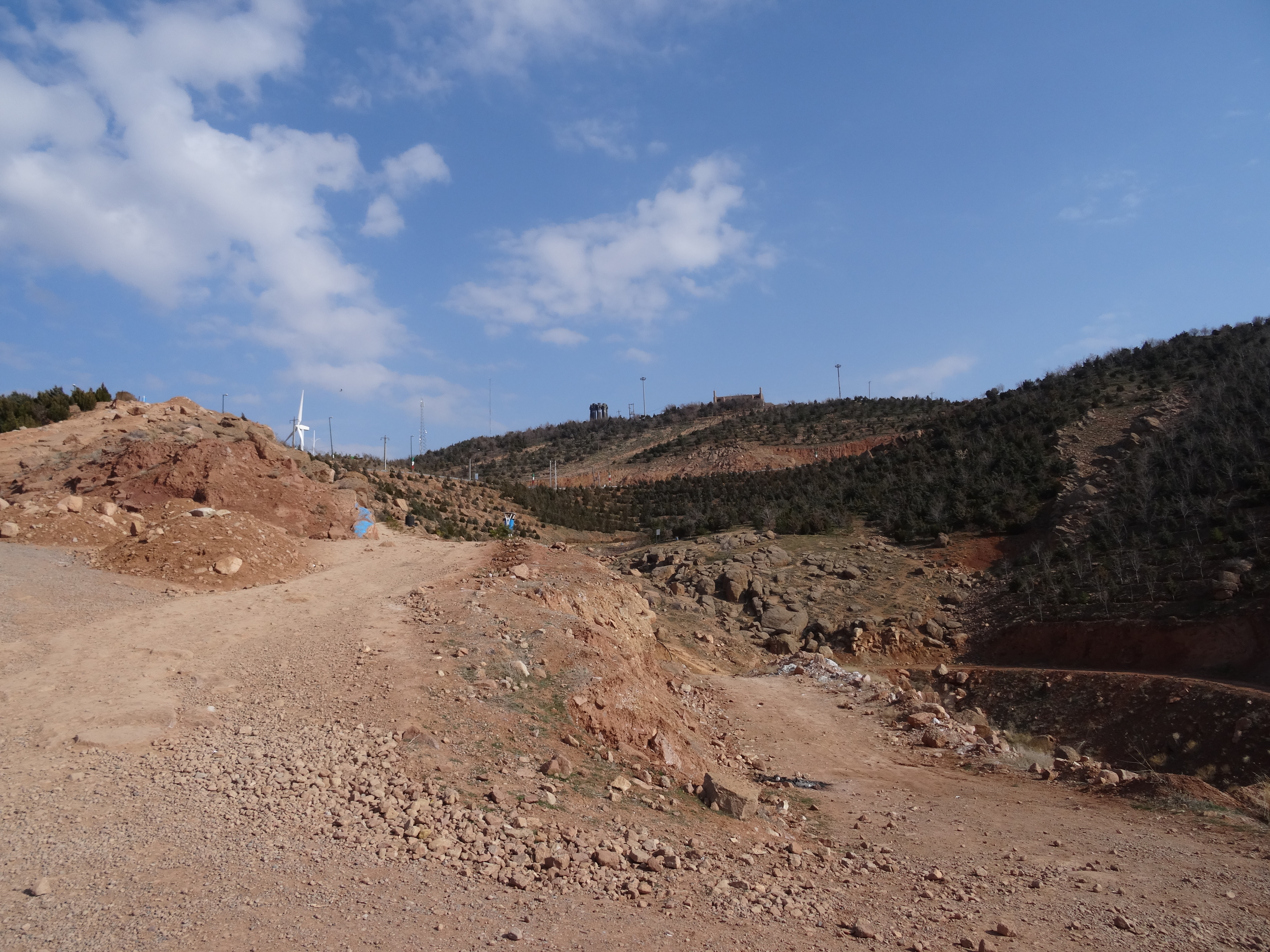
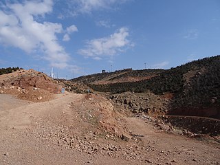
فارسی: منظره مقبره عون بن علی از دامنه کوه
|
||
Date | |||
Source | Own work | ||
Author | Farshid Afandideh |
Camera location | 38° 05′ 54.8″ N, 46° 19′ 39.28″ E | View this and other nearby images on: OpenStreetMap | 38.098556; 46.327578 |
---|
Licensing
[edit]- You are free:
- to share – to copy, distribute and transmit the work
- to remix – to adapt the work
- Under the following conditions:
- attribution – You must give appropriate credit, provide a link to the license, and indicate if changes were made. You may do so in any reasonable manner, but not in any way that suggests the licensor endorses you or your use.
- share alike – If you remix, transform, or build upon the material, you must distribute your contributions under the same or compatible license as the original.
This image was uploaded as part of Wiki Loves Monuments 2018.
Afrikaans ∙ Alemannisch ∙ azərbaycanca ∙ Bahasa Indonesia ∙ Bahasa Melayu ∙ Bikol Central ∙ bosanski ∙ brezhoneg ∙ català ∙ čeština ∙ Cymraeg ∙ dansk ∙ davvisámegiella ∙ Deutsch ∙ eesti ∙ English ∙ español ∙ Esperanto ∙ euskara ∙ français ∙ Frysk ∙ Gaeilge ∙ galego ∙ hrvatski ∙ Ido ∙ italiano ∙ latviešu ∙ Lëtzebuergesch ∙ Malagasy ∙ magyar ∙ Malti ∙ Nederlands ∙ norsk ∙ norsk nynorsk ∙ norsk bokmål ∙ polski ∙ português ∙ português do Brasil ∙ română ∙ shqip ∙ sicilianu ∙ slovenčina ∙ slovenščina ∙ suomi ∙ svenska ∙ Tagalog ∙ Türkçe ∙ Yorùbá ∙ Zazaki ∙ Ελληνικά ∙ беларуская ∙ беларуская (тарашкевіца) ∙ български ∙ кыргызча ∙ македонски ∙ русский ∙ српски / srpski ∙ українська ∙ ქართული ∙ հայերեն ∙ नेपाली ∙ हिन्दी ∙ বাংলা ∙ മലയാളം ∙ ไทย ∙ 한국어 ∙ +/− |
File history
Click on a date/time to view the file as it appeared at that time.
Date/Time | Thumbnail | Dimensions | User | Comment | |
---|---|---|---|---|---|
current | 20:29, 4 October 2018 | 5,184 × 3,888 (6.65 MB) | Embedded Data Bot (talk | contribs) | This file contains embedded data: After 6.7MiB (6976512 bytes, via Ending): Identified type: image/jpeg (JPEG image data, Exif standard: [TIFF image data, little-endian, direntries=4, xresolution=62, yresolution=70, resolutionunit=2], baseline, precision 8, 1440x1080, frames 3) | |
20:28, 4 October 2018 | 5,184 × 3,888 (7.22 MB) | Farshid.afan (talk | contribs) | User created page with UploadWizard |
You cannot overwrite this file.
File usage on Commons
There are no pages that use this file.
Metadata
This file contains additional information such as Exif metadata which may have been added by the digital camera, scanner, or software program used to create or digitize it. If the file has been modified from its original state, some details such as the timestamp may not fully reflect those of the original file. The timestamp is only as accurate as the clock in the camera, and it may be completely wrong.
Camera manufacturer | SONY |
---|---|
Camera model | DSC-HX50V |
Exposure time | 1/1,250 sec (0.0008) |
F-number | f/3.5 |
ISO speed rating | 80 |
Date and time of data generation | 09:38, 15 March 2015 |
Lens focal length | 4.3 mm |
Latitude | 38° 5′ 54.8″ N |
Longitude | 46° 19′ 39.28″ E |
Altitude | 1,625.9 meters above sea level |
Orientation | Normal |
Horizontal resolution | 350 dpi |
Vertical resolution | 350 dpi |
Software used | DSC-HX50V v1.00 |
File change date and time | 09:38, 15 March 2015 |
Y and C positioning | Co-sited |
Exposure Program | Landscape mode (for landscape photos with the background in focus) |
Exif version | 2.3 |
Date and time of digitizing | 09:38, 15 March 2015 |
Meaning of each component |
|
Image compression mode | 3 |
APEX brightness | 10.446875 |
APEX exposure bias | 0 |
Maximum land aperture | 3.6171875 APEX (f/3.5) |
Metering mode | Pattern |
Light source | Unknown |
Flash | Flash did not fire, compulsory flash suppression |
Supported Flashpix version | 1 |
Color space | sRGB |
File source | Digital still camera |
Scene type | A directly photographed image |
Custom image processing | Normal process |
Exposure mode | Auto exposure |
White balance | Auto white balance |
Digital zoom ratio | 1 |
Scene capture type | Landscape |
Contrast | Normal |
Saturation | Normal |
Sharpness | Normal |
GPS time (atomic clock) | 06:08:57.69 |
Receiver status | Measurement in progress |
Measurement mode | 3-dimensional measurement |
Measurement precision | Poor (1.74) |
Speed unit | Kilometers per hour |
Speed of GPS receiver | 6.192 |
Reference for direction of movement | True direction |
Direction of movement | 346.01 |
Geodetic survey data used | WGS-84 |
GPS date | 15 March 2015 |
GPS differential correction | 0 |
GPS tag version | 0.0.3.2 |
Structured data
some value
15 March 2015
38°5'54.802"N, 46°19'39.281"E
0.0008 second
3.5
4.3 millimetre
image/jpeg
- Cultural heritage monuments in Iran with known IDs
- Images from Wiki Loves Monuments in Tabriz
- Cultural heritage monuments in Iran missing SDC location of creation
- Files with coordinates missing SDC location of creation
- CC-BY-SA-4.0
- Self-published work
- Images from Wiki Loves Monuments 2018
- Images from Wiki Loves Monuments 2018 in Iran
- Images from Wiki Loves Monuments missing SDC location of creation
- Uploaded via Campaign:wlm-ir
- Iran photographs taken on 2015-03-15