File:Hounslow London UK location map.svg
Aller à la navigation
Aller à la recherche

Taille de cet aperçu PNG pour ce fichier SVG : 800 × 529 pixels. Autres résolutions : 320 × 212 pixels | 640 × 423 pixels | 1 024 × 677 pixels | 1 280 × 846 pixels | 2 560 × 1 692 pixels | 1 425 × 942 pixels.
Fichier d’origine (Fichier SVG, nominalement de 1 425 × 942 pixels, taille : 5,03 Mio)
Légendes
Légendes
Ajoutez en une ligne la description de ce que représente ce fichier
| Description |
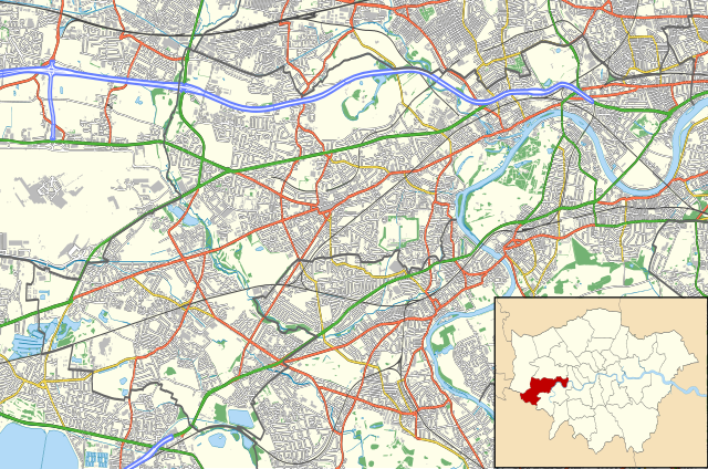
Location map of the London Borough of Hounslow with the following information shown:
Equirectangular map projection on WGS 84 datum, with N/S stretched 160% Geographic limits:
|
| Date | |
| Source |
|
| Auteur | Nilfanion |
| Autorisation (Réutilisation de ce fichier) |
Ce fichier est disponible selon les termes de la licence Creative Commons Attribution – Partage dans les Mêmes Conditions 3.0 (non transposée). Attribution: Contains Ordnance Survey data © Crown copyright and database right
|
Historique du fichier
Cliquer sur une date et heure pour voir le fichier tel qu'il était à ce moment-là.
| Date et heure | Vignette | Dimensions | Utilisateur | Commentaire | |
|---|---|---|---|---|---|
| actuel | 15 novembre 2011 à 23:10 | | 1 425 × 942 (5,03 Mio) | Nilfanion (d | contributions) | {{Information |Description=Location map of the London Borough of Hounslow with the following information shown: *{{legend|#646464|Ward boundaries}} *{{legend|#667fff|Motorways}} *{{legend|#4cb336|Primary routes}} *{{legend |
Vous ne pouvez pas remplacer ce fichier.
Utilisations locales du fichier
Aucune page n’utilise ce fichier.
Utilisations du fichier sur d’autres wikis
Les autres wikis suivants utilisent ce fichier :
- Utilisation sur ar.wikipedia.org
- Utilisation sur ceb.wikipedia.org
- Utilisation sur en.wikipedia.org
- Chiswick House
- Osterley Park
- Syon House
- Hogarth's House
- River Crane, London
- Boston Manor House
- London Museum of Water & Steam
- Strand-on-the-Green
- West Middlesex University Hospital
- Murders of Eve Stratford and Lynne Weedon
- Chiswick Town Hall
- Module:Location map/data/United Kingdom London Hounslow/doc
- Campion House
- Hounslow Hospital
- Chiswick Asylum
- South Middlesex Hospital
- Module:Location map/data/United Kingdom London Hounslow
- Hounslow Civic Centre
- Hounslow House
- Murder of Patsy Morris
- Utilisation sur fa.wikipedia.org
- Utilisation sur fr.wikipedia.org
- Utilisation sur kn.wikipedia.org
- Utilisation sur si.wikipedia.org
- Utilisation sur tr.wikipedia.org
- Utilisation sur war.wikipedia.org