File:Hudson bay explorer.png
Hudson_bay_explorer.png (550 × 442 piksel, fayl həcmi: 449 KB, MIME növü: image/png)
Captions
Captions
| İzah |
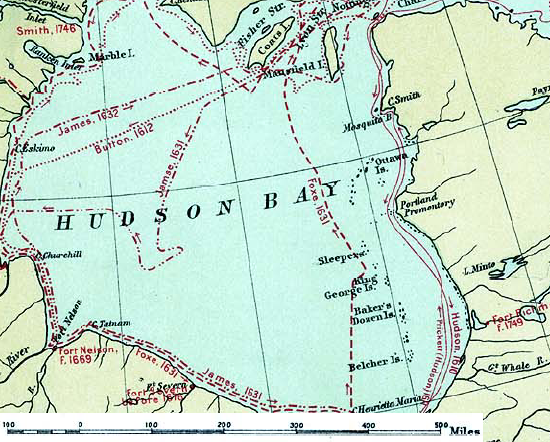
English: Map of the routes of the main European explorers in Hudson Bay, Canada. |
|||||
| Tarix | ||||||
| Mənbə | Excerpted from 1st Edition, 1906, Atlas of Canada - Routes of Explorers,1497 to 1905. | |||||
| Müəllif | Department of the Interior, Ottawa | |||||
| İcazə (Faylın təkrar istifadəsi) |
Crown copyright expired.
|

Orijinal yükləmə gündəliyi[redaktə]
- 2007-01-26 22:28 CyclePat 550×442×8 (459278 bytes) ==Description== This map shows the routes followed by the principal explorers of what is now Canada, from 1497 up to 1905. The map also shows the location of forts with the date of their establishment. It was created using [[:image:Canada, Routes of Explo
Faylın tarixçəsi
Faylın əvvəlki versiyasını görmək üçün gün/tarix bölməsindəki tarixlərə klikləyin.
| Tarix/Vaxt | Kiçik şəkil | Ölçülər | İstifadəçi | Şərh | |
|---|---|---|---|---|---|
| indiki | 11:41, 10 iyul 2008 | | 550 × 442 (449 KB) | Urdangaray (müzakirə | töhfələr) | {{Information |Description={{en|thumb|400px|right|Canada, Routes of Explorers,1497 to 1905 This map shows the routes followed by the principal explorers of what is now Canada, from 1497 up to 190 |
Siz bu faylı yenidən yükləyə bilməzsiniz.
Fayl keçidləri
Bu faylı istifadə edən səhifə yoxdur.
Faylın qlobal istifadəsi
Bu fayl aşağıdakı vikilərdə istifadə olunur:
- arz.wikipedia.org layihəsində istifadəsi
- ast.wikipedia.org layihəsində istifadəsi
- az.wikipedia.org layihəsində istifadəsi
- bg.wikipedia.org layihəsində istifadəsi
- ca.wikipedia.org layihəsində istifadəsi
- cv.wikipedia.org layihəsində istifadəsi
- de.wikipedia.org layihəsində istifadəsi
- en.wikipedia.org layihəsində istifadəsi
- es.wikipedia.org layihəsində istifadəsi
- hi.wikipedia.org layihəsində istifadəsi
- nn.wikipedia.org layihəsində istifadəsi
- ru.wikipedia.org layihəsində istifadəsi
- zh.wikipedia.org layihəsində istifadəsi