File:Hurricane Marie (MODIS 2020-10-03).jpg

Original file (4,338 × 3,594 pixels, file size: 1.99 MB, MIME type: image/jpeg)
Captions
Captions
Summary
[edit].jpg&action=edit§ion=1)
| Description |
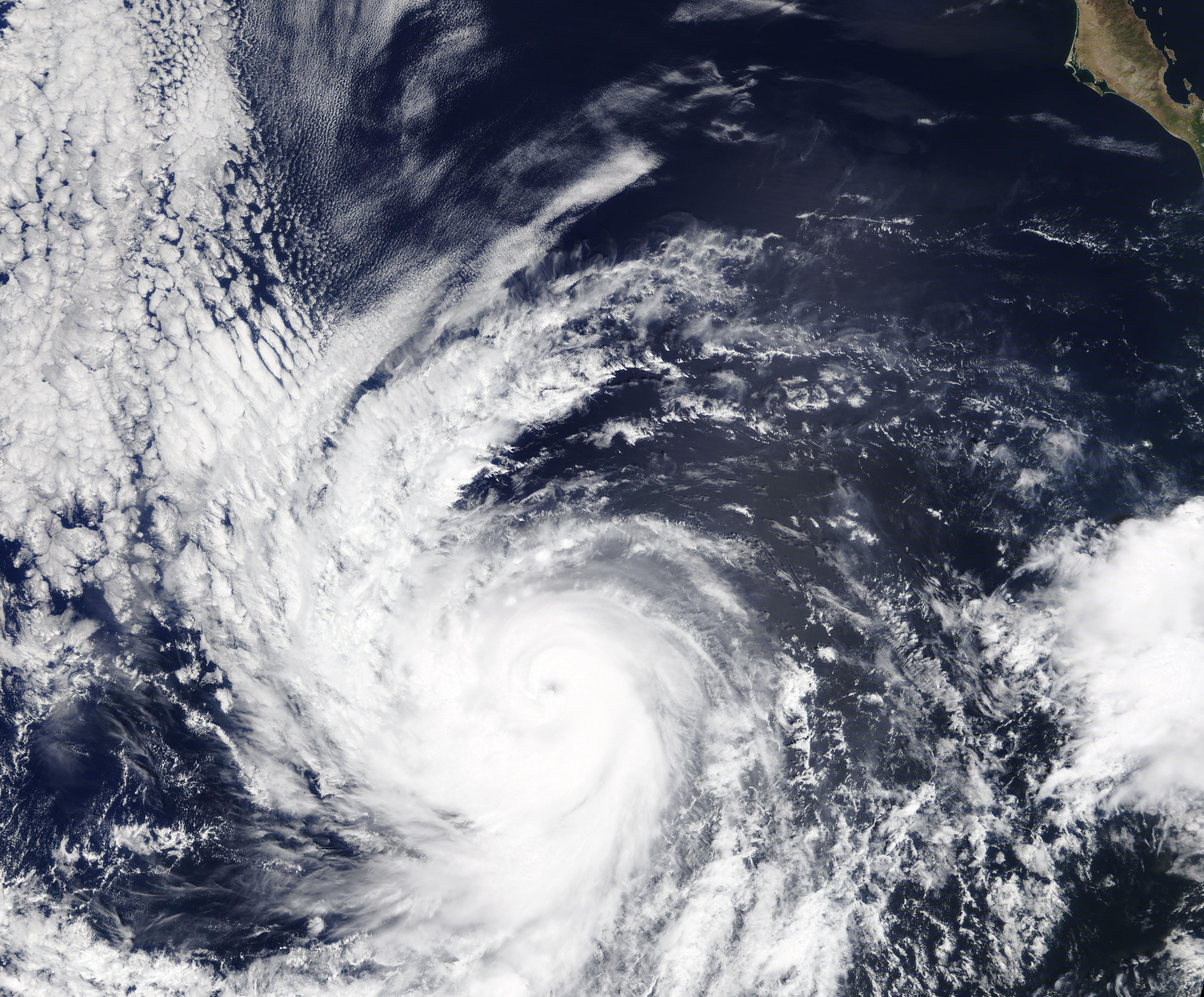
English: Tropical Depression 18E formed on the afternoon of September 29, 2020, well southwest of the southwestern coast of Mexico. Twelve hours later the depression strengthened into a tropical storm and the National Hurricane Center (NHC) gave it the name Marie. Marie experienced a short life as a tropical storm, with wind speeds increasing enough to bring it to hurricane status by the afternoon of September 30. After a rapid and intense intensification, Hurricane Marie became a major hurricane by the next day.
At 5:00 a.m. EDT (0900 UTC), the NHC reported Hurricane Marie had become a Category 4 storm on the Saffir-Simpson Hurricane Wind Scale, with maximum sustained winds increasing to 130 mph (215 km/h) with higher gusts. Hurricane-force winds extended outwards up to 125 miles (205 km). At that time, the center of Hurricane Marie was located near latitude 16.2 degrees north and longitude 123.2 degrees west, or about 980 miles (1,580 km) west-southwest of the southern tip of Baja California. It was moving towards the west-northwest at about 15 mph (24 km/h), taking it into open ocean. Hurricane Marie has maintained her strength through the afternoon of October 2, remaining at Category 4 status. The NCH advises that Marie should remain in a low-shear environment and over warmer waters for the next 24 hours, during which time additional strengthening is possible. After 24 hours, Marie should interact with increasing wind shear and cooler waters, taking the punch out of the system and putting the storm on a weakening trend. Forecasts suggest that Hurricane Marie should drop to tropical storm strength within 72 hours, then continuing to weaken to a depression by mid-week. The Moderate Resolution Imaging Spectroradiometer (MODIS) on board NASA’s Terra satellite acquired a true-color image of Hurricane Marie on October 1 as the storm neared peak strength. At that time, Marie sported a distinct eye and tight circulation near the center, giving the center of the storm the tight apostrophe-shape often seen in strong hurricanes. Bands of rain stretched towards the northwest and the southwest. |
||
| Date | Taken on 1 October 2020 | ||
| Source |
|
||
| Author | MODIS Land Rapid Response Team, NASA GSFC |
| This media is a product of the Terra mission Credit and attribution belongs to the mission team, if not already specified in the "author" row |
Licensing
[edit].jpg&action=edit§ion=2)
| This file is in the public domain in the United States because it was solely created by NASA. NASA copyright policy states that "NASA material is not protected by copyright unless noted". (See Template:PD-USGov, NASA copyright policy page or JPL Image Use Policy.) | ||
 |
Warnings:
|
File history
Click on a date/time to view the file as it appeared at that time.
| Date/Time | Thumbnail | Dimensions | User | Comment | |
|---|---|---|---|---|---|
| current | 19:50, 7 February 2024 | | 4,338 × 3,594 (1.99 MB) | OptimusPrimeBot (talk | contribs) | #Spacemedia - Upload of http://modis.gsfc.nasa.gov/gallery/images/image10032020_500m.jpg via Commons:Spacemedia |
You cannot overwrite this file.
File usage on Commons
There are no pages that use this file.
.jpg&oldid=849872867)