File:Hvidovre from highrise "Store Hus" in Avedøre.jpg

Original file (2,592 × 1,944 pixels, file size: 3.54 MB, MIME type: image/jpeg)
Captions
Captions
Summary[edit]
| Description |
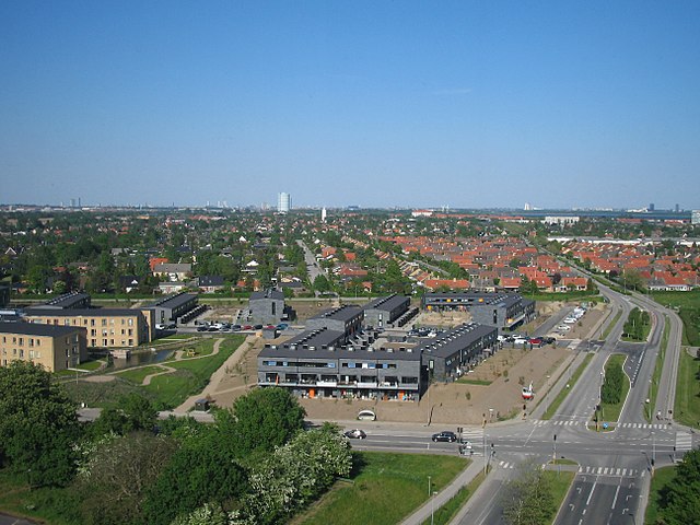
English: the far left the black highrise is the Ferring building in Ørestad.
The blue tower in the middle is the gas-silo in Valby. The city-walk was very interesting, and we were given insights into the thinking, or lack of, of the city planners. They did have a huge challenge, Denmark was lacking 100,000 housing units, and they managed to deliver, the downside was that it produced the endless concrete landscapes, that the planners and architects themself wouldn't live in themself. The planned citys were also hurt by changing conditions, by the time "Avedøre Stationsby" was finished we were in a recession, and public housing was hit by the crisis because they were forced to house marginalised people in cities like this. Forstadsmuseet, the Museum of suburbia, that organised the city-walk also has a flickr accout: www.flickr.com/photos/forstadsmuseet/ |
| Date | |
| Source | View of Hvidovre from highrise "Store Hus" in Avedøre |
| Author | Kim Bach from Taastrup, Denmark |
| Camera location | | View this and other nearby images on: OpenStreetMap |
|---|
Licensing[edit]
- You are free:
- to share – to copy, distribute and transmit the work
- to remix – to adapt the work
- Under the following conditions:
- attribution – You must give appropriate credit, provide a link to the license, and indicate if changes were made. You may do so in any reasonable manner, but not in any way that suggests the licensor endorses you or your use.
- share alike – If you remix, transform, or build upon the material, you must distribute your contributions under the same or compatible license as the original.
| This image was originally posted to Flickr by Kim Bach at https://flickr.com/photos/63934584@N00/7258525294. It was reviewed on 29 January 2017 by FlickreviewR and was confirmed to be licensed under the terms of the cc-by-sa-2.0. |
File history
Click on a date/time to view the file as it appeared at that time.
| Date/Time | Thumbnail | Dimensions | User | Comment | |
|---|---|---|---|---|---|
| current | 09:40, 29 January 2017 | | 2,592 × 1,944 (3.54 MB) | Ramblersen (talk | contribs) | the far left the black highrise is the Ferring building in Ørestad. The blue tower in the middle is the gas-silo in Valby. The city-walk was very interesting, and we were given insights into the thinking, or lack of, of the city planners. They did h... |
You cannot overwrite this file.
File usage on Commons
There are no pages that use this file.
File usage on other wikis
The following other wikis use this file: