File:IDF Combat Engineering Corps, ישראל-דרום, צילום אויר 01-Mount-Sodom (FL165786323 2634410).jpg
Jump to navigation
Jump to search

Size of this preview: 555 × 599 pixels. Other resolutions: 222 × 240 pixels | 445 × 480 pixels | 711 × 768 pixels | 948 × 1,024 pixels | 1,897 × 2,048 pixels | 11,898 × 12,846 pixels.
Original file (11,898 × 12,846 pixels, file size: 168.57 MB, MIME type: image/jpeg)
Captions
Captions
Add a one-line explanation of what this file represents
Summary
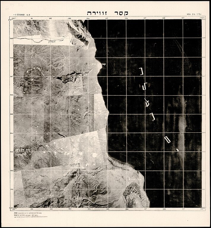
[edit]| Combat Engineering Corps: ישראל-דרום, צילום אויר
( |
||||||||||||||||||||||||
|---|---|---|---|---|---|---|---|---|---|---|---|---|---|---|---|---|---|---|---|---|---|---|---|---|
| Artist |
|
|||||||||||||||||||||||
| Title |
ישראל-דרום, צילום אויר |
|||||||||||||||||||||||
| Publisher |
צהל. שרות מפות וצלומים |
|||||||||||||||||||||||
| Description |
ישראל-דרום, צילום אויר. . . מטה חיל ההנדסה - מודיעין. |
|||||||||||||||||||||||
| Language | Hebrew | |||||||||||||||||||||||
| Publication date | 1948 | |||||||||||||||||||||||
| Medium | 6 גליונות. | |||||||||||||||||||||||
| Collection |
|
|||||||||||||||||||||||
| Current location |
|
|||||||||||||||||||||||
| Place of publication | Israel | |||||||||||||||||||||||
| search Merhav catalog | Israel | |||||||||||||||||||||||
| Notes | על מקצת הגליונות: הוכן בעזרת צלומי אויר משנת 1945 עי שרות מפות וצלומים צהל, 1949.; באר שבע- 13-7, | |||||||||||||||||||||||
| scale | 1:22,000 cm | |||||||||||||||||||||||
| IE PID | IE165786320 | |||||||||||||||||||||||
| Rosetta filename | FL165786323 | |||||||||||||||||||||||
| NNL item ID (P3959) | 990026344100205171 | |||||||||||||||||||||||
| search Merhav catalog | Hebrew, Combat Engineering Corps | |||||||||||||||||||||||
| search Merhav catalog | חרבת חורהחרבת כסיפהבאר שבעערדקסר זווירהג'בל רחימת זידצהל. שרות מפות וצלומים | |||||||||||||||||||||||
| Source/Photographer |
|
|||||||||||||||||||||||
| Other versions | ||||||||||||||||||||||||
| Jpg / Tif version |
|
|||||||||||||||||||||||

.jpg)

.jpg&action=edit§ion=1)
Licensing
[edit].jpg&action=edit§ion=2)
This work created by the United Kingdom Government is in the public domain.
This is because it is one of the following:
HMSO has declared that the expiry of Crown Copyrights applies worldwide (ref: HMSO Email Reply)
|
 |
This work was created or ordered by the State of Israel, and is in the public domain because it satisfies one of the conditions stipulated in Israel's copyright statute from 2007 (translation) regarding the State's copyrights:
|

|
File history
Click on a date/time to view the file as it appeared at that time.
| Date/Time | Thumbnail | Dimensions | User | Comment | |
|---|---|---|---|---|---|
| current | 16:36, 20 August 2023 | | 11,898 × 12,846 (168.57 MB) | Geagea (talk | contribs) | pattypan 22.03 |
You cannot overwrite this file.
File usage on Commons
The following 2 pages use this file:
.jpg&oldid=909757330)