File:Ile de Montréal avec ses nouvelles circonscriptions.jpg
Original file (2,349 × 1,860 pixels, file size: 3.37 MB, MIME type: image/jpeg)
Captions
Captions
Summary[edit]
| Description |
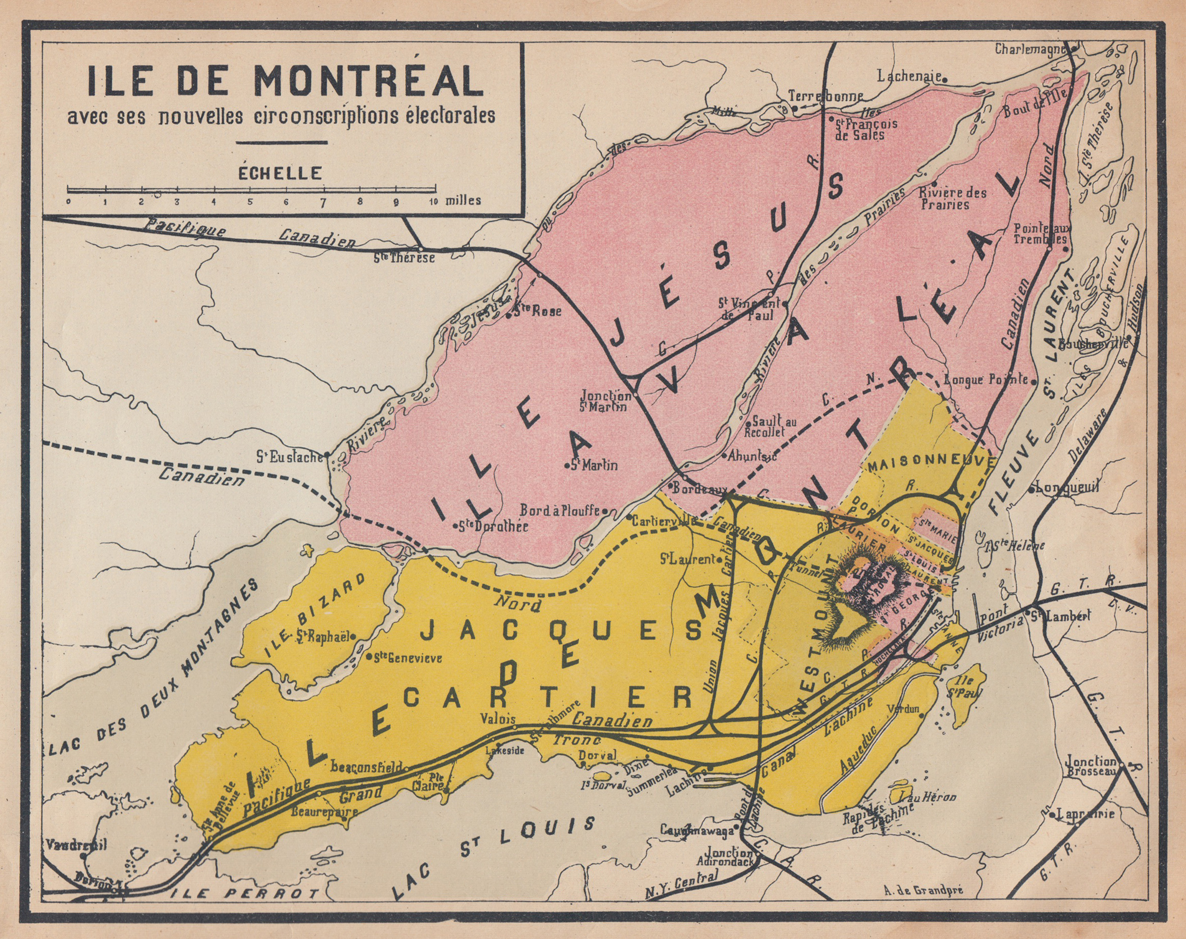
English: [Translation from French] Island of Montreal with its new electoral districts. Electoral map from Géographie-Atlas, Cours Moyen, Montreal 1920
Français : Île de Montréal avec ses nouvelles circonscriptions électorales. Carte électorale tirée de Géographie-Atlas, Cours Moyen. Montréal 1920. Frères des Écoles chrétiennes (?) |
| Date | |
| Source |
https://www.flickr.com/photos/116392178@N08/16322713122 Uploaded to Flickr by Martin Gagnon on Jan. 15, 2015 |
| Author | A. de Grandpré |
Licensing[edit]
This work is in the public domain in the United States because it was published (or registered with the U.S. Copyright Office) before January 1, 1929.
Public domain works must be out of copyright in both the United States and in the source country of the work in order to be hosted on the Commons. If the work is not a U.S. work, the file must have an additional copyright tag indicating the copyright status in the source country.
Note: This tag should not be used for sound recordings. |
This Canadian work is in the public domain in Canada because its copyright has expired due to one of the following:
it was not subject to Crown copyright, and
|
 |
| This image, originally posted to Flickr, was reviewed on 15:20, 14 March 2018 (UTC) by the administrator or reviewer ww2censor, who confirmed that it was available on Flickr under the stated license on that date. |
File history
Click on a date/time to view the file as it appeared at that time.
| Date/Time | Thumbnail | Dimensions | User | Comment | |
|---|---|---|---|---|---|
| current | 03:35, 10 March 2018 | | 2,349 × 1,860 (3.37 MB) | Cortomaltais (talk | contribs) | {{Information |description ={{en|1=[Translation from French] Island of Montreal with its new electoral districts.}} {{fr|1=Île de Montréal avec ses nouvelles circonscriptions électorales.}} |source =https://www.flickr.com/photos/116392178@N08/16322713122 |author =Frères des Écoles chrétiennes |date =1920 }} Published on Flickr by Martin Gagnon on Jan. 15, 2015 Category:Old maps of Montreal |
You cannot overwrite this file.
File usage on Commons
There are no pages that use this file.
File usage on other wikis
The following other wikis use this file:
- Usage on en.wikipedia.org
- Usage on fr.wikipedia.org
- Jacques-Cartier (circonscription provinciale)
- Laval (district électoral)
- Montréal-Dorion
- Maisonneuve (circonscription provinciale)
- Westmount (circonscription provinciale)
- Carte électorale du Québec
- Montréal–Sainte-Marie
- Montréal no 2
- Montréal–Saint-Laurent
- Montréal–Saint-Georges
- Montréal–Saint-Louis
- Montréal–Sainte-Anne
- Montréal–Saint-Henri
- Montréal-Laurier
- Usage on www.wikidata.org