File:Illinois Locator Map with US.PNG
跳转到导航
跳转到搜索
没有更高的分辨率。
Illinois_Locator_Map_with_US.PNG (288 × 405像素,文件大小:13 KB,MIME类型:image/png)
说明
说明
添加一行文字以描述该文件所表现的内容
摘要
[编辑]

|
此locator map图片可使用矢量图形重新创建为SVG文件。这具有很多好处;更多信息请参见共享资源:待清理媒体。如果存在此图片的SVG格式,请将其上传,然后将此模板替换为
{{vector version available|新图片名称}}。
建议您将SVG命名为“Illinois Locator Map with US.svg”,这样在使用Vector version available(或Vva)模板时就不需要填写新图片名称参数。 |
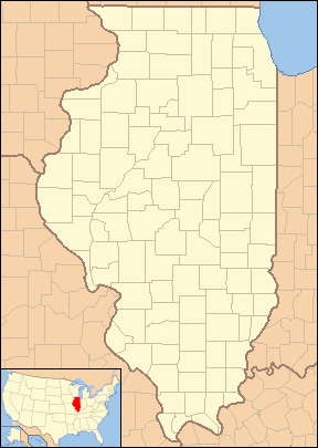
| 描述 | Locator Map of Illinois, United States |
| 日期 | |
| 来源 | taken from US Census website [1] and modified by User:VerruckteDan, User:Ruhrfisch, User:Huebi, and User:Appraiser |
| 作者 | US Census, User:VerruckteDan, User:Ruhrfisch, User:Huebi, and User:Appraiser |
| 授权 (二次使用本文件) |
US Census / US Government work is public domain, my modifications licensed under the GNU Free Documentation License |
许可协议
[编辑]

|
已授权您依据自由软件基金会发行的无固定段落及封面封底文字(Invariant Sections, Front-Cover Texts, and Back-Cover Texts)的GNU自由文件许可协议1.2版或任意后续版本的条款,复制、传播和/或修改本文件。该协议的副本请见“GNU Free Documentation License”。 |
| 本文件采用知识共享署名-相同方式共享 3.0 未本地化版本许可协议授权。 | ||
| 署名: We, Ruhrfisch and Appraiser | ||
| ||
| 本许可协议标签作为GFDL许可协议更新的组成部分被添加至本文件。 |
本文件采用知识共享署名-相同方式共享 2.5 通用许可协议授权。
- 您可以自由地:
- 共享 – 复制、发行并传播本作品
- 修改 – 改编作品
- 惟须遵守下列条件:
- 署名 – 您必须对作品进行署名,提供授权条款的链接,并说明是否对原始内容进行了更改。您可以用任何合理的方式来署名,但不得以任何方式表明许可人认可您或您的使用。
- 相同方式共享 – 如果您再混合、转换或者基于本作品进行创作,您必须以与原先许可协议相同或相兼容的许可协议分发您贡献的作品。
您可以选择您需要的许可协议。
and
This image or file is a work of a United States Census Bureau employee, taken or made as part of that person's official duties. As a work of the U.S. federal government, the image is in the public domain.
|
 |
文件历史
点击某个日期/时间查看对应时刻的文件。
| 日期/时间 | 缩略图 | 大小 | 用户 | 备注 | |
|---|---|---|---|---|---|
| 当前 | 2013年6月24日 (一) 12:16 | | 288 × 405(13 KB) | Zyxw(留言 | 贡献) | Same width & height as File:Illinois Locator Map.PNG for use with mapping templates. Inset is File:Map of USA IL.svg. Smaller file size. |
| 2008年3月8日 (六) 21:43 |  | 292 × 409(18 KB) | Appraiser(留言 | 贡献) | {{Information| |Description= Locator Map of Illinois, United States |Source= taken from US Census website [http://factfinder.census.gov/] and modified by User:Ruhrfisch, User:Huebi, and User:Appraiser |Date= March 2008 |Author= US Census, [[U | |
| 2008年3月3日 (一) 03:03 |  | 288 × 405(17 KB) | Appraiser(留言 | 贡献) | {{Information| |Description= Locator Map of Illinois, United States |Source= taken from US Census website [http://factfinder.census.gov/] and modified by User:Appraiser |Date= March 2007 |Author= US Census, Appraiser |Permission= US Census / US Gover |
您不可以覆盖此文件。
文件用途
以下2个页面使用本文件:
全域文件用途
以下其他wiki使用此文件:
- ar.wikipedia.org上的用途
- be-tarask.wikipedia.org上的用途
- ceb.wikipedia.org上的用途
- en.wikipedia.org上的用途
- es.wikipedia.org上的用途
- fa.wikipedia.org上的用途
- دلاوان، ایلینوی
- ایست مولین، ایلینوی
- ایست سنت لوئیس، ایلینوی
- ادواردزویل، ایلینوی
- ژنو، ایلینوی
- گرافتون، ایلینوی
- جکسونویل، ایلینوی
- جرزیویل، ایلینوی
- مندوتا، ایلینوی
- مانتیسلو، ایلینوی
- مونتکارمل، ایلینوی
- ناپرویل، ایلینوی
- نائوو، ایلینوی
- اوگلسبی، ایلینوی
- پئوریا، ایلینوی
- پرینستون، ایلینوی
- کوئینسی، ایلینوی
- سنت چارلز، ایلینوی
- تیلور ویل، ایلینوی
- ilo.wikipedia.org上的用途
- kbp.wikipedia.org上的用途
- sh.wikipedia.org上的用途
查看此文件的更多全域用途。