File:Ince Castle - geograph.org.uk - 344828.jpg
Ince_Castle_-_geograph.org.uk_-_344828.jpg (640 × 435 billedpunkter, filstørrelse: 63 KB, MIME-type: image/jpeg)
Captions
Captions
Beskrivelse
[redigér]
| Beskrivelse |
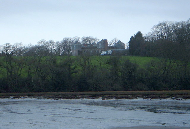
English: Ince Castle This is Ince Castle which was built in 1642 at the start of the Civil War and was captured in 1646. It consists of 4 three storey towers with walls 4 foot thick. By the 1850s it was used as a farm and was allowed to decay but it was restored in the early 20th century. It burnt down in 1986 (apparently by grandmother being a bit irresponsible with a candle) - but it has now been rebuilt.
In 1649, John Killigrew inherited Ince Castle from an uncle. He married four wives and installed them separately into each of the four towers giving them a story that the fields were plagued with mice - which kept them inside. For some time, each of the four ladies lived happily in ignorance of the other three, until a thicko servant delivered a letter to the wrong wife, and all was revealed! John Killigrew was sentenced to sixteen years, four years for each count of bigamy. John pointed out to the judge that, as his first marriage was not bigamous, he should serve only twelve years! Good lad. It is now the home of Lord and Lady Boyd who probably wouldn't like to see me making footprints in their ever so posh mud. |
| Dato | |
| Kilde | From geograph.org.uk |
| Forfatter | Bill Booth |
| Andre versioner | Derivative works of this file: Ince Castle - geograph.org.uk - 344828 cropped.jpg |
| Kameraposition | | Dette og andre billeder på deres position på: OpenStreetMap |
|---|
_heading:225.00&language=da)
| Objektposition | | Dette og andre billeder på deres position på: OpenStreetMap |
|---|
_heading:225.00&language=da)
Licensering
[redigér]

|
This image was taken from the Geograph project collection. See this photograph's page on the Geograph website for the photographer's contact details. The copyright on this image is owned by Bill Booth and is licensed for reuse under the Creative Commons Attribution-ShareAlike 2.0 license.
|
- Du må frit:
- at dele – at kopiere, distribuere og overføre værket
- at remixe – at tilpasse værket
- Under følgende vilkår:
- kreditering – Du skal give passende kreditering, angive et link til licensen, og oplyse om der er foretaget ændringer. Du må gøre det på enhver fornuftig måde, men ikke på en måde der antyder at licensgiveren godkender dig eller din anvendelse.
- deling på samme vilkår – Hvis du bearbejder, ændrer eller bygger videre på dette værk, skal du distribuere dine bidrag under den samme eller en kompatibel licens som originalen.
Filhistorik
Klik på en dato/tid for at se filen som den så ud på det tidspunkt.
| Dato/tid | Miniaturebillede | Dimensioner | Bruger | Kommentar | |
|---|---|---|---|---|---|
| nuværende | 2. jan. 2011, 17:18 | | 640 × 435 (63 KB) | GeographBot (diskussion | bidrag) | == {{int:filedesc}} == {{Information |description={{en|1=Ince Castle This is Ince Castle which was built in 1642 at the start of the Civil War and was captured in 1646. It consists of 4 three storey towers with walls 4 foot thick. By the 1850s it was used |
Du kan ikke overskrive denne fil.
Filanvendelse
De følgende 2 sider bruger denne fil:
Global filanvendelse
Følgende andre wikier anvender denne fil:
- Anvendelser på ceb.wikipedia.org
- Anvendelser på dag.wikipedia.org
- Anvendelser på da.wikipedia.org
- Anvendelser på de.wikipedia.org
- Anvendelser på en.wikipedia.org
- Anvendelser på fr.wikipedia.org
- Anvendelser på ru.wikipedia.org
- Anvendelser på sv.wikipedia.org
- Anvendelser på www.wikidata.org