File:India Kerala location map.svg

Rozmiar pierwotny (Plik SVG, nominalnie 874 × 1274 pikseli, rozmiar pliku: 350 KB)
Podpisy
Podpisy
Opis[edytuj]
| Opis |
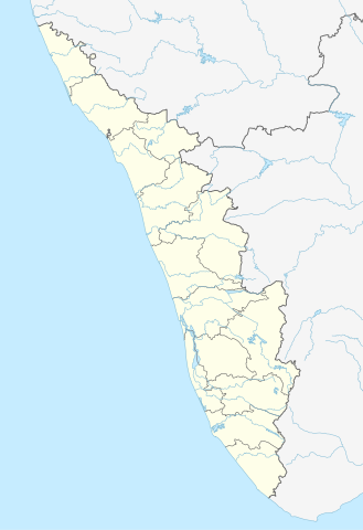
Quadratische Plattkarte, N-S-Streckung 102 %. Geographische Begrenzung der Karte:
Equirectangular projection, N/S stretching 102 %. Geographic limits of the map:
|
|
| Data | ||
| Źródło |
Praca własna, using
|
|
| Autor | NordNordWest | |
| Licencja (Ponowne użycie tego pliku) |
Ten plik udostępniony jest na licencji Creative Commons Uznanie autorstwa – Na tych samych warunkach 3.0 Niemcy.
 Ten plik udostępniony jest na licencji Creative Commons Uznanie autorstwa – Na tych samych warunkach 3.0.
|


|
Ta mapa została stworzona lub ulepszona w niemieckiej Kartenwerkstatt (Pracowni Kartograficznej). I Ty możesz zaproponować inne mapy do ulepszenia.
|
Historia pliku
Kliknij na odpowiedniej dacie/czasie, aby zobaczyć wersję pliku z tamtego okresu.
| Data/czas | Miniatura | Wymiary | Użytkownik | Opis | |
|---|---|---|---|---|---|
| aktualny | 16:13, 10 cze 2023 | | 874 × 1274 (350 KB) | C1MM (dyskusja | edycje) | c boundaries |
| 16:04, 10 cze 2023 |  | 874 × 1274 (351 KB) | C1MM (dyskusja | edycje) | c bounds | |
| 14:41, 22 sie 2021 |  | 775 × 1129 (394 KB) | C1MM (dyskusja | edycje) | Corrected rivers and dist boundaries | |
| 18:17, 4 maj 2012 |  | 827 × 1205 (135 KB) | NordNordWest (dyskusja | edycje) | upd | |
| 09:30, 11 mar 2011 |  | 827 × 1205 (132 KB) | NordNordWest (dyskusja | edycje) | =={{int:filedesc}}== {{Information |Description= {{de|Positionskarte von Kerala, Indien}} Quadratische Plattkarte, N-S-Streckung 102 %. Geographische Begrenzung der Karte: * N: 13.0° N * S: 8.0° N * W: 74.5° O * O: 78.0° |
Nie możesz nadpisać tego pliku.
Lokalne wykorzystanie pliku
Następujące strony korzystają z tego pliku:
- User:NordNordWest/Gallery/Location maps
- File:India Kerala relief map.png
- File:Wayanad Kerala location map.svg
- Category:Airports in Kerala
- Category:Archaeological sites in Kerala
- Category:Births in Kerala
- Category:Bodies of water in Kerala
- Category:Bridges in Kerala
- Category:Bus stations in Kerala
- Category:Canals in Kerala
- Category:Dams in Kerala
- Category:Deaths in Kerala
- Category:Disasters and accidents in Kerala
- Category:Engineers from Kerala
- Category:Flora of Kerala
- Category:Forts in Kerala
- Category:Hill stations in Kerala
- Category:Hills of Kerala
- Category:Hindu temples in Kerala
- Category:Hospitals in Kerala
- Category:Jain temples in Kerala
- Category:Kerala
- Category:Kerala in the 2000s
- Category:Lakes of Kerala
- Category:Local government in Kerala
- Category:Maps of Kerala
- Category:Monuments of National Importance in Kerala
- Category:Mountains of Kerala
- Category:Municipal corporations in Kerala
- Category:Newspapers of Kerala
- Category:Palaces in Kerala
- Category:People of Kerala
- Category:Populated places in Kerala
- Category:Power plants in Kerala
- Category:Rail transport in Kerala
- Category:Railway junction stations in Kerala
- Category:Railway stations in Kerala
- Category:Reservoirs in Kerala
- Category:Rivers of Kerala
- Category:Screenwriters from Kerala
- Category:Shiva temples in Kerala
- Category:Temples in Kerala
- Category:Transport in Kerala
- Category:Visitor attractions in Kerala
- Category:Waterfalls in Kerala
Globalne wykorzystanie pliku
Ten plik jest wykorzystywany także w innych projektach wiki:
- Wykorzystanie na ar.wikipedia.org
- Wykorzystanie na azb.wikipedia.org
- باتی چاتالور
- باتی پودوسری
- پیدیکاپارامبو
- پیداوور
- وایاتوپوژا
- وئیلور
- پرووانتانام
- پرووالور
- پرووا (هیندوستان)
- پرونا (هیندوستان)
- پرونیلام
- واوانور
- پرونقوژی
- وانیمال
- وانییامبالام
- ونیکود
- ونجینیسری
- ونقانور
- سارکارا-چیرایینکیژو
- سانتانپارا
- ماژووانور
- ماژوکیر
- کالکونتال
- کالیکاو
- ماترا (هیندوستان)
- ماتیلاکام
- ماتامبا
- کالایاپورام
- کالاتوکاداوو
- کالانجور
- ونقانلور
- ونقولا
- ماروتا, ایندیا
- کالامپالا
- ونقارا, مالاپورام دیستریکت
- ونکیتانقو
- کالاکتی
- واندیتاوالام
- واندانمدو
- واندانپاتال
- وانداماتوم
- وانداژی-یی
- وانداژی-ی
- ونجارامودو
- ونپاکال
- کاکور (هیندوستان)
- ماریاناد
- کاکولیسری
- کاکودی
Pokaż listę globalnego wykorzystania tego pliku.