File:India Kerala location map.svg
跳至導覽
跳至搜尋

此 SVG 檔案的 PNG 預覽的大小:411 × 599 像素。 其他解析度:164 × 240 像素 | 329 × 480 像素 | 527 × 768 像素 | 702 × 1,024 像素 | 1,405 × 2,048 像素 | 874 × 1,274 像素。
原始檔案 (SVG 檔案,表面大小:874 × 1,274 像素,檔案大小:350 KB)
說明
說明
添加單行說明來描述出檔案所代表的內容
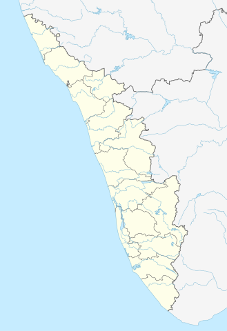
map of the Kerala
摘要
[編輯]| 描述 |
Quadratische Plattkarte, N-S-Streckung 102 %. Geographische Begrenzung der Karte:
Equirectangular projection, N/S stretching 102 %. Geographic limits of the map:
|
|
| 日期 | ||
| 來源 |
自己的作品, using
|
|
| 作者 | NordNordWest | |
| 授權許可 (重用此檔案) |
此檔案採用創用CC 姓名標示-相同方式分享 3.0 德國授權條款。
 此檔案採用創用CC 姓名標示-相同方式分享 3.0 未在地化版本授權條款。
|


|
|
檔案歷史
點選日期/時間以檢視該時間的檔案版本。
| 日期/時間 | 縮圖 | 尺寸 | 使用者 | 備註 | |
|---|---|---|---|---|---|
| 目前 | 2023年6月10日 (六) 16:13 | | 874 × 1,274(350 KB) | C1MM(留言 | 貢獻) | c boundaries |
| 2023年6月10日 (六) 16:04 |  | 874 × 1,274(351 KB) | C1MM(留言 | 貢獻) | c bounds | |
| 2021年8月22日 (日) 14:41 |  | 775 × 1,129(394 KB) | C1MM(留言 | 貢獻) | Corrected rivers and dist boundaries | |
| 2012年5月4日 (五) 18:17 |  | 827 × 1,205(135 KB) | NordNordWest(留言 | 貢獻) | upd | |
| 2011年3月11日 (五) 09:30 |  | 827 × 1,205(132 KB) | NordNordWest(留言 | 貢獻) | =={{int:filedesc}}== {{Information |Description= {{de|Positionskarte von Kerala, Indien}} Quadratische Plattkarte, N-S-Streckung 102 %. Geographische Begrenzung der Karte: * N: 13.0° N * S: 8.0° N * W: 74.5° O * O: 78.0° |
無法覆蓋此檔案。
檔案用途
下列45個頁面有用到此檔案:
- User:NordNordWest/Gallery/Location maps
- File:India Kerala relief map.png
- File:Wayanad Kerala location map.svg
- Category:Airports in Kerala
- Category:Archaeological sites in Kerala
- Category:Births in Kerala
- Category:Bodies of water in Kerala
- Category:Bridges in Kerala
- Category:Bus stations in Kerala
- Category:Canals in Kerala
- Category:Dams in Kerala
- Category:Deaths in Kerala
- Category:Disasters and accidents in Kerala
- Category:Engineers from Kerala
- Category:Flora of Kerala
- Category:Forts in Kerala
- Category:Hill stations in Kerala
- Category:Hills of Kerala
- Category:Hindu temples in Kerala
- Category:Hospitals in Kerala
- Category:Jain temples in Kerala
- Category:Kerala
- Category:Kerala in the 2000s
- Category:Lakes of Kerala
- Category:Local government in Kerala
- Category:Maps of Kerala
- Category:Monuments of National Importance in Kerala
- Category:Mountains of Kerala
- Category:Municipal corporations in Kerala
- Category:Newspapers of Kerala
- Category:Palaces in Kerala
- Category:People of Kerala
- Category:Populated places in Kerala
- Category:Power plants in Kerala
- Category:Rail transport in Kerala
- Category:Railway junction stations in Kerala
- Category:Railway stations in Kerala
- Category:Reservoirs in Kerala
- Category:Rivers of Kerala
- Category:Screenwriters from Kerala
- Category:Shiva temples in Kerala
- Category:Temples in Kerala
- Category:Transport in Kerala
- Category:Visitor attractions in Kerala
- Category:Waterfalls in Kerala
全域檔案使用狀況
以下其他 wiki 使用了這個檔案:
- ar.wikipedia.org 的使用狀況
- azb.wikipedia.org 的使用狀況
- باتی چاتالور
- باتی پودوسری
- پیدیکاپارامبو
- پیداوور
- وایاتوپوژا
- وئیلور
- پرووانتانام
- پرووالور
- پرووا (هیندوستان)
- پرونا (هیندوستان)
- پرونیلام
- واوانور
- پرونقوژی
- وانیمال
- وانییامبالام
- ونیکود
- ونجینیسری
- ونقانور
- سارکارا-چیرایینکیژو
- سانتانپارا
- ماژووانور
- ماژوکیر
- کالکونتال
- کالیکاو
- ماترا (هیندوستان)
- ماتیلاکام
- ماتامبا
- کالایاپورام
- کالاتوکاداوو
- کالانجور
- ونقانلور
- ونقولا
- ماروتا, ایندیا
- کالامپالا
- ونقارا, مالاپورام دیستریکت
- ونکیتانقو
- کالاکتی
- واندیتاوالام
- واندانمدو
- واندانپاتال
- وانداماتوم
- وانداژی-یی
- وانداژی-ی
- ونجارامودو
- ونپاکال
- کاکور (هیندوستان)
- ماریاناد
- کاکولیسری
- کاکودی
檢視此檔案的更多全域使用狀況。