File:India Madhya Pradesh location map.svg
跳至導覽
跳至搜尋

此 SVG 檔案的 PNG 預覽的大小:800 × 563 像素。 其他解析度:320 × 225 像素 | 640 × 450 像素 | 1,024 × 720 像素 | 1,280 × 900 像素 | 2,560 × 1,800 像素 | 1,041 × 732 像素。
原始檔案 (SVG 檔案,表面大小:1,041 × 732 像素,檔案大小:180 KB)
說明
說明
添加單行說明來描述出檔案所代表的內容
摘要
[編輯]| 描述 |
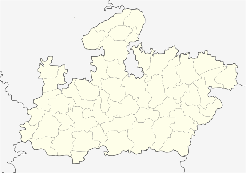
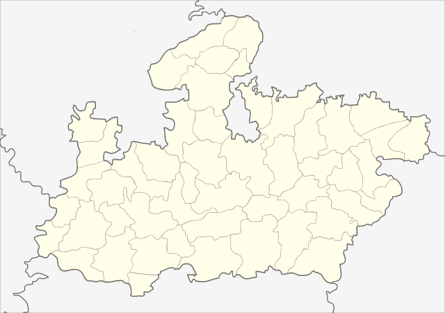
English: Locator map of Madhya Pradesh.
Geographical limits of the map:
Français : Carte de localisation du Madhya Pradesh, Inde. |
| 日期 | (UTC) |
| 來源 | India_Madhya_Pradesh_locator_map.svg |
| 作者 |
India_Madhya_Pradesh_locator_map.svg: user:Planemad
|
| 其他版本 |
|


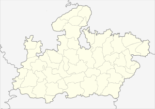
| 這是一張修飾過的圖片,即本圖片是用軟體修改過後的版本,修改的方式或內容有:Cropped map of madhya pradesh。原版圖片來源:India Madhya Pradesh locator map.svg。修改者:Nayvik。
|
授權條款
[編輯]
此檔案採用創用CC 姓名標示-相同方式分享 3.0 未在地化版本授權條款。
- 您可以自由:
- 分享 – 複製、發佈和傳播本作品
- 重新修改 – 創作演繹作品
- 惟需遵照下列條件:
- 姓名標示 – 您必須指名出正確的製作者,和提供授權條款的連結,以及表示是否有對內容上做出變更。您可以用任何合理的方式來行動,但不得以任何方式表明授權條款是對您許可或是由您所使用。
- 相同方式分享 – 如果您利用本素材進行再混合、轉換或創作,您必須基於如同原先的相同或兼容的條款,來分布您的貢獻成品。
原始上傳日誌
[編輯]
This image is a derivative work of the following images:
- File:India_Madhya_Pradesh_locator_map.svg licensed with Cc-by-sa-3.0
- 2006-08-06T17:38:20Z Planemad 1639x1852 (768594 Bytes) {{WikiProject_India_Maps |Title=Madhya Pradesh locator map |Description=Locator map of the state of Madhya Pradesh, [[w:India|India]] with district boundaries. |Source=. |Date=August 6 2006 |Author=[[w:user:Nichalp]][[w:user
Uploaded with derivativeFX
| 註解 | 該圖片含有註解:在維基媒體共享資源上查看註解 |
檔案歷史
點選日期/時間以檢視該時間的檔案版本。
| 日期/時間 | 縮圖 | 尺寸 | 使用者 | 備註 | |
|---|---|---|---|---|---|
| 目前 | 2013年2月25日 (一) 22:26 | | 1,041 × 732(180 KB) | Milenioscuro(留言 | 貢獻) | updated new districts, colors according german map workshop and the other India location maps |
| 2010年11月25日 (四) 12:19 |  | 610 × 440(146 KB) | Nayvik(留言 | 貢獻) | Changed background color | |
| 2010年11月25日 (四) 12:13 |  | 610 × 440(146 KB) | Nayvik(留言 | 貢獻) | {{Information |Description=Locator map of Madhya Pradesh.<br> Geographical limits of the map: * 28.0°N * 20.0°N * 84.0°E * 72.0°E |Source=*File:India_Madhya_Pradesh_locator_map.svg |Date=2010-11-25 12:11 (UTC) |Author=*[[:Fi |
無法覆蓋此檔案。
檔案用途
下列40個頁面有用到此檔案:
- Commons:Graphic Lab/Map workshop/Archive/2012
- File:India Madhya Pradesh relief map.png
- Category:Airports in Madhya Pradesh
- Category:Archaeological sites in Madhya Pradesh
- Category:Births in Madhya Pradesh
- Category:Cricket in Madhya Pradesh
- Category:Dams in Madhya Pradesh
- Category:Deaths in Madhya Pradesh
- Category:Education in Madhya Pradesh
- Category:Festivals of Madhya Pradesh
- Category:Films shot in Madhya Pradesh
- Category:Forts in Madhya Pradesh
- Category:Geography of Madhya Pradesh
- Category:Hill stations in Madhya Pradesh
- Category:Hills of Madhya Pradesh
- Category:Hindu temples in Madhya Pradesh
- Category:Hospitals in Madhya Pradesh
- Category:Jain temples in Madhya Pradesh
- Category:Lakes of Madhya Pradesh
- Category:Madhya Pradesh
- Category:Maps of Madhya Pradesh
- Category:Museums in Madhya Pradesh
- Category:Palaces in Madhya Pradesh
- Category:People of Madhya Pradesh
- Category:Populated places in Madhya Pradesh
- Category:Postcards of Madhya Pradesh
- Category:Power plants in Madhya Pradesh
- Category:Railway junction stations in Madhya Pradesh
- Category:Railway stations in Madhya Pradesh
- Category:Reservoirs in Madhya Pradesh
- Category:Rivers of Madhya Pradesh
- Category:Roads in Madhya Pradesh
- Category:Shiva temples in Madhya Pradesh
- Category:Temples in Madhya Pradesh
- Category:Transport in Madhya Pradesh
- Category:Valleys of Madhya Pradesh
- Category:Villages in Madhya Pradesh
- Category:Visitor attractions in Madhya Pradesh
- Category:Waterfalls in Madhya Pradesh
- Category:World Heritage Sites in Madhya Pradesh
全域檔案使用狀況
以下其他 wiki 使用了這個檔案:
- de.wikipedia.org 的使用狀況
- de.wikivoyage.org 的使用狀況
- en.wikipedia.org 的使用狀況
- eo.wikipedia.org 的使用狀況
- fa.wikipedia.org 的使用狀況
檢視此檔案的更多全域使用狀況。