File:Indonesian cities and regencies.svg
Jump to navigation
Jump to search

Size of this PNG preview of this SVG file: 800 × 294 pixels. Other resolutions: 320 × 118 pixels | 640 × 235 pixels | 1,024 × 377 pixels | 1,280 × 471 pixels | 2,560 × 942 pixels.
Original file (SVG file, nominally 1,631 × 600 pixels, file size: 532 KB)
Captions
Captions
Add a one-line explanation of what this file represents
Summary[edit]
| Description |
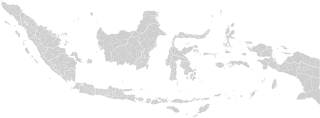
English: Blank map of Indonesian cities and regencies. Bahasa Indonesia: Peta kabupaten dan kota di Indonesia |
| Date | |
| Source | File:Electoral Districts Indonesia DPR 2019.svg, with update on new city/regency |
| Author | Hddty |
| Other versions |
|
| SVG development |
Licensing[edit]
I, the copyright holder of this work, hereby publish it under the following license:
This file is licensed under the Creative Commons Attribution-Share Alike 4.0 International license.
- You are free:
- to share – to copy, distribute and transmit the work
- to remix – to adapt the work
- Under the following conditions:
- attribution – You must give appropriate credit, provide a link to the license, and indicate if changes were made. You may do so in any reasonable manner, but not in any way that suggests the licensor endorses you or your use.
- share alike – If you remix, transform, or build upon the material, you must distribute your contributions under the same or compatible license as the original.
File history
Click on a date/time to view the file as it appeared at that time.
| Date/Time | Thumbnail | Dimensions | User | Comment | |
|---|---|---|---|---|---|
| current | 16:49, 11 December 2022 | 1,631 × 600 (532 KB) | NordNordWest (talk | contribs) | upd Papua | |
| 14:43, 20 July 2022 | 1,631 × 600 (435 KB) | Afrogindahood (talk | contribs) | Addition of new provinces in Western New Guinea | ||
| 15:01, 4 June 2021 | 1,631 × 600 (726 KB) | Ibrahim Muizzuddin (talk | contribs) | Minor edit: Splitting Kab. Konawe with Kab. Konawe Kepulauan | ||
| 08:49, 20 May 2021 | 1,631 × 600 (725 KB) | Ibrahim Muizzuddin (talk | contribs) | Add ID | ||
| 01:45, 4 April 2020 | 1,631 × 600 (671 KB) | Hddty (talk | contribs) | uploaded as separate file on {{f|Indonesian cities and regencies 2.svg}} | ||
| 21:12, 5 December 2019 | 800 × 320 (847 KB) | Juxlos (talk | contribs) | Updated based on Bennylin's update for regencies, added shape for East Timor and East Malaysia/Brunei | ||
| 17:11, 26 May 2019 | 1,631 × 600 (671 KB) | Hddty (talk | contribs) | fix | ||
| 17:00, 26 May 2019 | 1,631 × 600 (671 KB) | Hddty (talk | contribs) | non transparent | ||
| 16:54, 26 May 2019 | 1,631 × 600 (674 KB) | Hddty (talk | contribs) | {{Information |description=Indonesian cities and regencies blank |date=2019-05-26 |source=File:Electoral Districts Indonesia DPR 2019.svg with update on new city/regency |author=User:Hddty. |permission= |other versions= }} =={{int:license-header}}== {{self|cc-by-sa-4.0}} Category:SVG maps of Indonesia |
You cannot overwrite this file.
File usage on Commons
The following 4 pages use this file:
File usage on other wikis
The following other wikis use this file:
- Usage on en.wikipedia.org
- Usage on id.wikipedia.org
- Usage on ja.wikipedia.org