File:Induced earthquakes in Oklahoma area.png
Jump to navigation
Jump to search
Size of this preview: 800 × 566 pixels. Other resolutions: 320 × 226 pixels | 640 × 453 pixels | 1,047 × 741 pixels.
Original file (1,047 × 741 pixels, file size: 141 KB, MIME type: image/png)
Captions
Captions
Add a one-line explanation of what this file represents
Summary
[edit]
| Description |
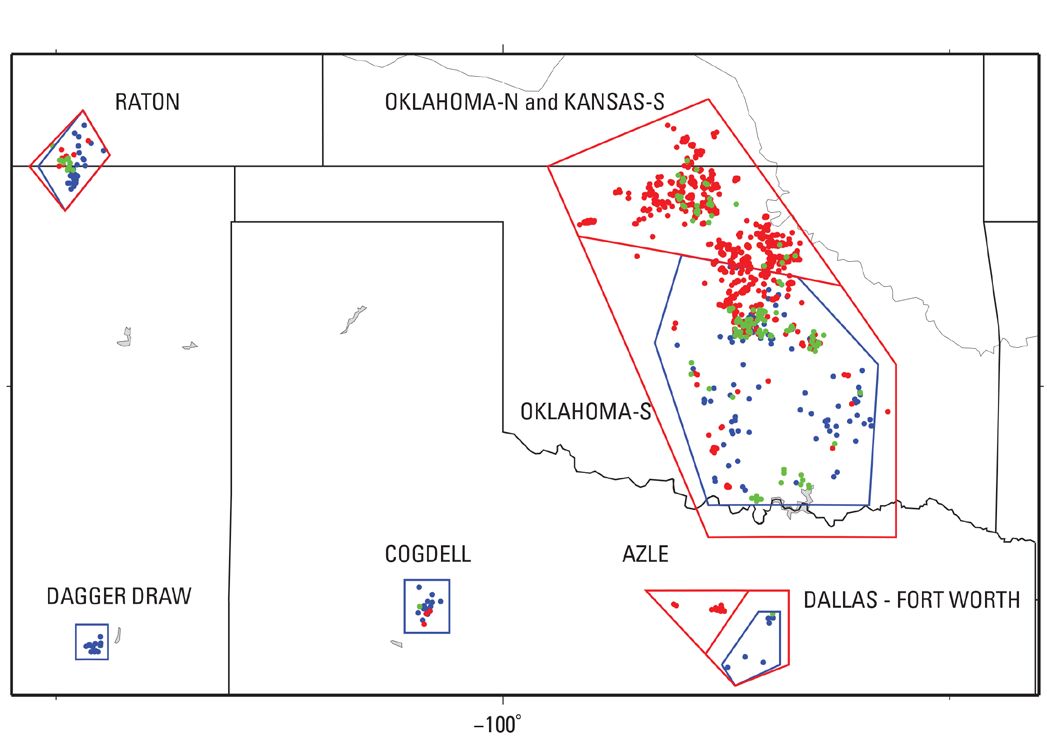
English: Polygons showing where potential induced earthquakes have been extracted for the following: Induced seismicity showing area near Oklahoma. Red = 2014 nondeclustered catalog, Green = 2013 nondeclustered catalog, Blue = 2012 and previous using a declustered catalog. The minimum magnitude (Mmin) used in these plots is M2.7. |
| Date | |
| Source | http://pubs.usgs.gov/of/2015/1070/pdf/ofr2015-1070.pdf p. 12 |
| Author | United States Geological Survey |
Licensing
[edit]
This image is in the public domain in the United States because it only contains materials that originally came from the United States Geological Survey, an agency of the United States Department of the Interior. For more information, see the official USGS copyright policy.
|
File history
Click on a date/time to view the file as it appeared at that time.
| Date/Time | Thumbnail | Dimensions | User | Comment | |
|---|---|---|---|---|---|
| current | 22:26, 25 April 2015 | | 1,047 × 741 (141 KB) | Master of Time (talk | contribs) | User created page with UploadWizard |
You cannot overwrite this file.
File usage on Commons
There are no pages that use this file.
File usage on other wikis
The following other wikis use this file:
- Usage on en.wikipedia.org