File:Irōzaki Fault Relief Map, SRTM-1.gif
Jump to navigation
Jump to search
No higher resolution available.
Irōzaki_Fault_Relief_Map,_SRTM-1.gif (800 × 600 pixels, file size: 255 KB, MIME type: image/gif, looped, 3 frames, 6.0 s)
Captions
Captions
Add a one-line explanation of what this file represents
Summary[edit]
| Description |
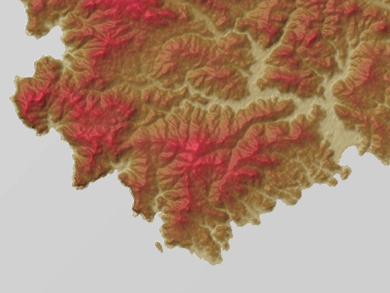
English: A topographic map of the Irozaki Fault in the southernmost coast of the Izu Peninsula, Shizuoka Prefecture, Honshu, Japan. See also 1974 Izu Peninsula earthquake.
赤色系の地形図ですがアジア航測に特許がある赤色立体地図ではありませんのでご注意ください。 |
| Date | |
| Source |
Topographic data: NASA's SRTM-1 30m Mesh (ver.3 2014) |
| Author | Batholith |
| Object location | | View this and other nearby images on: OpenStreetMap |
|---|
Licensing[edit]
| I, the copyright holder of this work, release this work into the public domain. This applies worldwide. In some countries this may not be legally possible; if so: I grant anyone the right to use this work for any purpose, without any conditions, unless such conditions are required by law. |
This image uses high-resolution digital topography data from NASA's Shuttle Radar Topography Mission (SRTM) at JPL-Caltech [1]. It is in the public domain in the United States.
|
 | |
File history
Click on a date/time to view the file as it appeared at that time.
| Date/Time | Thumbnail | Dimensions | User | Comment | |
|---|---|---|---|---|---|
| current | 12:50, 8 April 2016 | | 800 × 600 (255 KB) | Batholith (talk | contribs) | {{Information |Description= {{en|Relief map of '''Irōzaki Fault''', Izu Peninsula, Shizuoka Prefecture, Honshu, Japan. Data from "[[:en:Shuttle Radar Topography M... |
You cannot overwrite this file.
File usage on Commons
The following 2 pages use this file:
File usage on other wikis
The following other wikis use this file:
- Usage on ja.wikipedia.org
- Usage on www.wikidata.org