File:Irago Channel view from Toba-Observatory S.jpg
Jump to navigation
Jump to search

Size of this preview: 800 × 400 pixels. Other resolutions: 320 × 160 pixels | 640 × 320 pixels | 1,440 × 720 pixels.
Original file (1,440 × 720 pixels, file size: 598 KB, MIME type: image/jpeg)
Captions
Captions
Add a one-line explanation of what this file represents
Summary
[edit]
| Camera location | | View this and other nearby images on: OpenStreetMap |
|---|
| Description |
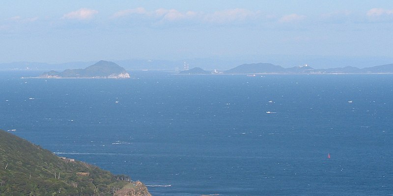
English: The Irago Channel (between Kamishima Is. and Cape Irago) view from Toba-Observatory
I took this image at the Toba-Observatory ("Perl-Road"), Kuzaki, Toba, Mie Pref., Japan. |
| Date | |
| Source |
Tawashi2006 日本語:投稿者Tawashi2006撮影 |
| Author | Tawashi2006 |
| Permission (Reusing this file) |
GFDL,Creative Commons Attribution ShareAlike 2.1 Japan License |
| Other versions |
Licensing
[edit]
I, the copyright holder of this work, hereby publish it under the following licenses:

|
Permission is granted to copy, distribute and/or modify this document under the terms of the GNU Free Documentation License, Version 1.2 or any later version published by the Free Software Foundation; with no Invariant Sections, no Front-Cover Texts, and no Back-Cover Texts. A copy of the license is included in the section entitled GNU Free Documentation License. |
| This file is licensed under the Creative Commons Attribution-Share Alike 3.0 Unported license. | ||
| ||
| This licensing tag was added to this file as part of the GFDL licensing update. |
This file is licensed under the Creative Commons Attribution-Share Alike 2.1 Japan license.
- You are free:
- to share – to copy, distribute and transmit the work
- to remix – to adapt the work
- Under the following conditions:
- attribution – You must give appropriate credit, provide a link to the license, and indicate if changes were made. You may do so in any reasonable manner, but not in any way that suggests the licensor endorses you or your use.
- share alike – If you remix, transform, or build upon the material, you must distribute your contributions under the same or compatible license as the original.

You may select the license of your choice.
File history
Click on a date/time to view the file as it appeared at that time.
| Date/Time | Thumbnail | Dimensions | User | Comment | |
|---|---|---|---|---|---|
| current | 14:48, 3 January 2008 | | 1,440 × 720 (598 KB) | Tawashi2006 (talk | contribs) | *{{ja|鳥羽展望台から見た伊良湖水道}} *{{en|The Irago Channel (between Kamishima Is. and Cape Irago) view from Toba-Observatory.}} Place:Kuzaki Toba, Mie Pref., Japan. {{Loc |
You cannot overwrite this file.
File usage on Commons
The following page uses this file:
File usage on other wikis
The following other wikis use this file:
- Usage on ceb.wikipedia.org
- Usage on ja.wikipedia.org
- Usage on ko.wikipedia.org
- Usage on pl.wikipedia.org
- Usage on www.wikidata.org