File:Ireland location map.svg
跳至導覽
跳至搜尋

此 SVG 檔案的 PNG 預覽的大小:481 × 599 像素。 其他解析度:192 × 240 像素 | 385 × 480 像素 | 616 × 768 像素 | 822 × 1,024 像素 | 1,643 × 2,048 像素 | 1,450 × 1,807 像素。
原始檔案 (SVG 檔案,表面大小:1,450 × 1,807 像素,檔案大小:938 KB)
說明
說明
添加單行說明來描述出檔案所代表的內容
摘要
[編輯]| 描述 |
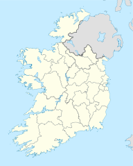
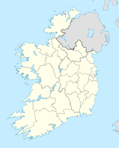
Deutsch: Positionskarte von Irland
Quadratische Plattkarte, N-S-Streckung 170 %. Geographische Begrenzung der Karte:
English: Location map of Ireland
Equirectangular projection, N/S stretching 170 %. Geographic limits of the map:
|
| 日期 | 01-07-2008 |
| 來源 | own work, using United States National Imagery and Mapping Agency data |
| 作者 | NordNordWest |
| 其他版本 |
DerivativeVersions |


|
|
授權條款
[編輯]
我,本作品的著作權持有者,決定用以下授權條款發佈本作品:

|
已授權您依據自由軟體基金會發行的無固定段落、封面文字和封底文字GNU自由文件授權條款1.2版或任意後續版本,對本檔進行複製、傳播和/或修改。該協議的副本列在GNU自由文件授權條款中。 |
此檔案採用創用CC 姓名標示-相同方式分享 3.0 未在地化版本授權條款。
- 您可以自由:
- 分享 – 複製、發佈和傳播本作品
- 重新修改 – 創作演繹作品
- 惟需遵照下列條件:
- 姓名標示 – 您必須指名出正確的製作者,和提供授權條款的連結,以及表示是否有對內容上做出變更。您可以用任何合理的方式來行動,但不得以任何方式表明授權條款是對您許可或是由您所使用。
- 相同方式分享 – 如果您利用本素材進行再混合、轉換或創作,您必須基於如同原先的相同或兼容的條款,來分布您的貢獻成品。
您可以選擇您需要的授權條款。
檔案歷史
點選日期/時間以檢視該時間的檔案版本。
| 日期/時間 | 縮圖 | 尺寸 | 使用者 | 備註 | |
|---|---|---|---|---|---|
| 目前 | 2020年7月18日 (六) 06:45 | | 1,450 × 1,807(938 KB) | Chipmunkdavis(留言 | 貢獻) | Adding toggle to display pre-2014 boundaries, adjusting some code for names and shape |
| 2020年7月11日 (六) 06:47 |  | 1,450 × 1,807(908 KB) | Chipmunkdavis(留言 | 貢獻) | Overhauling code, together with code from File:Galway City in Ireland.svg (itself derived from this file), to be both simpler and more easily editable. All islands are now grouped with their mainland county, and counties are grouped into provinces. Groups exist for traditional counties where divided. | |
| 2014年9月12日 (五) 12:08 |  | 1,450 × 1,807(597 KB) | Ravenpuff(留言 | 貢獻) | Retry that | |
| 2014年9月12日 (五) 11:57 |  | 1,450 × 1,807(597 KB) | Ravenpuff(留言 | 貢獻) | Merged North Tipperary and South Tiperrary, Limerick and County Limerick, Waterford and County Waterford (Local Government Reform Act 2014) | |
| 2009年9月1日 (二) 18:04 |  | 1,450 × 1,807(598 KB) | NordNordWest(留言 | 貢獻) | ||
| 2008年8月25日 (一) 19:08 |  | 1,450 × 1,807(599 KB) | NordNordWest(留言 | 貢獻) | size correction | |
| 2008年7月19日 (六) 18:13 |  | 483 × 602(581 KB) | NordNordWest(留言 | 貢獻) | ||
| 2008年7月1日 (二) 14:13 |  | 483 × 602(554 KB) | NordNordWest(留言 | 貢獻) | {{Information |Description= {{de|Positionskarte von Irland}} Quadratische Plattkarte, N-S-Streckung 170 %. Geographische Begrenzung der Karte: * N: 55.6° N * S: 51.2° N * W: 11.0° W * O: 5.0° W {{en|Location map of [[:en:Ireland|Ireland |
無法覆蓋此檔案。
檔案用途
下列51個頁面有用到此檔案:
- Republic of Ireland / Poblacht na hÉireann
- User:NordNordWest/Gallery/Location maps
- User:SpinnerLaserz/Flags/Flags of Ireland/Ireland
- File:600x748-Carte-de-l'Irlande-R.jpg
- File:Carlow in Ireland.svg
- File:Cavan in Ireland.svg
- File:Clare in Ireland.svg
- File:Connacht in Ireland.svg
- File:Cork City in Ireland.svg
- File:Cork in Ireland.svg
- File:Donegal in Ireland.svg
- File:Dublin City in Ireland.svg
- File:Dun Laoghaire-Rathdown in Ireland.svg
- File:Fingal in Ireland.svg
- File:Galway City in Ireland.svg
- File:Galway in Ireland.svg
- File:Ireland location map.svg
- File:Ireland location map Border region.svg
- File:Ireland location map Dublin region.svg
- File:Ireland location map Mid-East.svg
- File:Ireland location map South-East.svg
- File:Ireland location map South East.svg
- File:Ireland location map South West.svg
- File:Ireland location map West region.svg
- File:Ireland with counties.svg
- File:Kerry in Ireland.svg
- File:Kildare in Ireland.svg
- File:Kilkenny in Ireland.svg
- File:Laois in Ireland.svg
- File:Leinster in Ireland.svg
- File:Leitrim in Ireland.svg
- File:Limerick City in Ireland.svg
- File:Limerick in Ireland.svg
- File:Longford in Ireland.svg
- File:Louth in Ireland.svg
- File:Mayo in Ireland.svg
- File:Meath in Ireland.svg
- File:Monaghan in Ireland.svg
- File:Munster in Ireland.svg
- File:North Tipperary in Ireland.svg
- File:Offaly in Ireland.svg
- File:Roscommon in Ireland.svg
- File:Sligo in Ireland.svg
- File:South Dublin in Ireland.svg
- File:South Tipperary in Ireland.svg
- File:Ulster in Ireland.svg
- File:Waterford City in Ireland.svg
- File:Waterford in Ireland.svg
- File:Westmeath in Ireland.svg
- File:Wexford in Ireland.svg
- File:Wicklow in Ireland.svg
全域檔案使用狀況
以下其他 wiki 使用了這個檔案:
- af.wikipedia.org 的使用狀況
- am.wikipedia.org 的使用狀況
- ar.wikipedia.org 的使用狀況
- arz.wikipedia.org 的使用狀況
- ba.wikipedia.org 的使用狀況
- be-tarask.wikipedia.org 的使用狀況
- be.wikipedia.org 的使用狀況
- bg.wikipedia.org 的使用狀況
檢視此檔案的更多全域使用狀況。