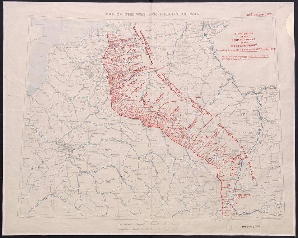
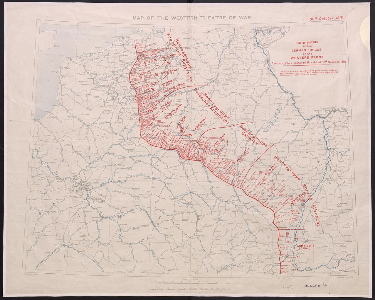
File:Istribution of the German forces on the Western Front according to a captured map dated 30th October 1918.jpg
Перейти к навигации
Перейти к поиску

Размер этого предпросмотра: 748 × 600 пкс. Другие разрешения: 299 × 240 пкс | 599 × 480 пкс | 958 × 768 пкс | 1277 × 1024 пкс | 2555 × 2048 пкс | 3000 × 2405 пкс.
Исходный файл (3000 × 2405 пкс, размер файла: 763 КБ, MIME-тип: image/jpeg)
Краткие подписи
Краткие подписи
Добавьте однострочное описание того, что собой представляет этот файл
| Описание | Scale 1:750000; Area of Germany shown is mostly west of the Rhine. Information overprinted on Map of the Western Theatre of War. GSGS 2862. Ordnance Survey. 1916. Note on map: 'The Divisions are reproduced as given on the original Map. The exact meaning of the conventional signs against Divisions in reserve is not known.' | ||
| Дата | |||
| Источник |
|
||
| Автор | Great Britain. War Office. General Staff. Geographical Section, |

This work is an Ordnance Survey map over 50 years old, which is covered by Crown Copyright which in this case expires 50 years after publication. Ordnance Survey does however ask that they be credited and that the date of publication be given.
Any ancillary rights gained through the creation of the electronic version are granted as freely usable under any circumstances.
|
Это художественное произведение, созданное Правительством Соединённого Королевства Великобритании и Северной Ирландии, находится в общественном достоянии (англ. public domain)
по одной из следующих причин:
Канцелярия Её Величества (HMSO) заявила, что истечение Авторских прав, принадлежащих Короне (англ. Crown copyright), происходит по всему миру (справка: ответ HMSO на сообщение электронной почты)
|
 |
История файла
Нажмите на дату/время, чтобы увидеть версию файла от того времени.
| Дата/время | Миниатюра | Размеры | Участник | Примечание | |
|---|---|---|---|---|---|
| текущий | 18:18, 2 ноября 2014 | | 3000 × 2405 (763 КБ) | Labattblueboy (обсуждение | вклад) | {{Information |Description= Scale 1:750000; Area of Germany shown is mostly west of the Rhine. Information overprinted on Map of the Western Theatre of War. GSGS 2862. Ordnance Survey. 1916. Note on map: 'The Divisions are reproduced as given on the or... |
Вы не можете перезаписать этот файл.
Использование файла
Следующая страница использует этот файл:
Глобальное использование файла
Данный файл используется в следующих вики:
- Использование в ru.wikipedia.org