File:Japan, Wakayama, Gobō - Hidaka river (2018).jpg
Jump to navigation
Jump to search

Size of this preview: 800 × 579 pixels. Other resolutions: 320 × 231 pixels | 640 × 463 pixels | 1,024 × 741 pixels | 1,280 × 926 pixels | 1,493 × 1,080 pixels.
Original file (1,493 × 1,080 pixels, file size: 872 KB, MIME type: image/jpeg)
Captions
Captions
Add a one-line explanation of what this file represents
Summary
[edit].jpg&action=edit§ion=1)
| Description |
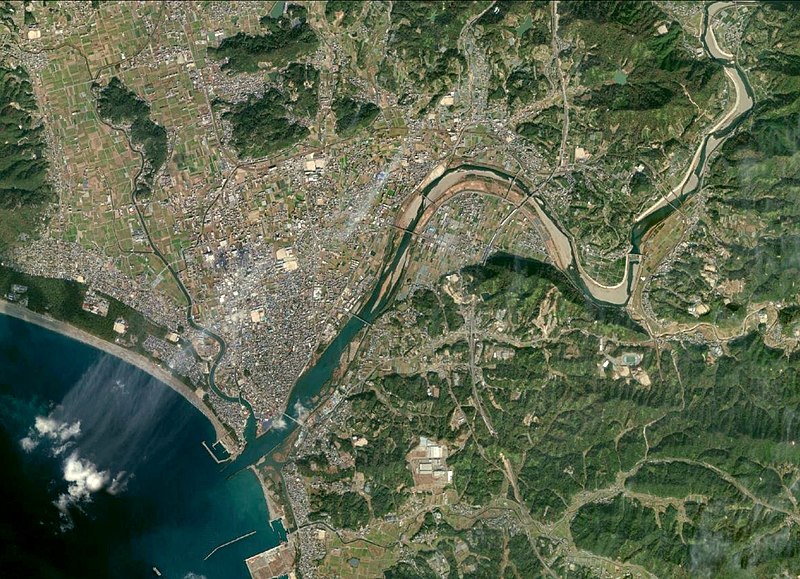
Français : Japon, Hidakagawa (préfecture de Wakayama) : vue aérienne de l'embouchure du fleuve Hidaka. |
| Date | |
| Source | http://landsatlook.usgs.gov |
| Author | USGS Landsat |
This image is in the public domain in the United States because it only contains materials that originally came from the United States Geological Survey, an agency of the United States Department of the Interior. For more information, see the official USGS copyright policy.
|
Licensing
[edit].jpg&action=edit§ion=2)
| This file is in the public domain in the United States because it was solely created by NASA. NASA copyright policy states that "NASA material is not protected by copyright unless noted". (See Template:PD-USGov, NASA copyright policy page or JPL Image Use Policy.) | ||
 |
Warnings:
|
File history
Click on a date/time to view the file as it appeared at that time.
| Date/Time | Thumbnail | Dimensions | User | Comment | |
|---|---|---|---|---|---|
| current | 10:43, 23 October 2020 | | 1,493 × 1,080 (872 KB) | ContributorQ (talk | contribs) | Uploaded a work by USGS Landsat from http://landsatlook.usgs.gov with UploadWizard |
You cannot overwrite this file.
File usage on Commons
There are no pages that use this file.
File usage on other wikis
The following other wikis use this file:
- Usage on fr.wikipedia.org
.jpg&oldid=498090869)