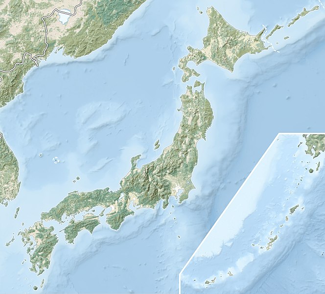
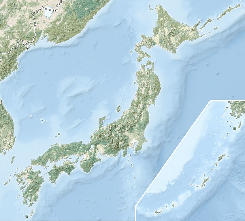
File:Japan natural location map with side map of the Ryukyu Islands.jpg
Spring til navigation
Spring til søgning

Størrelse af denne forhåndsvisning: 664 × 600 pixels. Andre opløsninger: 266 × 240 pixels | 531 × 480 pixels | 850 × 768 pixels | 1.133 × 1.024 pixels | 2.497 × 2.256 pixels.
Oprindelig fil (2.497 × 2.256 billedpunkter, filstørrelse: 830 KB, MIME-type: image/jpeg)
Captions
Captions
Tilføj en kort forklaring på en enkelt linje om hvad filen viser
1933 Sanriku earthquake
Beskrivelse[redigér]
| Beskrivelse |
English: Natural Location map of Japan
Equirectangular projection. Geographic limits to locate objects in the main map with the main islands:
Geographic limits to locate objects in the side map with the Ryukyu Islands:
|
||
| Dato | |||
| Kilde |
|
||
| Forfatter | Alexrk2 | ||
| Tilladelse (Genbrug af denne fil) |
Denne fil er udgivet under Creative Commons Kreditering-Del på samme vilkår 3.0 Ikke-porteret-licensen.
|
||
| Andre versioner |
|


Filhistorik
Klik på en dato/tid for at se filen som den så ud på det tidspunkt.
| Dato/tid | Miniaturebillede | Dimensioner | Bruger | Kommentar | |
|---|---|---|---|---|---|
| nuværende | 9. mar. 2022, 21:41 | | 2.497 × 2.256 (830 KB) | Sting (diskussion | bidrag) | Natural Earth land cover data for Ryukyu Islands |
| 22. jun. 2018, 09:44 |  | 2.497 × 2.256 (794 KB) | Mardetanha (diskussion | bidrag) | Reverted to version as of 19:56, 22 March 2011 (UTC) | |
| 22. mar. 2011, 19:56 |  | 2.497 × 2.256 (794 KB) | Alexrk2 (diskussion | bidrag) | RGB | |
| 22. mar. 2011, 19:07 |  | 2.497 × 2.256 (745 KB) | Chumwa (diskussion | bidrag) | RGB mode | |
| 21. mar. 2011, 21:08 |  | 2.497 × 2.256 (1,54 MB) | Alexrk2 (diskussion | bidrag) | == {{int:filedesc}} == {{Information |Description= {{en|Natural Location map of Japan Equirectangular projection. Geographic limits to locate objects in the main map with the main islands: * N: 45°51'37" N (45.86°N) * S: 30°01'13" N (30. |
Du kan ikke overskrive denne fil.
Filanvendelse
De følgende 6 sider bruger denne fil:
- User:Chumwa/Gallery
- File:Japan bluemarble location map with side map of the Ryukyu Islands.jpg
- File:Japan location map with side map of the Ryukyu Islands.svg
- File:Japan natural location map with side map of the Ryukyu Islands.jpg
- File:Japan relief location map with side map of the Ryukyu Islands.jpg
- File:Pacific earthquakes off the coast of Japan March 2022.png
Global filanvendelse
Følgende andre wikier anvender denne fil:
- Anvendelser på ace.wikipedia.org
- Anvendelser på als.wikipedia.org
- Anvendelser på ar.wikipedia.org
- Anvendelser på arz.wikipedia.org
- Anvendelser på ast.wikipedia.org
- Anvendelser på as.wikipedia.org
- Anvendelser på azb.wikipedia.org
- Anvendelser på az.wikipedia.org
- Hokkaydo
- Kyuşu
- Fuci
- Honşu
- İtsukuşima
- Asama dağı
- Şablon:Yer xəritəsi Yaponiya
- Tohoku zəlzələsi və sunamisi (2011)
- Fukuşima-1 AES
- Böyük Hanşin zəlzələsi
- Böyük Kanto zəlzələsi
- Hoey zəlzələsi
- Mino-Ovari zəlzələsi (1891)
- Yapon çökəkliyi
- Ryukyu adaları
- Osumi boğazı
- Sanqar boğazı
- Koreya boğazı
- Tsuşima boğazı
- Harim dənizi
- Yatsuşiro dənizi
- Hiuqa dənizi
- Daxili Yapon dənizi
- Atsumi yarımadası
- Naqasaki yarımadası
- İzu yarımadası
- Simabara yarımadası
- Şiretoko yarımadası
- Nosuke yarımadası
Vis flere globale anvendelser af denne fil.