File:Jonas Clore House, Sycamore Street and 7th Street, Belleview, KY.jpg
Jump to navigation
Jump to search

Size of this preview: 800 × 600 pixels. Other resolutions: 320 × 240 pixels | 640 × 480 pixels | 1,024 × 768 pixels | 1,280 × 960 pixels | 2,560 × 1,920 pixels | 4,032 × 3,024 pixels.
Original file (4,032 × 3,024 pixels, file size: 4.7 MB, MIME type: image/jpeg)
Captions
Captions
Add a one-line explanation of what this file represents
Summary[edit]
| Description |
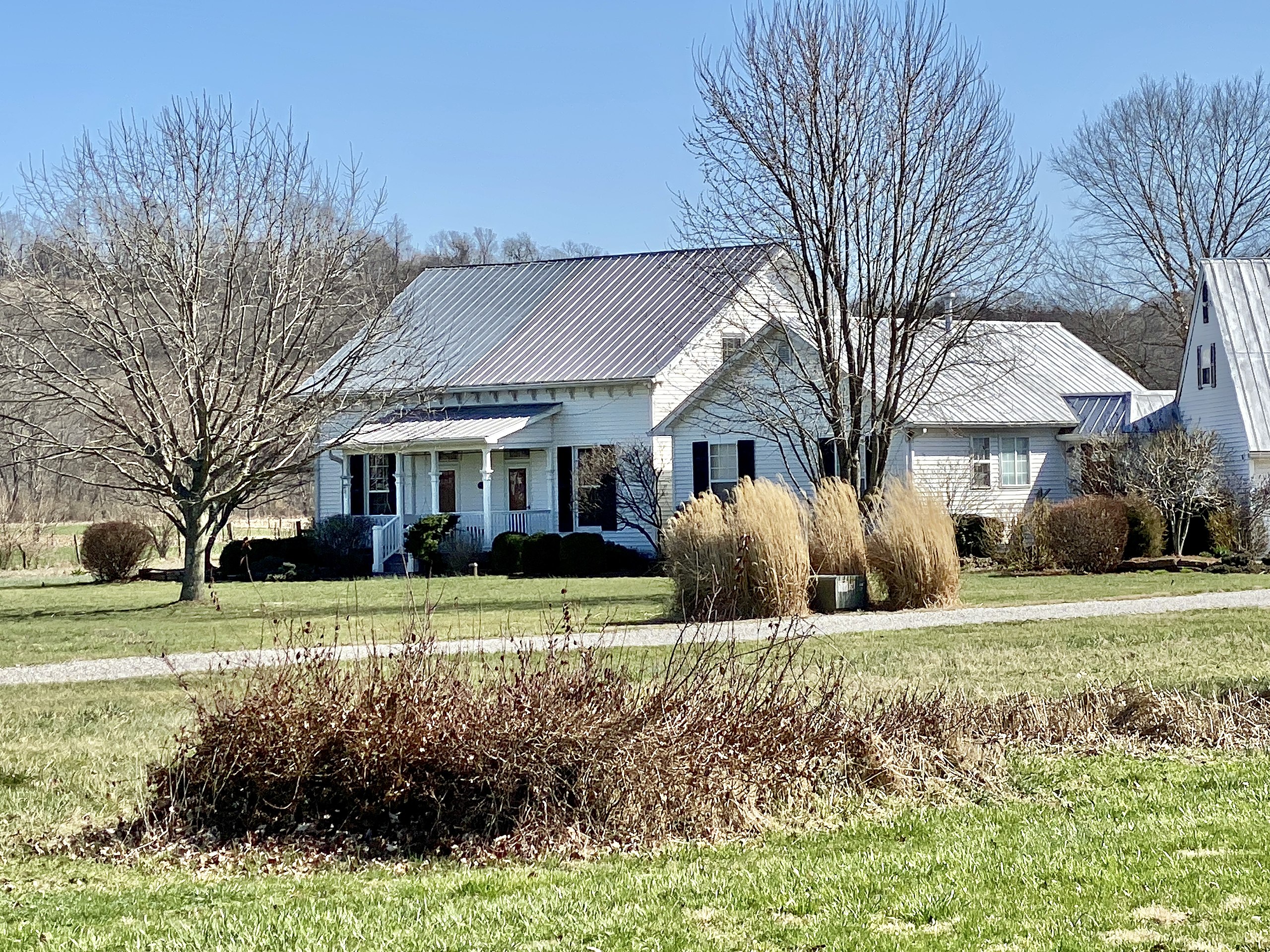
English: Originally located on Main Street in Belleview, this Italianate and Carpenter Gothic Revival-style house was constructed circa 1878 for Jonas Clore, whom also owned the former Belleview Post Office building that originally sat next door. According to aerial imagery, in 2004-2005 the house and the adjacent historic post office, which stood in the way of the northward expansion of the Belleview Baptist Church, were moved approximately 800 feet southeast of their original location to a previously open field at the corner of 7th Street and Sycamore Street, and the house was expanded with an addition that included a garage. As part of the move, the house was rotated 180 degrees from its original orientation, with the front facade now facing north instead of south. The wood-frame house features wooden clapboard siding, a side gable roof covered in standing seam metal with bracketed eaves, replacement windows, two entrance doors with transoms from the front porch, and a shed-roof front porch with decorative columns and a wooden railing. An addition on the west side of the building was added after the move in 2005, and features two gabled sections connected via small hallways to the historic structure, which are simpler in their detailing than the original house, but reference its roofline and materials. To the southwest of the house is the historic post office building, which now sits behind the garage portion of the addition. The house was listed on the National Register of Historic Places in 1989. |
| Date | |
| Source | https://www.flickr.com/photos/59081381@N03/52726720010/ |
| Author | w_lemay |
| Camera location | | View this and other nearby images on: OpenStreetMap |
|---|
Licensing[edit]
This file is licensed under the Creative Commons Attribution-Share Alike 2.0 Generic license.
- You are free:
- to share – to copy, distribute and transmit the work
- to remix – to adapt the work
- Under the following conditions:
- attribution – You must give appropriate credit, provide a link to the license, and indicate if changes were made. You may do so in any reasonable manner, but not in any way that suggests the licensor endorses you or your use.
- share alike – If you remix, transform, or build upon the material, you must distribute your contributions under the same or compatible license as the original.
| This image was originally posted to Flickr by w_lemay at https://flickr.com/photos/59081381@N03/52726720010. It was reviewed on 15 March 2023 by FlickreviewR 2 and was confirmed to be licensed under the terms of the cc-by-sa-2.0. |
File history
Click on a date/time to view the file as it appeared at that time.
| Date/Time | Thumbnail | Dimensions | User | Comment | |
|---|---|---|---|---|---|
| current | 00:16, 15 March 2023 | | 4,032 × 3,024 (4.7 MB) | Ɱ (talk | contribs) | Uploaded a work by w_lemay from https://www.flickr.com/photos/59081381@N03/52726720010/ with UploadWizard |
You cannot overwrite this file.
File usage on Commons
There are no pages that use this file.
File usage on other wikis
The following other wikis use this file:
- Usage on en.wikipedia.org